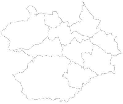
Santa Maria is a municipality (município) in the central region of Rio Grande do Sul, the southernmost state of Brazil. In 2020, its population was 283,677 inhabitants in a total area of 1,823 square kilometres (704 sq mi). Santa Maria is the 5th biggest municipality in the state, and the largest in its micro-region.
This is a list of the administrative divisions of the municipality of Santa Maria, in the Brazilian state of Rio Grande do Sul.
Palma is a bairro in the District of Palma in the municipality of Santa Maria, in the Brazilian state of Rio Grande do Sul. It is situated in east of Santa Maria.

Santa Flora is a district of the municipality of Santa Maria, in the Brazilian state of Rio Grande do Sul. It is situated in the south portion of Santa Maria. The district's seat is located 36 km from Downtown Santa Maria.

Arroio do Só is a district of the municipality of Santa Maria, in the Brazilian state of Rio Grande do Sul. It is situated in the east portion of Santa Maria. The district's seat is located 36 km from Downtown Santa Maria, and, is situated closely to limit with the district of Palma and limits with the municipality of Restinga Seca.

Boca do Monte is a district of the municipality of Santa Maria, in the Brazilian state of Rio Grande do Sul. It is situated in the northwest portion of Santa Maria. The district's seat is located 16 km from Downtown Santa Maria.

Arroio Grande is a district of the municipality of Santa Maria, in the Brazilian state of Rio Grande do Sul. It is situated in the north portion of Santa Maria. The district's seat is located 18 km from Downtown Santa Maria. The district is known as the portal to a wave of Italian immigration in the late 1870s.
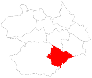
Passo do Verde is a district of the municipality of Santa Maria, in the Brazilian state of Rio Grande do Sul. It is situated in the south portion of Santa Maria. The district's seat is located 23 km from Downtown Santa Maria, nearby the Vacacaí River close to the boundary of Santa Maria with São Sepé.
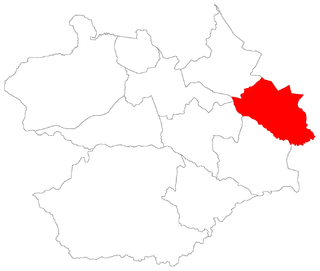
Palma ("palm") is a district of the municipality of Santa Maria in the Brazilian state of Rio Grande do Sul. It is situated in north-eastern Santa Maria. The district's seat is located in its geographic center, 23 km from Downtown Santa Maria.

Santo Antão is a district of the municipality of Santa Maria, in the Brazilian state of Rio Grande do Sul. It is situated in the north portion of Santa Maria. The district's seat is 11 km far from Downtown Santa Maria.

São Valentim is a district of the municipality of Santa Maria, in the Brazilian state of Rio Grande do Sul. It is situated in the west portion of Santa Maria. The district's seat is 12 km far from Downtown Santa Maria.
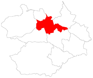
Sede ("Seat") is a district of the municipality of Santa Maria, in the Brazilian state of Rio Grande do Sul. It is situated in the north portion of Santa Maria. Downtown Santa Maria is one of its bairros (neighbourhoods).

Pains is a bairro in the District of Pains in the municipality of Santa Maria, in the Brazilian state of Rio Grande do Sul. It is located in southest Santa Maria.

Arroio do Só is a bairro in the District of Arroio do Só in the municipality of Santa Maria, in the Brazilian state of Rio Grande do Sul. It is located in east Santa Maria.

Passo do Verde is a bairro in the District of Passo do Verde in the municipality of Santa Maria, in the Brazilian state of Rio Grande do Sul. It is situated in the south of Santa Maria.
Santa Flora is a bairro in the District of Santa Flora in the municipality of Santa Maria, in the Brazilian state of Rio Grande do Sul. It is situated in south of Santa Maria.

Arroio Grande is a bairro in the District of Arroio Grande in the municipality of Santa Maria, in the Brazilian state of Rio Grande do Sul. It is situated in northeast of Santa Maria.
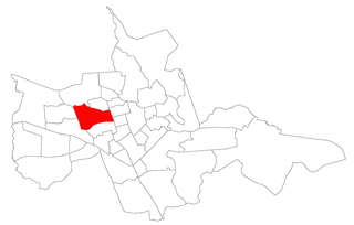
Passo d'Areia is a bairro in the District of Sede in the municipality of Santa Maria, in the Brazilian state of Rio Grande do Sul. It is located in center-west Santa Maria.

Divina Providência is a bairro in the District of Sede in the municipality of Santa Maria, in the Brazilian state of Rio Grande do Sul. It is located in north Santa Maria.

São Valentim is a bairro in the District of São Valentim in the municipality of Santa Maria, in the Brazilian state of Rio Grande do Sul. It is situated in south of Santa Maria.

