
Redwood County is a county in the U.S. state of Minnesota. As of the 2020 census the population was 15,425. Its county seat is Redwood Falls, along the Redwood River near its confluence with the Minnesota River.

Chisago County is a county in the east-central part of the U.S. state of Minnesota. The county covers an area of 442 square miles and, as of the 2020 Census, had a population of 56,621 people. It is part of the Minneapolis-St. Paul-Bloomington Metropolitan Statistical Area.

Palmdale is a city in northern Los Angeles County in the U.S. state of California. The city lies in the Antelope Valley of Southern California. The San Gabriel Mountains separate Palmdale from the Los Angeles Basin to the south.
Amador Township is a township in Chisago County, Minnesota, United States. The population was 885 at the 2010 census. The unincorporated community of Almelund is located within the township.

Franconia Township is a township in Chisago County, Minnesota, United States. The population was 1,805 at the 2010 census, up from 1,128 in 2000. The township is home to the Franconia Sculpture Park.
Shafer Township is a township in Chisago County, Minnesota, United States. The population was 1,048 as of the 2010 census, up from 646 in 2000.
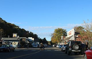
Taylors Falls is a city in Chisago County, Minnesota, United States, located at the junction of U.S. Highway 8 and Minnesota State Highway 95. The population was 1,055 at the 2020 census.

Thief River Falls, sometimes referred to as Thief River or abbreviated as TRF, is a city in Pennington County in the northwest portion of the U.S. state of Minnesota. The population was 8,749 at the 2020 census. Thief River Falls is the county seat for Pennington County.

Center City is a city and the county seat of Chisago County, Minnesota, United States. The population was 628 at the 2010 census.

The Antelope Valley is located in northern Los Angeles County, California, United States, and the southeast portion of California's Kern County, and constitutes the western tip of the Mojave Desert. It is situated between the Tehachapi, Sierra Pelona, and the San Gabriel Mountains. The valley was named for the pronghorns that roamed there until they were all eliminated in the 1880s, mostly by hunting, or resettled in other areas. The principal cities in the Antelope Valley are Palmdale and Lancaster.

Central Minnesota is the central part of the state of Minnesota. No definitive boundaries of the region exist, but most definitions would include the land north of Interstate 94, east of U.S. Highway 59, south of U.S. Highway 2, and west of U.S. Highway 169.

Minnesota State Highway 95 is a 126.892-mile-long (204.213 km) highway in east-central Minnesota, which runs from its intersection with State Highway 23 near St. Cloud and continues east and south to its southern terminus at its intersection with U.S. Highways 61 / 10 (co-signed) at Cottage Grove.
Palmdale is an unincorporated community in Glades County, Florida, United States, located on US 27 just north of the junction with State Road 29.
Chisago Lakes is an area of Chisago County, Minnesota, along Highway 8. The Chisago Lakes Area Chamber of Commerce includes the combined areas of Shafer, Center City, Chisago City, Almelund, Taylor's Falls, and Lindström.
Almelund is an unincorporated community in Amador Township, Chisago County, Minnesota, United States.
Schaefer is a surname of Germanic origin.
Point Douglas to Superior Military Road, also known as Point Douglas to St. Louis River Military Road was a road that ran between Point Douglas, located at the outlet of the Lower St. Croix Lake near Hastings, Minnesota, first to the falls of the St. Louis River near Thomson, Minnesota, and later extended to the mouth of the St. Louis River in Superior, Wisconsin. From Douglas Point immediately east of Hastings, Minnesota, the route connected Stillwater, Taylors Falls, Sunrise, Chengwatana, Fortuna, Scotts Corner, to Thomson and Superior. Several discontinuous sections of this road are still in use.

Palmdale is an unincorporated community and census-designated place (CDP) in Derry Township, Dauphin County, Pennsylvania, United States. As of the 2010 census the population was 1,308. Palmdale is in the Harrisburg–Carlisle metropolitan statistical area.
Franconia is an unincorporated community in Franconia Township, Chisago County, Minnesota, United States.
The following low-power television stations broadcast on digital or analog channel 38 in the United States:


