Pandan, Catanduanes

Last updated
Pandan
Municipality of Pandan
Flag of Pandan, Catanduanes.png
Nickname: 
Fishing Capital of Catanduanes
Ph locator catanduanes pandan.png
Map of Catanduanes with Pandan highlighted
OpenStreetMap
Pandan, Catanduanes
Philippines location map (square).svg
Red pog.svg
Pandan
Location within the Philippines
Coordinates: 14°03′N124°10′E / 14.05°N 124.17°E / 14.05; 124.17
Country Philippines
Region Bicol Region
Province Catanduanes
District Lone district
Founded 1650
Barangays 26 (see Barangays)
Government
[1]
  Type Sangguniang Bayan
   Mayor Honesto C. Tabligan II
   Vice Mayor Eric T. Rodriguez
   Representative Hector S. Sanchez
   Municipal Council
Members
   Electorate 16,223 voters (2022)
Area
[2]
  Total119.90 km2 (46.29 sq mi)
Elevation
63 m (207 ft)
Highest elevation
279 m (915 ft)
Lowest elevation
−2 m (−7 ft)
Population
 (2020 census) [3]
  Total21,473
  Density180/km2 (460/sq mi)
   Households
4,694
Economy
   Income class 4th municipal income class
   Poverty incidence
22.75
% (2018) [4]
   Revenue 109.2 million (2020)
   Assets 170.8 million (2020)
   Expenditure 99.91 million (2020)
   Liabilities 44.34 million (2020)
Service provider
  ElectricityFirst Catanduanes Electric Cooperative (FICELCO)
Time zone UTC+8 (PST)
ZIP code
4809
PSGC
IDD : area code +63(0)52
Native languages Tagalog
Website www.pandan-catanduanes.gov.ph

Pandan, officially the Municipality of Pandan, is a 4th class municipality in the province of Catanduanes, Philippines. According to the 2020 census, it has a population of 21,473 people. [3]

Contents

History

Formerly the town site was located some two kilometers away south of the present site. Then the people were disturbed by constant depredation of bandits coming from other places.

The present site has been chosen because it was near the sea and the fishermen found it very convenient for their trade, however, being near the sea, it was vulnerable to Moros who always come to get their belongings or even capture some people.

As a defense against such moro raids, the people planted pandan shrubs close to each other to form a formidable defense against invaders. When the Spaniards came, they found the plants around the poblacion in great abundance. When asked what the name of the shrubs was, the people told them that they were pandan shrubs. Thus, the Spaniards called the place Pandan.

Historical structures

The Pandan Church was built in 1874. the roof was completely razed by fire in a great conflagration of the town in 1920. This was repaired within five years during the incumbency of Father Jose Magno. The roof was again blown completely in 1940 by the strongest typhoon that has ever passed Catanduanes. It took many years to repair it; again, this was destroyed by typhoon Jean in 1947. Complete repair under the management of Father Orias was done near the end of 1953.

Old ruins

The only old ruin to be found in Pandan is the present Roman Catholic Cemetery. It was constructed during the Spanish era. Formerly, this cemetery was surrounded with concrete walls, which crumbled due to work of time and element. At present, very little portion of the walls remain.

The outstanding events that took place in Pandan during the Spanish regime may be divided into five different aspects, namely, social, political, religious, educational, health and sanitation.

Social and political

The system of governing the town was carried and through the so-called capitan or gobernadorcillo, which at present is called a municipal mayor. He was assisted in the administration of the town by the coadelieros, cabeza de barangay and aguacil who are now called policemen, councilor and barrio lieutenants or barrio captains now barangay captains respectively.

During those days land taxes were unknown. Once a person had paid his personal tax which amounted to P1.50, he was exempted from paying taxes of any kind.

Rape, robbery and killing were the greatest crimes during those days, and the penalty of offenders was death by hanging. Penalties for minor offenses like failure to clean one's surroundings consisted only of confining the guilty in the tribunal, now called the municipal building. Those found guilty were made to stand in a “pandog” all day long and given several beatings.

One thing unique about the Spanish Administration was the equality with which penalties were administered, because no matter what key positions in town one was holding, once he was guilty of any crime he was punished relentlessly.

Religious

On e commendable trend of the time was the people's strict adherence to their religious duties and practices. During Sundays at 7:00 o’clock in the evening a curfew bell in the Tribunal would be sounded, after which nobody was expected to be seen lingering around the town, otherwise, if anybody was caught by the cuadelieros (policemen), he was given a hundred lashes. During curfew hours everybody was expected to be in their respective houses singing such holy songs as the so-called “tarahadi”

Educational

There were very few teachers in the town, because teachers were still to be imported from the mainland. There was no such thing as principal, district supervisor, division superintendent because the administration of the school was solely the teacher's responsibility. During examination time the governor who was the over-all head of the province would just come over and gave oral examination to the pupils.

Severe and inhuman corporal punishment was the order of the day and woe to those who were rather slow in learning their daily lessons. Teaching consisted mostly of religious, a little of handwork and Spanish.

Health and sanitation

One accomplishment achieved along this line was the rigid enforcement of cleanliness of the immediate vicinity of the house. When one is found delinquent of his duty he is hog-tied and given a hundred lashes.

Whenever the governor of the province visited the town and discovered that some streets were not properly cared for, it was the capitan who suffered the penalty of being fined.

American occupation and World War II

The first American came to this town in the year 1900 under Captain Mane. The people did not offer resistance to the occupation of the Americans, so there was no fighting between the natives and the Americans. The natives were at first afraid of the American soldiers. They thought that the Americans might abuse them. When the natives observed the Americans began their policy of attraction by giving their foods to the natives. They offered cakes and candies to the children.

The Americans with the help of the prominent people organized the government. The municipal mayor or “capitan” as was called during those days was voted by the male inhabitants who were 21 years old or above. A male may be qualified to vote if he possessed any of the following (1) he must be 21 years old or above; (2) he could read and write; (3) and if he owned a piece of land. The first capitan who was elected was Capitan Eduardo Vera.

The Americans organized public schools. They selected big houses for school buildings. The first teachers were Americans. The most popular among them was Catler. The Americans gave pencils, paper and slates to the pupils in order to encourage the people to get to school. Even the adults were encouraged to go to school. The subjects taught were English, Language, Arithmetic, Reading and Writing. The Americans taught the natives healthful and sanitary living. They taught the people to clean their homes and surroundings and to make toilets. They established a provisional hospital wherein the soldiers and even natives were treated free by the American doctors.

The Americans stayed in the place for about a year. When they left the same system of government was instituted. The mayor or capitan was elected by the qualified voters.

The town was improved when Pedro Vera became the Representative of this province in 1928. Schools, roads and bridges were constructed. The Post Office, the Light House, and the present schools in this town today are some of the improvements done through the effort of Vera. The dike that prevents the destruction of the town was constructed through the effort of Rep. Pedro Vera.

In 1950 there was drought and the people suffered because there was no harvest of rice. In 1935 there was another typhoon, but it was not very strong. the second World War broke out in December 1941.

Pandan is the hometown of Former Senator Jose O. Vera, Rep. Pedro Vera, Former Governor Jorge V. Almojuela, Cardinal Jose T. Sanchez, Former Ambassador and Immigration Commissioner Leandro I. Verceles (the first Bicolano career diplomat), Former Congressman and Governor Leandro B. Verceles, Jr., Former Vice Governor Teofisto I. Verceles and Former Governor Araceli B. Wong. The present mayor is Raul Eubra Tabirar.

Geography

Cagnipa Rolling Hills Cove around the area of the Cagnipa Rolling Hills, Catanduanes.jpg
Cagnipa Rolling Hills

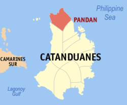
The municipality lies on the northern tip of the province, 107 kilometres (66 mi) from the capital town of Virac. Bounded on the south by the municipality of Caramoran, on the west by the Maqueda Channel, on the east by the municipality of Bagamanoc and on the north by the Pacific Ocean. It has a total land area of 11,990 hectares.

Of the 26 barangays that comprise the municipality, four of which actually form the town proper, which are Libod, the biggest barangay in terms of population, Napo, Pandan del Sur and Pandan del Norte. The rest are found usually near the seashore. The rest being inland barangays.

The municipality does not only boast of the natural beauties, it has which are the Parway, Mangbang, Parola beaches, the Hinik-Hinik falls (Hinik-hinik is a local term for rain shower) and Minaipit falls, but especially of its being a hometown of Senators, Congressman, Governor, Cardinal and Ambassador.

Barangays

Pandan is politically subdivided into 26 barangays. [5] Each barangay consists of puroks and some have sitios.

  • Bagawang
  • Balagñonan
  • Baldoc
  • Canlubi
  • Catamban
  • Cobo
  • Hiyop
  • Libod (Poblacion)
  • Lourdes
  • Lumabao
  • Marambong
  • Napo (Poblacion)
  • Oga
  • Pandan del Norte (Poblacion)
  • Pandan del Sur (Poblacion)
  • Panuto
  • Porot (San Jose)
  • Salvacion (Tariwara)
  • San Andres (Dinungsuran)
  • San Isidro (Langob)
  • San Rafael (Bogtong)
  • San Roque
  • Santa Cruz (Catagbacan)
  • Tabugoc
  • Tokio
  • Wagdas

Climate

Climate data for Pandan, Catanduanes
MonthJanFebMarAprMayJunJulAugSepOctNovDecYear
Mean daily maximum °C (°F)27
(81)
27
(81)
28
(82)
30
(86)
31
(88)
30
(86)
29
(84)
29
(84)
29
(84)
29
(84)
28
(82)
27
(81)
29
(84)
Mean daily minimum °C (°F)22
(72)
22
(72)
23
(73)
24
(75)
25
(77)
25
(77)
25
(77)
25
(77)
25
(77)
24
(75)
24
(75)
23
(73)
24
(75)
Average precipitation mm (inches)138
(5.4)
83
(3.3)
74
(2.9)
50
(2.0)
108
(4.3)
165
(6.5)
202
(8.0)
165
(6.5)
190
(7.5)
186
(7.3)
188
(7.4)
183
(7.2)
1,732
(68.3)
Average rainy days16.811.913.513.820.525.227.426.226.124.720.718.5245.3
Source: Meteoblue [6]

Demographics

Population census of Pandan
YearPop.±% p.a.
1903 3,281    
1918 8,408+6.47%
1939 15,460+2.94%
1948 10,253−4.46%
1960 12,764+1.84%
1970 14,612+1.36%
1975 14,862+0.34%
1980 15,156+0.39%
1990 15,784+0.41%
1995 15,725−0.07%
2000 17,696+2.56%
2007 19,005+0.99%
2010 19,393+0.74%
2015 20,516+1.08%
2020 21,473+0.90%
Source: Philippine Statistics Authority [7] [8] [9] [10]

In the 2020 census, the population of Pandan, Catanduanes, was 21,473 people, [3] with a density of 180 inhabitants per square kilometre or 470 inhabitants per square mile.

Culture

The people of Pandan are generally peace-loving, God-fearing and are happy people. Everyone in the community is a brother, a sister and a friend where the products of which could be shared even food itself without thought of having it repaid or reciprocated. Visitors are offered the comforts that the family could afford even it means that the owner should lay on the floor just to make the visitor eased at home by using the “papag”. And that is not enough, before going home; products of their yard would be wrapped for you to bring in your family plus a bunch of cockling chickens.

During celebrations, immediate neighbors are invited bringing among the whole members of the family and this seemed to be incomplete without tuba drinking and little dancing. Pantomina is a long-cherished dance that never changes with time despite of the current dance and music. Pandananons has a series of collected pantomina songs which are now famous composed locally, of course it is not only the above songs, Pandananons used to compose, for evidence of which that gained popularity was a song composed by Alfredo dela Rosa, former Municipal Secretary of the Sangguniang Bayan of Pandan, entitled “Islang Catandungan”. This song won first place in the regional contest in Sorsogon sometime on the late 1960s.

Economy

Education

Municipality of Pandan had a quite high literacy rate and it is improving through the years. Each barangays had their own elementary schools.

Elementary schools:

Secondary schools:

Tertiary school:

Related Research Articles

<span class="mw-page-title-main">Catanduanes</span> Province in Bicol, Philippines

Catanduanes, officially the Province of Catanduanes, is an island province located in the Bicol Region of Luzon in the Philippines. It is the 12th-largest island in the Philippines, and lies to the east of Camarines Sur, across Maqueda Channel. Its capital is Virac. It had a population of 271,879 people as of the 2020 census.

<span class="mw-page-title-main">Claveria, Masbate</span> Municipality in Masbate, Philippines

Claveria, officially the Municipality of Claveria, is a 3rd class municipality in the province of Masbate, Philippines. According to the 2020 census, it has a population of 42,142 people. Ranked 592nd among 1,488 municipalities in the Philippines.

<span class="mw-page-title-main">Virac, Catanduanes</span> Capital of Catanduanes, Philippines

Virac, officially the Municipality of Virac, is a 1st class municipality and capital of the province of Catanduanes, Philippines. According to the 2020 census, it has a population of 76,520 people.

<span class="mw-page-title-main">Ligao</span> Component city in Albay, Philippines

Ligao, officially the City of Ligao, is a 4th class component city in the province of Albay, Philippines. According to the 2020 census, it has a population of 118,096 people. Most of the city's economy came from agriculture sector.

<span class="mw-page-title-main">Mercedes, Camarines Norte</span> Municipality in Camarines Norte, Philippines

Mercedes, officially the Municipality of Mercedes, is a 2nd class municipality in the province of Camarines Norte, Philippines. According to the 2020 census, it has a population of 55,334 people.

<span class="mw-page-title-main">Bagamanoc</span> Municipality in Catanduanes, Philippines

Bagamanoc, officially the Municipality of Bagamanoc, is a 5th class municipality in the province of Catanduanes, Philippines. According to the 2020 census, it has a population of 11,086 people.

<span class="mw-page-title-main">Baras, Catanduanes</span> Municipality in Catanduanes, Philippines

Baras, officially the Municipality of Baras, is a 5th class municipality in the province of Catanduanes, Philippines. According to the 2020 census, it has a population of 13,484 people.

<span class="mw-page-title-main">Bato, Catanduanes</span> Municipality in Catanduanes, Philippines

Bato, officially the Municipality of Bato, is a 5th class municipality in the province of Catanduanes, Philippines. According to the 2020 census, it has a population of 21,748 people.

<span class="mw-page-title-main">Caramoran</span> Municipality in Catanduanes, Philippines

Caramoran, officially the Municipality of Caramoran, is a 3rd class municipality in the province of Catanduanes, Philippines. According to the 2020 census, it has a population of 32,114 people.

<span class="mw-page-title-main">Gigmoto</span> Municipality in Catanduanes, Philippines

Gigmoto, officially the Municipality of Gigmoto, is a 5th class municipality in the province of Catanduanes, Philippines. According to the 2020 census, it has a population of 8,712 people.

<span class="mw-page-title-main">Panganiban, Catanduanes</span> Municipality in Catanduanes, Philippines

Panganiban, officially the Municipality of Panganiban, is a 5th class municipality in the province of Catanduanes, Philippines. According to the 2020 census, it has a population of 9,713 people.

<span class="mw-page-title-main">San Andres, Catanduanes</span> Municipality in Catanduanes, Philippines

San Andres, officially the Municipality of San Andres, is a 3rd class municipality in the province of Catanduanes, Philippines. According to the 2020 census, it has a population of 38,480 people.

<span class="mw-page-title-main">San Miguel, Catanduanes</span> Municipality in Catanduanes, Philippines

San Miguel, officially the Municipality of San Miguel, is a 5th class municipality in the province of Catanduanes, Philippines. According to the 2020 census, it has a population of 15,680 people.

<span class="mw-page-title-main">Viga, Catanduanes</span> Municipality in Catanduanes, Philippines

Viga, officially the Municipality of Viga, is a 4th class municipality in the province of Catanduanes, Philippines. According to the 2020 census, it has a population of 22,869 people.

<span class="mw-page-title-main">Gubat</span> Municipality in Sorsogon, Philippines

Gubat, officially the Municipality of Gubat, is a 2nd class municipality in the province of Sorsogon, Philippines. According to the 2020 census, it has a population of 60,294 people.

<span class="mw-page-title-main">San Felipe, Zambales</span> Municipality in Zambales, Philippines

San Felipe, officially the Municipality of San Felipe, is a 4th class municipality in the province of Zambales, Philippines. According to the 2020 census, it has a population of 25,033 people.

<span class="mw-page-title-main">Cabusao</span> Municipality in Camarines Sur, Philippines

Cabusao, officially the Municipality of Cabusao, is a 5th class municipality in the province of Camarines Sur, Philippines. According to the 2020 census, it has a population of 19,257 people.

<span class="mw-page-title-main">Ocampo, Camarines Sur</span> Municipality in Camarines Sur, Philippines

Ocampo, officially the Municipality of Ocampo, is a 1st class municipality in the province of Camarines Sur, Philippines. According to the 2020 census, it has a population of 51,073 people.

<span class="mw-page-title-main">Sagñay</span> Municipality in Camarines Sur, Philippines

Sagñay,, officially the Municipality of Sagñay, is a 4th class municipality in the province of Camarines Sur in the Philippines. According to the 2020 census, it has a population of 36,841 people.

<span class="mw-page-title-main">San Fernando, Camarines Sur</span> Municipality in Camarines Sur, Philippines

San Fernando, officially the Municipality of San Fernando, is a 2nd class municipality in the province of Camarines Sur, Philippines. According to the 2020 census, it has a population of 38,626 people.

References

  1. Municipality of Pandan | (DILG)
  2. "2015 Census of Population, Report No. 3 – Population, Land Area, and Population Density" (PDF). Philippine Statistics Authority. Quezon City, Philippines. August 2016. ISSN   0117-1453. Archived (PDF) from the original on May 25, 2021. Retrieved July 16, 2021.
  3. 1 2 3 Census of Population (2020). "Region V (Bicol Region)". Total Population by Province, City, Municipality and Barangay. Philippine Statistics Authority . Retrieved 8 July 2021.
  4. "PSA Releases the 2018 Municipal and City Level Poverty Estimates". Philippine Statistics Authority. 15 December 2021. Retrieved 22 January 2022.
  5. "Province: Catanduanes". PSGC Interactive. Quezon City, Philippines: Philippine Statistics Authority . Retrieved 12 November 2016.
  6. "Pandan, Catanduanes : Average Temperatures and Rainfall". Meteoblue. Retrieved 29 December 2018.
  7. Census of Population (2015). "Region V (Bicol Region)". Total Population by Province, City, Municipality and Barangay. Philippine Statistics Authority . Retrieved 20 June 2016.
  8. Census of Population and Housing (2010). "Region V (Bicol Region)" (PDF). Total Population by Province, City, Municipality and Barangay. National Statistics Office . Retrieved 29 June 2016.
  9. Censuses of Population (1903–2007). "Region V (Bicol Region)". Table 1. Population Enumerated in Various Censuses by Province/Highly Urbanized City: 1903 to 2007. National Statistics Office.{{cite encyclopedia}}: CS1 maint: numeric names: authors list (link)
  10. "Province of Catanduanes". Municipality Population Data. Local Water Utilities Administration Research Division. Retrieved 17 December 2016.
  11. "Poverty incidence (PI):". Philippine Statistics Authority. Retrieved December 28, 2020.
  12. "Estimation of Local Poverty in the Philippines" (PDF). Philippine Statistics Authority. 29 November 2005.
  13. "City and Municipal Level Poverty Estimates; 2006 and 2009" (PDF). Philippine Statistics Authority. 3 August 2012.
  14. "2012 Municipal and City Level Poverty Estimates" (PDF). Philippine Statistics Authority. 31 May 2016.
  15. "Municipal and City Level Small Area Poverty Estimates; 2009, 2012 and 2015". Philippine Statistics Authority. 10 July 2019.
  16. "PSA Releases the 2018 Municipal and City Level Poverty Estimates". Philippine Statistics Authority. 15 December 2021. Retrieved 22 January 2022.