The Parish of Mulwaree is a parish of Argyle County. [1] It is located on the western shore of Lake Bathurst, New South Wales. [2] [3]

The Parish of Mulwaree is a parish of Argyle County. [1] It is located on the western shore of Lake Bathurst, New South Wales. [2] [3]
The area was traditional lands of the Ngunnawal people, but was also traversed by other tribes going to the coast or the Monaro during the Bogong moth season. Stone artefacts dating back 20,000 years have been found at nearby Lake George.
The Lake Bathurst was discovered in April 1818 by an exploration commissioned by Governor Lachlan Macquarie to find a route from the inland to the settlement on the south coast at Jervis Bay that was headed by Surveyor General James Meehan. A village of Mulwaree was gazetted in the 19th century on the southern shore of Lake Bathurst, but failed to grow, moving 1½km to the west at the site of Tarago, on the main trainline.
Significant features in the parish include:

The area has been identified by BirdLife International as an Important Bird Area (IBA) because it regularly supports significant numbers of
The Parish is predominantly Agricultureal in its economic base, however, the economic base has diversified in recent years with:
The parish has begun to be used as commuter zone for the nearby city of Canberra.

New South Wales is a state on the east coast of Australia. It borders Queensland to the north, Victoria to the south, and South Australia to the west. Its coast borders the Coral and Tasman Seas to the east. The Australian Capital Territory is an enclave within the state. New South Wales' state capital is Sydney, which is also Australia's most populous city. In March 2019, the population of New South Wales was over 8 million, making it Australia's most populous state. Just under two-thirds of the state's population, 5.1 million, live in the Greater Sydney area. The demonym for inhabitants of New South Wales is New South Welshmen; but some have protested this term while there is no commonly accepted alternative.

Goulburn is a regional city in the Southern Tablelands of the Australian state of New South Wales, approximately 195 kilometres (121 mi) south-west of Sydney, and 90 kilometres (56 mi) north-east of Canberra. It was proclaimed as Australia's first inland city through letters patent by Queen Victoria in 1863. Goulburn had a population of 23,835 at June 2018. Goulburn is the seat of Goulburn Mulwaree Council.

Richmond is a town in New South Wales, in the local government area of the City of Hawkesbury. It is located at a latitude of 33° 35' 54" South and a longitude of 150°45' 04" east, 19 metres above sea level on the alluvial Hawkesbury River flats, at the foot of the Blue Mountains. It is about 65 km by road from Sydney.

King Island is an island in the Bass Strait, belonging to the Australian state of Tasmania. It is the largest of three islands known as the New Year Group, and the second-largest island in Bass Strait. The island's population at the 2016 census was 1,585 people, up from 1,566 in 2011. The local government area of the island is the King Island Council.

The Division of Hume is an Australian electoral division in the state of New South Wales.

Tarago is a town in the Southern Tablelands of New South Wales, Australia in Goulburn Mulwaree Council. Part of the defined locality, which includes a large area of grazing country, is on the eastern shore of Lake George in the area of the Queanbeyan–Palerang Regional Council. The town is situated 39 kilometres south of the city of Goulburn and 69 kilometres northeast of Canberra, the capital city of Australia. It is located on the Goulburn-Braidwood road. The town is notable for recent renewable energy projects in the surrounding districts.

Bungendore is a town in the Queanbeyan Region of New South Wales, Australia, in Queanbeyan-Palerang Regional Council. It is on the Kings Highway near Lake George, the Molonglo River Valley and the Australian Capital Territory border. It has become a major tourist centre in recent years, popular with visitors from Canberra and some of it has heritage protection. It has expanded rapidly in recent years as a dormitory town of Canberra.

Bawley Point is a small coastal hamlet in New South Wales, Australia, in the Shoalhaven with a population of 698 people at the 2016 census. It is located 30 minutes south of Ulladulla, New South Wales, and 30 minutes north of Batemans Bay on the South Coast of NSW. The town's name is believed to be derived from an Aboriginal word meaning "Brown snake".
Thomas Robert Frame, is an Australian academic, author, Anglican priest and former Anglican Bishop to the Defence Force, serving between 2001 and 2007.

Lake Bathurst is a shallow lake located 27 kilometres (17 mi) south-east of Goulburn, New South Wales in Australia. It is also the name of a nearby locality in the Goulburn Mulwaree Council.

The Parish of Tarago is a parish of Argyle County. It does not actually contain the town of Tarago, which is located further to the south-east in the Parish of Mulwaree. The Parish was built by the Department of Lands in New South Wales.
The Mulwaree River, a perennial river that is part of the Hawkesbury-Nepean catchment, is located in the Southern Tablelands region of New South Wales, Australia.
The Capital Wind Farm near Bungendore is the largest wind farm in New South Wales. It is part of the 6,000-hectare (15,000-acre) Capital Renewable Energy Precinct, along with nearby Woodlawn Wind Farm and the Capital East Solar Demonstration Plant.

The Menindee Lakes is a chain of shallow ephemeral freshwater lakes connected to the Darling River to form a storage system. The lakes lie in the far west region of New South Wales, Australia, near the town of Menindee.
The Woodlawn Wind Farm is a wind farm located near Bungendore, New South Wales. It is part of the Capital Renewable Energy Precinct, along with nearby Capital Wind Farm and the Woodlawn Bioreactor.

Goulburn Mulwaree Council is a local government area located in the Southern Tablelands region of New South Wales, Australia. The area is located adjacent to the Hume Highway and the Southern Highlands railway line. The estimated resident population of the area stood at 29,609 on 2016 census.

Currawang is a locality in the Queanbeyan–Palerang Regional Council, on the edges of Upper Lachlan Shire and Goulburn-Mulwaree Council, in New South Wales, Australia. It is located to the north of Lake George. It shares its name with the Currawang Parish of Argyle County, in which it is located. This was formerly known as the parish of Currowang. Both names derive from an Aboriginal word for the spearwood tree.

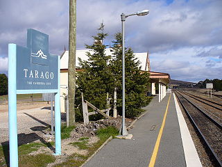
Tarago railway station is a heritage-listed railway station located on the Bombala line in New South Wales, Australia. It serves the town of Tarago. It was built in 1884 by G. & C. Horn. It was added to the New South Wales State Heritage Register on 2 April 1999.

Lower Boro is a locality in the Goulburn Mulwaree Council area, New South Wales, Australia. It is located about 16 km southeast of Tarago. The link from Tarago to Windellama, which is part of a link from Canberra to Nerriga and Nowra, passes through the northern part of the locality. At the 2016 census, Lower Boro had a population of 176.

Merigan, New South Wales is a civil parish of Murray County, New South Wales.
| This Southern Tablelands geography article is a stub. You can help Wikipedia by expanding it. |
| This New South Wales government-related article is a stub. You can help Wikipedia by expanding it. |