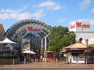
Liverpool is a suburb of Greater Western Sydney, in the state of New South Wales, Australia. It is located 27 kilometres (17 mi) south-west of the Sydney CBD. Liverpool is the administrative seat of the local government area of the City of Liverpool and is situated in the Cumberland Plain.
Casula is a suburb of Sydney, in the state of New South Wales, Australia. It is 34 kilometres south-west of the Sydney central business district, in the local government area of the City of Liverpool.

Greater Western Sydney (GWS) is a large region of the metropolitan area of Greater Sydney, New South Wales, Australia that generally embraces the north-west, south-west, central-west, and far western sub-regions within Sydney's metropolitan area and encompasses 13 local government areas: Blacktown, Canterbury-Bankstown, Camden, Campbelltown, Cumberland, Fairfield, Hawkesbury, Hills Shire, Liverpool, Parramatta, Penrith, Wollondilly and the western portion of the City of Parramatta Council. It includes Western Sydney, which has a number of different definitions, although the one consistently used is the region composed of the nine local government authorities which are all members of the Western Sydney Regional Organisation of Councils (WSROC). The NSW Government's Office of Western Sydney uses the broader Greater Western Sydney definition to refer to the region.

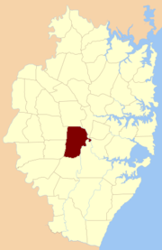
Cumberland County is a county in the State of New South Wales, Australia. Most of the Sydney metropolitan area is located within the County of Cumberland.

The Division of Fowler is an Australian electoral division in the state of New South Wales.

The South Creek or Wianamatta, a creek that is part of the Hawkesbury-Nepean catchment, is located on the Cumberland Plain, also referred to as Greater Western Sydney, New South Wales, Australia.

Canley Vale railway station is located on the Main South line, serving the Sydney suburb of Canley Vale. It is served by Sydney Trains T2 Inner West & Leppington Line and T5 Cumberland line services.

Canley Vale is a suburb of Sydney, in the state of New South Wales, Australia. Canley Vale is located 30 kilometres south-west of the Sydney central business district, in the local government area of the City of Fairfield and is part of the South-western Sydney region.
Canley Heights is a suburb of Sydney, in the state of New South Wales, Australia 31 kilometres south-west of the Sydney central business district, in the local government area of the City of Fairfield and is part of the South-western Sydney region.
Cabramatta Creek, an urban watercourse of the Georges River catchment, is located in the south-western region of Sydney, in New South Wales, Australia.

Minto Parish is one of the 57 parishes of Cumberland County, New South Wales, a cadastral unit for use on land titles. It includes Minto, Ingleburn, Glenfield and Macquarie Fields. Its eastern boundary is the Georges River, and western boundary was at the Great Southern Road.

St James Parish, Cumberland is one of the 57 parishes of Cumberland County, New South Wales, a cadastral unit for use on land titles. It is one of the four small parishes in the Sydney city area, which is named after the Anglican church of St James, which was consecrated in 1824. The name St James is also used today for the railway station in the same area.

St John Parish is one of the 57 parishes of Cumberland County, New South Wales, a cadastral unit for use on land titles. It is named after St John's Anglican church in Parramatta, which opened in 1803. The parish is shaped like a "T", with the northern part stretching from Toongabbie to near Homebush Bay. The southern end is at Prospect Creek near Yennora. Woodville Road and Parramatta Road form the boundaries to the south-east. The Old Prospect Road is part of the boundary in the west. It includes the suburbs of Merrylands, Parramatta, Silverwater, Westmead, Fairfield East and Guildford.
St Andrew Parish, Cumberland is one of the 57 parishes of Cumberland County, New South Wales, a cadastral unit for use on land titles. It is one of the four small parishes in the Sydney city area, which is named after the church of St Andrew's. The parish was named while the church was still in the planning stages. The parish includes Pyrmont and the Darling Harbour area. It is bounded by Wattle Street in the south west, George Street in the south and east, and King Street in the north-east. It includes Town Hall railway station, which is on the eastern end of the parish.
St Philip Parish is one of the 57 parishes of Cumberland County, New South Wales, a cadastral unit for use on land titles. It is located on the western part of the original colony at Sydney Cove, which was to the west of the Tank Stream. It is one of the four small parishes in the Sydney city area and is named after the church of St Philip's. It includes the southern end of the Sydney Harbour Bridge, The Rocks, Dawes Point and Millers Point. It is bounded by Sydney Harbour in the north, King Street in the south, George Street in the south-east, and what was once the Tank Stream in the east. The northern end of Darling Harbour is the boundary in the west. It includes Wynyard railway station.
Canley Vale High School is a government-funded co-educational comprehensive secondary day school, located in Canley Vale, a south-western suburb of Sydney, New South Wales, Australia.

The Division of McMahon is an Australian electoral division in the state of New South Wales.

The Leader was a weekly English language compact format newspaper published by R. Rowell in Liverpool, New South Wales, Australia.

The Inner West & Leppington Line is a commuter rail service operated by Sydney Trains, serving the inner west and south-western regions of Sydney, Australia. Consisting 37 stops, the service commences from the City Circle, then heads west to Granville. The line branches at this point; services either head northwest to Parramatta or south to Leppington. A third terminus at Homebush is used when the part-time Parramatta branch isn't operating. The line commenced operations on 26 November 2017, replacing the T2 Airport, Inner West & South Line.