Park, Kentucky

Last updated

Park
USA Kentucky location map.svg
Red pog.svg
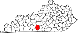
Park
Location within the state of Kentucky
Usa edcp location map.svg
Red pog.svg
Park
Park (the United States)
Coordinates: 37°8′25″N85°46′29″W / 37.14028°N 85.77472°W / 37.14028; -85.77472
Country United States
State Kentucky
County Barren
Elevation
718 ft (219 m)
Time zone UTC-5 (Eastern (EST))
  Summer (DST) UTC-4 (EDT)
GNIS feature ID508776 [1]

Park is an unincorporated community in Barren County, Kentucky, United States.

Notable people

Related Research Articles

<span class="mw-page-title-main">Kentucky</span> U.S. state

Kentucky, officially the Commonwealth of Kentucky, is a state in the Southeastern region of the United States and one of the states of the Upper South. Kentucky borders Illinois, Indiana, and Ohio to the north, West Virginia to the northeast, Virginia to the east, Tennessee to the south, and Missouri to the west. Its northern border is defined by the Ohio River. Its capital is Frankfort and its largest city is Louisville. Its population was approximately 4.5 million in 2020.

<span class="mw-page-title-main">Lexington, Kentucky</span> City in Kentucky, United States

Lexington is a city in Kentucky, United States, and it is the county seat of Fayette County. By population, it is the 2nd most populous city in Kentucky and 60th-most populous city in the United States. By land area, it is the country's 28th-largest city. The city is also known as "Horse Capital of the World". It is within the state's Bluegrass region. Notable locations within the city include the Kentucky Horse Park, The Red Mile and Keeneland race courses, Rupp Arena, Central Bank Center, Transylvania University, the University of Kentucky, Bluegrass Community and Technical College, and the National Thoroughbred Racing Association (NTRA) Headquarters.

<span class="mw-page-title-main">Frankfort, Kentucky</span> Capital city of Kentucky, United States

Frankfort is the capital city of the U.S. state of Kentucky and the seat of Franklin County. It is a home rule-class city. The population was 28,602 at the 2020 United States census. Located along the Kentucky River, Frankfort is the principal city of the Frankfort, Kentucky Micropolitan Statistical Area, which includes all of Franklin and Anderson counties. It is the fourth smallest state capital city in the United States by population.

<span class="mw-page-title-main">Louisville, Kentucky</span> Largest city in Kentucky, United States

Louisville is the most populous city in the Commonwealth of Kentucky, sixth-most populous city in the Southeast, and the 27th-most-populous city in the United States. Louisville is the historical seat and, since 2003, the nominal seat of Jefferson County, on the Indiana border.

<span class="mw-page-title-main">Mammoth Cave National Park</span> National park and cave in Kentucky, USA

Mammoth Cave National Park is a national park in south-central Kentucky, encompassing portions of Mammoth Cave, the longest cave system known in the world. The park's 52,830 acres (21,380 ha) are located primarily in Edmonson County, with small areas extending eastward into Hart and Barren counties. The Green River runs through the park, with a tributary called the Nolin River feeding into the Green just inside the park.

<span class="mw-page-title-main">Jeffersontown, Kentucky</span> City in Kentucky, United States

Jeffersontown is a home rule-class city in Jefferson County, Kentucky, United States. The population was 26,595 at the 2010 U.S. census.

<span class="mw-page-title-main">Bowling Green, Kentucky</span> City in Kentucky, United States

Bowling Green is a home rule-class city and the county seat of Warren County, Kentucky, United States. Founded by pioneers in 1798, Bowling Green was the provisional capital of Confederate Kentucky during the American Civil War. As of the 2020 census, its population of 72,294 made it the third-most-populous city in the state after Louisville and Lexington; its metropolitan area, which is the fourth largest in the state after Louisville, Lexington, and Northern Kentucky, had an estimated population of 179,240; and the combined statistical area it shares with Glasgow has an estimated population of 233,560.

<span class="mw-page-title-main">Kentucky Horse Park</span>

Kentucky Horse Park is a working horse farm, international equestrian competition venue, and an educational theme park opened in 1978 in Lexington, Kentucky. It is located off Kentucky State Highway 1973 and Interstate 75, at Exit 120, in northern Fayette County in the United States. The equestrian facility is a 1,224-acre (4.95 km2) park dedicated to "man's relationship with the horse." Open to the public, the park has a twice daily Horses of the World Show, showcasing both common and rare horses from around the globe. The horses are ridden in authentic costume. Each year the park is host to a number of special events and horse shows.

<span class="mw-page-title-main">Cumberland Gap National Historical Park</span> Historic area in Kentucky, Tennessee, and Virginia, U.S.

The Cumberland Gap National Historical Park is a United States National Historical Park located at the border between Kentucky, Tennessee, and Virginia, centered on the Cumberland Gap, a natural break in the Appalachian Mountains.

<span class="mw-page-title-main">Louisville metropolitan area</span> Geographic region surrounding Louisville, KY, USA

The Louisville metropolitan area is the 43rd largest metropolitan statistical area (MSA) in the United States. It had a population of 1,395,855 in 2020 according to the latest official census, and its principal city is Louisville, Kentucky.

<span class="mw-page-title-main">Cumberland Gap</span> Narrow pass through the Cumberland Mountains

The Cumberland Gap is a pass in the eastern United States through the long ridge of the Cumberland Mountains, within the Appalachian Mountains and near the tripoint of Kentucky, Virginia, and Tennessee. At an elevation of 1,631 feet (497 m) above sea level, it is famous in American colonial history for its role as a key passageway through the lower central Appalachians.

<span class="mw-page-title-main">Kentucky Kingdom</span> Amusement park in Louisville, Kentucky

Kentucky Kingdom, formerly known as Six Flags Kentucky Kingdom, is an amusement park in Louisville, Kentucky, United States. The 67-acre (27 ha) park includes a collection of amusement rides and the Hurricane Bay water park. Kentucky Kingdom is located at the intersection of Interstate 65 and Interstate 264, sharing a parking lot with the Kentucky Exposition Center.

<span class="mw-page-title-main">My Old Kentucky Home State Park</span> State park in Kentucky, United States

My Old Kentucky Home State Park is a state park located in Bardstown, Kentucky, United States. The park's centerpiece is Federal Hill, a former plantation home owned by United States Senator John Rowan in 1795. During the Rowan family's occupation, the mansion became a meeting place for local politicians and hosted several visiting dignitaries.

<span class="mw-page-title-main">Kentucky Alleyne Provincial Park</span> Provincial park in British Columbia

Kentucky Alleyne Provincial Park is a provincial park in British Columbia. The park is located 38 kilometres south of Merritt, British Columbia.

<span class="mw-page-title-main">Breaks Interstate Park</span>

Breaks Interstate Park is a bi-state state park located partly in southeastern Kentucky and mostly in southwestern Virginia, in the Jefferson National Forest, at the northeastern terminus of Pine Mountain. Rather than their respective state park systems, it is instead administered by an interstate compact between the states of Virginia and Kentucky. It is one of several interstate parks in the United States, but only one of two operated jointly under a compact rather than as two separate state park units. The Virginia Department of Conservation and Recreation and the Kentucky Department of Parks are still major partner organizations.

<span class="mw-page-title-main">National Register of Historic Places listings in Kentucky</span>

This is a list of properties and historic districts in Kentucky that are listed on the National Register of Historic Places. There are listings in all of Kentucky's 120 counties.

<span class="mw-page-title-main">Eastern Kentucky Coalfield</span> Coalfield in Kentucky, United States

The Eastern Kentucky Coalfield is part of the Central Appalachian bituminous coalfield, including all or parts of 30 Kentucky counties and adjoining areas in Ohio, West Virginia, Virginia, and Tennessee. It covers an area from the Allegheny Mountains in the east across the Cumberland Plateau to the Pottsville Escarpment in the west. The region is known for its coal mining; most family farms in the region have disappeared since the introduction of surface mining in the 1940s and 1950s.

<span class="mw-page-title-main">Kentucky Proud Park</span> Baseball park at the University of Kentucky

Kentucky Proud Park is a baseball stadium in Lexington, Kentucky. It is the home field of the University of Kentucky Wildcats college baseball team. Opened in 2018, with the Wildcats playing their first season in the stadium in 2019, it has a permanent capacity of 2,500, with grass berm seating adding more than 1,500 to the total capacity. Temporary seating can be added to bring the capacity to 7,000 for NCAA tournament games.

References