Nobob, Kentucky

Last updated

Nobob
USA Kentucky location map.svg
Red pog.svg
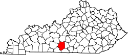
Nobob
Location within the state of Kentucky
Usa edcp location map.svg
Red pog.svg
Nobob
Nobob (the United States)
Coordinates: 36°51′55″N85°46′27″W / 36.86528°N 85.77417°W / 36.86528; -85.77417
Country United States
State Kentucky
County Barren
Elevation
833 ft (254 m)
Time zone UTC-6 (Central (CST))
  Summer (DST) UTC-5 (CST)
GNIS feature ID508712 [1]

Nobob is an unincorporated community in Barren County, Kentucky, United States.

History

Nobob was also known as Flathead. [2] A post office called Nobob was established in 1854, and remained in operation until it was discontinued in 1936. [3] The community took its name from nearby Nobob Creek. [4]

References

  1. U.S. Geological Survey Geographic Names Information System: Nobob, Kentucky
  2. "Barren County Names Traced". The Glasgow Daily Times. November 14, 1965. p. 53. Retrieved January 25, 2026.
  3. "Barren County". Jim Forte Postal History. Retrieved April 1, 2015.
  4. Rennick, Robert M. (December 5, 2013). From Red Hot to Monkey's Eyebrow: Unusual Kentucky Place Names. University Press of Kentucky. p. 41. ISBN   978-0-8131-4614-0.