Breckinridge County is a county located in the Commonwealth of Kentucky. As of the 2010 census, the population was 20,059. Its county seat is Hardinsburg, Kentucky. The county was named for John Breckinridge (1760–1806), a Kentucky Attorney General, state legislator, United States Senator, and United States Attorney General. It was the 38th Kentucky county in order of formation.

Breathitt County is a county located in the eastern Appalachian portion of the U.S. state of Kentucky. As of the 2010 census, the population was 13,878. Its county seat is Jackson, Kentucky. The county was formed in 1839 and was named for John Breathitt, who was Governor of Kentucky from 1832 to 1834. Breathitt County was a prohibition or dry county, until a public vote in July 2016 that allowed alcohol sales.

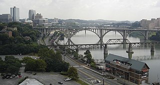
The Tennessee River is the largest tributary of the Ohio River. It is approximately 652 miles (1,049 km) long and is located in the southeastern United States in the Tennessee Valley. The river was once popularly known as the Cherokee River, among other names, as many of the Cherokee had their territory along its banks, especially in eastern Tennessee and northern Alabama. Its current name is derived from the Cherokee village Tanasi.

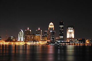
The Louisville metropolitan area or Kentuckiana, also known as the Louisville–Jefferson County, Kentucky–Indiana, metropolitan statistical area, is the 45th largest metropolitan statistical area (MSA) in the United States. The principal city is Louisville, Kentucky.

The Battle of Middle Creek was an engagement fought January 10, 1862, in Eastern Kentucky during the American Civil War.

Carr Creek Lake, located east of Hazard, Kentucky, along Kentucky Route 15 in Knott County, is a 710 acres (3 km2) reservoir created by the U.S. Army Corps of Engineers in 1976. Carr Creek Lake's earth and rock fill dam is 130 ft (40 m) tall and 720 ft (219 m) long, and the dam is located 8.8 mi (14 km) above the mouth of Carr Fork River, a tributary of the North Fork Kentucky River.

Harrods Creek is a neighborhood of Louisville, Kentucky centered near Harrods Creek at the intersection of River Road and Wolf Pen Branch Road. It is roughly bordered by the Ohio River to the west and US 42 to the east. Its ZIP code is 40027. Formerly an unincorporated community, it was designated a neighborhood of Louisville when the city merged with Jefferson County in 2003.
The Office of Kentucky Nature Preserves is an agency of the Commonwealth of Kentucky in the United States dedicated to the protection of Kentucky's natural heritage. It oversees a statewide program of nature preserves, Kentucky Wild Rivers Program, and the "Nature's Finest" license plate program of the Kentucky Heritage Land Conservation Fund Board. The program was formerly known as the "Kentucky State Nature Preserves Commission", from 1976 until a reorganization in 2018.
Peter Hackett was born in approximately 1763 or 1764 in the English colony of Virginia. It is believed that Peter was the son of Thomas Hackett, likely of Montgomery County, Virginia. As a boy Peter was bonded out to Captain James Estill, in approximately 1771, and was a part of the broad Scotch-Irish migration along the Wilderness Road through the Cumberland Gap from Virginia into what later became known as Kentucky in the late 18th century. In 1779 he was a resident of Boonesborough, one of the first English-speaking settlements beyond the Appalachian Mountains, and lived there until 1780. Early residents of Boonesborough included Daniel Boone, James Estill, Joseph Proctor, Nicholas Proctor, Adam Caperton, David Lynch, John Colefoot, John Moore, George Robertson, Thomas Miller, Reuben Proctor, Thomas Warren, Peter Hackett, and Thomas Watson. In 1780 Hackett helped establish Estill's Station, Kentucky, and lived there until about 1788.
Peters Creek and Peter Creek may refer to:

Carr Creek State Park is a park located along Kentucky Route 15 in Knott County, Kentucky, United States. The park itself encompasses 29 acres (12 ha), while the park's main feature, Carr Creek Lake, covers 750 acres (300 ha).

Eula Hall is a prominent Appalachian activist and healthcare pioneer who founded the Mud Creek Clinic in Grethel in Floyd County, Kentucky.

The Mount Horeb Earthworks Complex is an Adena culture group of earthworks in Fayette County, Kentucky. It consists of two major components, the Mount Horeb Site 1 and the Peter Village enclosure, and several smaller features including the Grimes Village site, Tarleton Mound, and Fisher Mound. The Peter Village and Grimes Village enclosures were mapped by Rafinesque and featured in Squier and Davis's landmark publication Ancient Monuments of the Mississippi Valley in 1848 as Plate XIV Figures 3 and 4.

Robinson Creek is an unincorporated community located in Pike County, Kentucky, United States.


