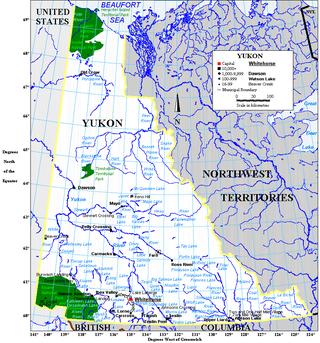
The Yukon River is a major watercourse of northwestern North America. From its source in British Columbia, it flows through Canada's territory of Yukon. The lower half of the river continues westward through the U.S. state of Alaska. The river is 3,190 kilometres (1,980 mi) long and empties into the Bering Sea at the Yukon–Kuskokwim Delta. The average flow is 6,400–7,000 m3/s (230,000–250,000 cu ft/s). The total drainage area is 854,700 km2 (330,000 sq mi), of which 323,800 km2 (125,000 sq mi) lies in Canada. The total area is more than 25% larger than Texas or Alberta.

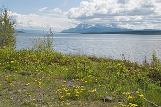
Bennett Lake is a lake in the Province of British Columbia and Yukon Territory in northwestern Canada, at an elevation of 656 m (2,152 ft). It is just north of the border with the United States state of Alaska, near the Alaskan port of Skagway. The lake has an area of either 90.68 or 96.8 km2. The average depth is 61.9 m (203 ft) and the maximum depth is 123 m (404 ft).

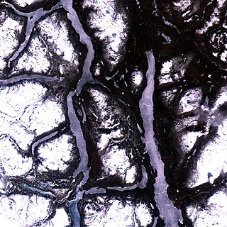
Tagish Lake is a lake in Yukon and northern British Columbia, Canada. The lake is more than 100 km (62 mi) long and about 2 km (1 mi) wide.

Nares Lake is a 107.15 km2 (41.37 sq mi) lake in the southern Yukon between Bennett Lake and Tagish Lake that lies below Nares Mountain. Nares Lake is in fact an arm of Tagish Lake. The community of Carcross is on the Nares Narrows between Bennett and Tagish Lake, along the Klondike Highway. The primary inflow to and outflow from the lake is the Nares River. Both the river and the lake are named after Admiral George Nares.

Atlin Lake is the largest natural lake in the Canadian province of British Columbia. The lake is 4 miles (6.4 km) wide and 85 miles (137 km) long. The northern tip of the lake is in the Yukon, as is Little Atlin Lake. However, most of the lake lies within the Atlin District of British Columbia. Atlin Lake is generally considered to be the source of the Yukon River although it is drained via the short Atlin River into Tagish Lake. Atlin Lake was named by the Tlingit First Nation people of the region.

Yukon is in the northwestern corner of Canada and is bordered by Alaska, British Columbia and the Northwest Territories. The sparsely populated territory abounds with natural scenery, snowmelt lakes and perennial white-capped mountains, including many of Canada's highest mountains. The territory's climate is Arctic in territory north of Old Crow, subarctic in the region, between Whitehorse and Old Crow, and humid continental climate south of Whitehorse and in areas close to the British Columbia border. Most of the territory is boreal forest with tundra being the main vegetation zone only in the extreme north and at high elevations.

The Boundary Ranges, also known in the singular and as the Alaska Boundary Range, are the largest and most northerly subrange of the Coast Mountains. They begin at the Nass River, near the southern end of the Alaska Panhandle in the Canadian province of British Columbia and run to the Kelsall River, near the Chilkoot Pass, beyond which are the Alsek Ranges of the Saint Elias Mountains, and northwards into the Yukon Territory flanking the west side of the Yukon River drainage as far as Champagne Pass, north of which being the Yukon Ranges. To their east are the Skeena Mountains and Stikine Plateau of the Interior Mountains complex that lies northwest of the Interior Plateau; the immediately adjoining subregion of the Stikine Plateau is the Tahltan Highland. To their northeast is the Tagish Highland, which is a subregion of the Yukon Plateau. Both highlands are considered in some descriptions as included in the Coast Mountains. The Alexander Archipelago lies offshore and is entirely within Alaska.

The Tagish Highland is an upland area on the inland side of the northernmost Boundary Ranges of the Coast Mountains, spanning far northwestern British Columbia from Atlin Lake to the area of the pass at Champagne, Yukon between the Alsek and Yukon Rivers. In some classification systems, and in local terminology, the Tagish Highland is considered to be part of the Boundary Ranges, as is the neighbouring Tahltan Highland to its south. As classified by the Canadian Mountain Encyclopedia per S. Holland, the Tagish Highland is part of the system unofficially described as the Interior Mountains.

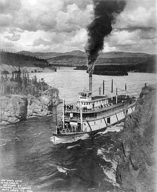
Steamboats on the Yukon River played a role in the development of Alaska and Yukon. Access to the interior of Alaska and Yukon was hindered by large mountains and distance, but the wide Yukon River provided a feasible route. The first steamers on the lower Yukon River were work boats for the Collins Overland Telegraph in 1866 or 1867, with a small steamer called Wilder. The mouth of the Yukon River is far to the west at St. Michael and a journey from Seattle or San Francisco covered some 4,000 miles (6,400 km).

Stikinia, or the Stikine terrane, is a terrane in British Columbia, Canada; the largest of the Canadian Cordillera. It formed as an independent, intraoceanic volcanic arc during the Paleozoic and Mesozoic.

Teslin Lake is a large lake spanning the border between British Columbia and Yukon, Canada. It is one of a group of large lakes in the region of far northwestern BC, east of the upper Alaska Panhandle, which are the southern extremity of the basin of the Yukon River, and which are known in Yukon as "the Southern Lakes". The lake is fed and drained primarily by the Teslin River, south and north, but is also fed from the east by the Jennings River and the Swift River, and from the west by the Hayes River.

The Yukon Plateau is a plateau located in the Yukon Territory, comprising much of the central and southern Yukon Territory and the far northern part of British Columbia, Canada between Tagish Lake (W) and the Cassiar Mountains (E) and north of the Nakina River.
Kusawa Lake is a lake in the southern Yukon, Canada. Kusawa means "long narrow lake" in the Tlingit language. The Kusawa Lake is a lake in Canada's Yukon Territory. It is located at an altitude of 671 m (2,201 ft) and is 60 km (37 mi) southwest of Whitehorse near the British Columbia border. It meanders over a length of 75 km (47 mi) with a maximum width of about 2.5 km (1.6 mi) through the mountains in the north of the Boundary Ranges. It is fed by the Primrose River and Kusawa River. The Takhini outflows to the Yukon River from the northern tip of Kusawa Lake. Kusawa Lake has an area of 142 km2 (55 sq mi). The lake has a maximum depth of 140 m (460 ft) and is of glacial origin. It is a common tourist destination and is also popular for fishing.
The Tagish are a First Nations people of Canada.
Partridge Lake is a lake in Cochrane District in Northeastern Ontario, Canada. It is the source of the Partridge River from an outflow at middle of the east side of the lake; the Partridge River flows to James Bay. There are five unnamed inflows to the lake.
The Partridge River is a river in the Yukon and British Columbia, Canada. It is in the Bering Sea drainage basin and is a tributary of Bennett Lake.
The Nares River is a river in the Yukon and British Columbia, Canada. It is in the Bering Sea drainage basin, is a tributary of Tagish Lake, and is named for George Nares, a naval officer.


