Parys

Last updated • 5 min readFrom Wikipedia, The Free Encyclopedia
Parys
Nederduitse Gereformeerde Mother Church Parys-006.jpg
Nederduitse Gereformeerde Mother Church, Hefer Street, Parys
South Africa Free State location map.svg
Red pog.svg
Parys
South Africa adm location map.svg
Red pog.svg
Parys
Coordinates: 26°54′S27°27′E / 26.900°S 27.450°E / -26.900; 27.450
Country South Africa
Province Free State
District Fezile Dabi
Municipality Ngwathe
Established1882 [1]
Area
[2]
  Total23.3 km2 (9.0 sq mi)
Population
 (2022) [2]
  Total45,868
  Density2,000/km2 (5,100/sq mi)
Racial makeup (2011)
[2]
   White 84.4%
   Black African 13.2%
   Coloured 1.3%
   Indian/Asian 0.7%
  Other0.4%
First languages (2011)
[2]
   Afrikaans 84.7%
   English 6.9%
   Sotho 5.1%
   Xhosa 1.0%
  Other2.3%
Time zone UTC+2 (SAST)
Postal code (street)
9585
PO box
9585
Area code 056
Website www.parys.co.za

Parys (pronounced /ˈpɑːrs/ ), resort town, northern Free State province, South Africa. It is situated on the southern bank of the Vaal River. [3] The name of the city is the Afrikaans translation of Paris. The origin of the name 'Parys' is attributed to German surveyor Schilbach, who named it after the city of Paris because of the similarity between its location next to the Vaal River and that of Paris on the River Seine. The area of Parys also includes the two townships of Tumahole and Schonkenville.

Contents

History

In the early 1870s, towns in the Northern Free State were situated very far apart, and members of different churches had to travel great distances to participate in religious services. It was then decided by the Ring of the Dutch Reformed Church to implant the idea of a congregation north of the Rhenoster River into the minds of the residents of the farm Klipspruit, on the Vaal River, which was owned by four van Coller brothers. Three gentlemen, Messrs. De Villiers, Luyt and Fleck were sent to the owners of Klipspruit to induce them to lay the farm out as a township, but the Van Coller brothers were very reluctant to listen to the arguments put forward by the three men. Not giving up hope of laying out a township, the three gentlemen went to the adjoining farm, Vischgat (the present Vredefort). The owners of Vischgat were more amenable to argument and inducement, and it was not long before the township Vredefort was born. The owners of Klipspruit soon awoke to the fact that a golden opportunity had slipped through their fingers and set out in haste to retrieve matters. History does not record the steps they took, but it seems probable that they secured the sympathy of the Dutch Reformed Church, for, later on in 1876 when the town was laid out, a goodly portion of ground was set aside and donated to the church. On the 14 th of June 1876 the first sale of seven erven was held by a Mr. Wouter de Villiers, and the upset price of the erven was 25 pounds each. [4]

20th century

The completion of the railway sideline to Parys in 1905 meant that Parys had suddenly become more accessible to the public, and this led to the growth of the town as a holiday resort and industrial center. The town was now being marketed as The Pride of the Vaal," and city dwellers flocked by train to the lush green riverbanks and special swimming facilities and accommodations provided by the Village Management Board at the time. Bungalows were built on Woody Island and were serviced by the Woody Island Ferry. Unfortunately, this venture did not last very long because of the inaccessibility of the island during the flood periods. By now, residents of the town had felt for quite some time that a bridge across the Vaal River was justly due. The Woody Island, Ferry Service crossed on to Woody Island and from there another ferry completed the crossing. The service was infrequent, and accidents happened frequently. Farmers on the Transvaal side even preferred to go to Potchefstroom, 48 kilometres (30 mi) away, rather than face the expense of the ferry crossings. Towards the end of 1913, tenders were requested for a reinforced concrete bridge over the Vaal. The project began in May 1914. The outbreak of the First World War three months later caused long delays, and the bridge was only finished and opened for traffic around Christmas 1915. Because of the bridge over the Vaal, trade grew, and Parys was a new market for farmers from the then-Transvaal side. Many new buildings were built as more and more traffic ran through the town.

The West End suburb of Parys on the south bank of the Vaal River Vaal River Parys.jpg
The West End suburb of Parys on the south bank of the Vaal River

Few of the original buildings and historic places remain today. The current Parys Palm Court Hotel is one of the surviving turn-of-the century buildings, as are the museum (once the magistrate's office) and "Moedergemeente" Church in the center of town. There are, however, a few original old houses remaining. Industries that have come and gone are the Orange River Canning Company, Parys Basket Works, which used a special willow planted on the riverbanks, a jam factory, a boat building factory, a cold drink factory, and the Parys Roller Milling Company. By the middle 1950s, big industries like ARWA, BASA (a nuts-and-bolts factory), Vaalrivierse Tabakkooperasie, Vetsak (an agricultural co-op that was founded in Parys), and Metro Clothing Company had settled in the industrial area of Parys. Only a handful of industries remain today, and like in the early days, the town is becoming increasingly popular as a weekend and holiday destination for people wanting to escape the pressures of city life.

Notable citizens

Related Research Articles

<span class="mw-page-title-main">Winnie Madikizela-Mandela</span> South African activist and politician (1936–2018)

Winnie Madikizela-Mandela, also known as Winnie Mandela, was a South African anti-apartheid activist and politician, and the second wife of Nelson Mandela. She served as a Member of Parliament from 1994 to 2003, and from 2009 until her death, and was a deputy minister of arts and culture from 1994 to 1996. A member of the African National Congress (ANC) political party, she served on the ANC's National Executive Committee and headed its Women's League. Madikizela-Mandela was known to her supporters as the "Mother of the Nation".

<span class="mw-page-title-main">Orange Free State</span> 1854–1902 Boer republic in Southern Africa

The Orange Free State was an independent Boer sovereign republic under British suzerainty in Southern Africa during the second half of the 19th century, which ceased to exist after it was defeated and surrendered to the British Empire at the end of the Second Boer War in 1902. It is one of the three historical precursors to the present-day Free State province.

<span class="mw-page-title-main">Vaal River</span> Tributary of the Orange River, South Africa

The Vaal River is the largest tributary of the Orange River in South Africa. The river has its source near Breyten in Mpumalanga province, east of Johannesburg and about 30 kilometres (19 mi) north of Ermelo and only about 240 kilometres (150 mi) from the Indian Ocean. It then flows westwards to its confluence with the Orange River southwest of Kimberley in the Northern Cape. It is 1,458 kilometres (906 mi) long, and forms the border between Mpumalanga, Gauteng and North West Province on its north bank, and the Free State on its south.

<span class="mw-page-title-main">Transvaal (province)</span> Former province of South Africa

The Province of the Transvaal, commonly referred to as the Transvaal, was a province of South Africa from 1910 until 1994, when a new constitution subdivided it following the end of apartheid. The name "Transvaal" refers to the province's geographical location to the north of the Vaal River. Its capital was Pretoria, which was also the country's executive capital.

<span class="mw-page-title-main">Paarl</span> Town in Western Cape, South Africa

Paarl is a town with 285,574 inhabitants in the Western Cape province of South Africa. It is the third-oldest city and European settlement in the Republic of South Africa and the largest town in the Cape Winelands. Due to the growth of the Mbekweni township, it is now a de facto urban unit with Wellington. It is situated about 60 kilometres (37 mi) northeast of Cape Town in the Western Cape Province and is known for its scenic environment and viticulture and fruit-growing heritage.

<span class="mw-page-title-main">Potchefstroom</span> Place in North West, South Africa

Potchefstroom, colloquially known as Potch, is an academic city in the North West Province of South Africa. It hosts the Potchefstroom Campus of the North-West University. Potchefstroom is on the Mooi Rivier, roughly 120 km (75 mi) west-southwest of Johannesburg and 45 km (28 mi) east-northeast of Klerksdorp.

<span class="mw-page-title-main">Vredefort impact structure</span> Largest verified impact structure on Earth, about 2 billion years old

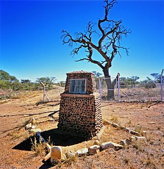
The Vredefort impact structure is one of the largest verified impact structures on Earth. The crater, which has since been eroded away, has been estimated at 170 kilometres (110 mi) to 300 km (190 mi) across when it was formed. The remaining structure, comprising the deformed underlying bedrock, is located in present-day Free State province of South Africa. It is named after the town of Vredefort, which is near its centre. The structure's central uplift is known as the Vredefort Dome. The impact structure was formed during the Paleoproterozoic Era, 2.023 billion years ago. It is the second-oldest known impact structure on Earth, after Yarrabubba.

<span class="mw-page-title-main">Vereeniging</span> City in Gauteng, South Africa

Vereeniging is a city located in the south of Gauteng province, South Africa, situated where the Klip River empties into the northern loop of the Vaal River. It is also one of the constituent parts of the Vaal Triangle region and was formerly situated in the Transvaal province. The name Vereeniging is the Dutch word meaning "association".

<span class="mw-page-title-main">N1 (South Africa)</span> National road in South Africa

The N1 is a national route in South Africa that runs from Cape Town through Bloemfontein, Johannesburg, Pretoria and Polokwane to Beit Bridge on the border with Zimbabwe. It forms the first section of the famed Cape to Cairo Road.

<span class="mw-page-title-main">Vanderbijlpark</span> City in Gauteng, South Africa

Vanderbijlpark is an industrial city with approximately 95,000 inhabitants, situated on the Vaal River in the south of Gauteng province, South Africa. The city is named after Hendrik van der Bijl, an electrical engineer and industrialist.

<span class="mw-page-title-main">Bothaville</span> Place in Free State, South Africa

Bothaville is a maize farming town situated near the Vaal River in the Lejweleputswa DM of the Free State province, South Africa. It is situated 60 km east of the Vaal, on the bank of its Vals River tributary. Bothaville and the adjacent Kgotsong township have a total of approximately 46,000 residents.

Sasolburg is the third largest city within the Metsimaholo Local Municipality in the far north of the Free State province of South Africa and is further sub-divided into three areas: Sasolburg proper, Vaalpark and Zamdela.

Villiers is a small town situated on the banks of the Vaal River next to the N3 highway in the Free State province of South Africa. It was founded in 1882 on the two farms Pearson Valley and Grootdraai owned by Lourens de Villiers.

<span class="mw-page-title-main">Vredefort</span> Place in Free State, South Africa

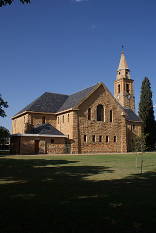
Vredefort is a small farming town in the Free State province of South Africa with cattle, peanuts, sorghum, sunflowers and maize being farmed. It is home to 3,000 residents.

<span class="mw-page-title-main">Barkly West</span> Place in Northern Cape, South Africa

Barkly West is a town in the Northern Cape province of South Africa, situated on the north bank of the Vaal River west of Kimberley.

<span class="mw-page-title-main">R30 (South Africa)</span> Road in South Africa

The R30 is a provincial route in South Africa that connects Bloemfontein with Rustenburg via Brandfort, Welkom, Bothaville, Klerksdorp and Ventersdorp. The southern part of the route is tolled, as the R30 forms the first section of the ZR Mahabane Toll Route, with the Brandfort Toll Plaza found 10 kilometres north of its Southern junction with the N1 National Route. The tolled portion ends at the junction with the R730.

In South Africa, as elsewhere in the world, the railways played a huge part in development and growth on nearly all terrains in the country. Conversely, events in South Africa and its neighbours over the years had a huge influence on the development of railways.

<span class="mw-page-title-main">Parys Commando</span> Military unit

Parys Commando was a light infantry regiment of the South African Army. It formed part of the South African Army Infantry Formation as well as the South African Territorial Reserve.

<span class="mw-page-title-main">Dorkay House</span>

Dorkay House is situated on Portion 168 of Farm Turnfontein at 5–7 Eloff Street, Johannesburg, South Africa. It was constructed in 1952 and was designed by architect Colman Segal (1923–1988). It takes its name from the original owner, Dora Kotzen.

Abu Baker Asvat, also known as Abu Asvat or Abu nicknamed Hurley was a South African medical doctor who practised in Soweto in the 1970s and 1980s. A founding member of Azapo, Asvat was the head of its health secretariat, and involved in initiatives aimed at improving the health of rural black South Africans during Apartheid.

References

  1. Robson, Linda Gillian (2011). "Annexure A" (PDF). The Royal Engineers and settlement planning in the Cape Colony 1806–1872: Approach, methodology and impact (PhD thesis). University of Pretoria. pp. xlv–lii. hdl:2263/26503.
  2. 1 2 3 4 Main Place Parys from Census 2011.
  3. "Encyclopedia Britannica | Britannica". www.britannica.com. Retrieved 2023-05-28.
  4. "History of PARYS in South Africa, situated in the Vredefort Dome". www.parys.co.za. Retrieved 2023-05-28.
  5. "Johann van Schalkwyk". iso.org. Archived from the original on 2011-05-16.