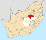
For administrative purposes, Egypt is divided into twenty-seven governorates. Egyptian governorates are the top tier of the country's jurisdiction hierarchy. A governorate is administered by a governor, who is appointed by the President of Egypt and serves at the president's discretion. Most governorates have a population density of less than one thousand per km2, while the three largest have a population density of less than three per km2.
Oldbury-on-Severn is a small village near the mouth of the River Severn in the South Gloucestershire district of the county of Gloucestershire in the west of England. The parish, which includes the village of Cowhill had a population at the 2011 census of 780. It is home to the nearby Oldbury nuclear power station, a Magnox power station which opened in 1967 and ceased operation on 29 February 2012.
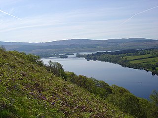
Loch Awe is a large body of mostly freshwater in Argyll and Bute, Scottish Highlands. It has also given its name to a village on its banks, variously known as Loch Awe or Lochawe. There are islands within the loch such as Innis Chonnell and Inishail.

Yelland is a village of 2,000 inhabitants situated in North Devon between Instow and Fremington in the English county of Devon. Yelland is included within the parish of Fremington.

Trawsfynydd is a linear village in Gwynedd, Wales, adjacent to the A470 north of Bronaber and Dolgellau near Blaenau Ffestiniog.

Tanygrisiau is a village and area within Blaenau Ffestiniog in the upper end of the Vale of Ffestiniog in the county of Gwynedd, north-west Wales. It can be found along the southern side of the Moelwyn mountain range and dates to around 1750. It joins onto the semi-urban area of Blaenau Ffestiniog, and is in the community of Ffestiniog; located between 650 feet (200 m) and 750 feet (230 m) above sea level. it is in the electoral ward of Bowydd and Rhiw which had a 2011 census population of 1878. The village itself has a population of around 350.

Maentwrog is a village and community in the Welsh county of Merionethshire, lying in the Vale of Ffestiniog just below Blaenau Ffestiniog, within the Snowdonia National Park. The River Dwyryd runs alongside the village. Its population of 585 in 2001 increased to 631 at the 2011 Census. The Community of Maentwrog includes the village of Gellilydan.
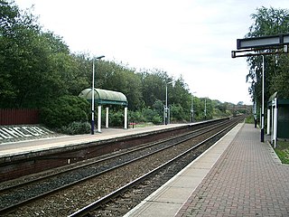
Huncoat railway station is a railway station which serves the village of Huncoat, between Accrington and Burnley in Lancashire, England. The station is 8 miles (13 km) east of Blackburn railway station on the East Lancashire Line operated by Northern.

Limingen (Norwegian) or Lyjmede (Southern Sami) is a lake in the municipalities of Røyrvik and Lierne in Trøndelag county, Norway. It is the eighth-largest lake in the country. The lake lies 418 metres (1,371 ft) above sea level and has an area of 94 square kilometres (36 sq mi). At the deepest point, it is 192 metres (630 ft) deep and averages about 87 metres (285 ft) deep. The lake has a volume of 8.34 cubic kilometres (2.00 cu mi) and is located just north of the large lake Tunnsjøen. The border with Sweden lies about 725 metres (0.5 mi) east of the lake.

Unchahar is a town and nagar panchayat in Raebareli district in the Indian state of Uttar Pradesh. It serves as the headquarters of a tehsil as well as a community development block. It is located on Lucknow Allahabad Highway, 115 km from Lucknow, 85 km from Allahabad. The place is well connected by rail and roads to nearby cities of Kanpur, Lucknow, and Allahabad. Unchahar is also a constituency of Uttar Pradesh Legislative assembly.

Aberthaw is an area containing the villages of East Aberthaw and West Aberthaw, on the coast of South Wales about 5 miles (8 km) west of Barry. It is home to Aberthaw Cement Works, Aberthaw Lime Works, and Aberthaw Power Station, a coal power station that is linked to the South Wales Valleys via the Vale of Glamorgan Railway. The area is historically within the parish of Penmark in the Vale of Glamorgan. The two villages of West and East Aberthaw are separated by the River Thaw. The village of East Aberthaw, near Rhoose, has a 13th-century pub. The village Baptist Chapel and Mission Room, no longer exist as such and have been converted for other uses.

Paluel is a commune in the Seine-Maritime department in the Normandy region in northern France.

Ennore is a neighbourhood in Chennai, India. Ennore is situated on a peninsula and is bounded by the Korttalaiyar River, Ennore Creek and the Bay of Bengal. The creek separates south Ennore from the north Ennore which covers major portions of North Chennai Thermal Power Station and Ennore Port. The neighbourhood is served by Ennore railway station. Over the years Ennore has become the hub of a range of industrial projects, mainly thermal power stations, fertilizer factories, industrial ports and coal yards.

Portishead railway station was opened by the Bristol and Portishead Pier and Railway in 1867; it was approximately 0.5 miles (0.80 km) from the village of Portishead. After the opening of the Pier in 1870, the line was extended with an additional railway station opened by the pier. The Pier station closed first; and the original Portishead station closed in 1954, with a new Portishead station opened nearer the town. The 1954 station closed in 1964 when passenger services were withdrawn from the line.
Myneni Hariprasada Rao, was born in Edlalanka village near Avanigadda, is a retired Director of the Nuclear Power Board of DAE, Mumbai, India. He has served for many years as a member of Southern, Western and Northern Indian Regional electricity boards.
Nashik Thermal Power Plant is located at Eklahare village near Nashik in Maharashtra. The power plant is one of the coal based power plants of Maharashtra State Power Generation Company (Mahagenco)

JSW Energy Limited (JSWEL) is a division of JSW Group in India.

The River Thaw is a river in the Vale of Glamorgan, south Wales. At 20 kilometres/12.4 miles, it is the longest river entirely in the Vale of Glamorgan.
The Life FM is a network of Christian radio stations in the United States, broadcasting southern gospel music.
Jhimpir railway station is located at Jhimpir village, Thatta district of Sindh province, Pakistan, 114 km (71 mi) from Karachi. Jhimpir Wind Power Plant is Pakistan's first wind power plant.