| The Paston Way | |
|---|---|
 Paston Way route marker | |
| Length | 20 mi (32 km) |
| Location | Northeastern Norfolk |
| Designation | Recreational walk |
| Trailheads | North Walsham 52°49′18″N1°23′13″E / 52.8216°N 1.3869°E Cromer 52°55′53″N1°18′02″E / 52.9314°N 1.3006°E |
| Use | Walking |
| Season | All year round |
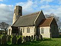
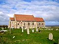
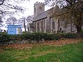
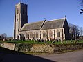
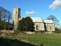
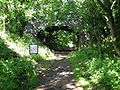
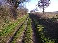
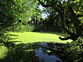
| Sights | Route takes in 16 churches and 16 villages and towns. |
The Paston Way is a footpath. It is entirely within the English county of Norfolk in the United Kingdom. [1] The footpath is twenty miles in length, the portals to the path are Cromer at its northwestern end and North Walsham at it southeastern end.