Patrick Creek, California

Last updated

Coordinates: 41°52′30″N123°50′42″W / 41.87500°N 123.84500°W / 41.87500; -123.84500

Geographic coordinate system Coordinate system

A geographic coordinate system is a coordinate system that enables every location on Earth to be specified by a set of numbers, letters or symbols. The coordinates are often chosen such that one of the numbers represents a vertical position and two or three of the numbers represent a horizontal position; alternatively, a geographic position may be expressed in a combined three-dimensional Cartesian vector. A common choice of coordinates is latitude, longitude and elevation. To specify a location on a plane requires a map projection.

Patrick Creek
Unincorporated community
California Locator Map with US.PNG
Red pog.svg
Patrick Creek
Location in California
Usa edcp location map.svg
Red pog.svg
Patrick Creek
Patrick Creek (the US)
Coordinates: 41°52′30″N123°50′42″W / 41.87500°N 123.84500°W / 41.87500; -123.84500
Country United States
State California
County Del Norte County
Elevation [1] 843 ft (257 m)

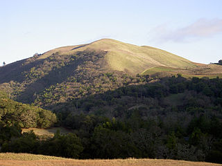
Patrick Creek is an unincorporated community in Del Norte County, California. It is located 7 miles (11 km) east-northeast Gasquet, [2] at an elevation of 843 feet (257 m).

Unincorporated area Region of land not governed by own local government

In law, an unincorporated area is a region of land that is not governed by a local municipal corporation; similarly an unincorporated community is a settlement that is not governed by its own local municipal corporation, but rather is administered as part of larger administrative divisions, such as a township, parish, borough, county, city, canton, state, province or country. Occasionally, municipalities dissolve or disincorporate, which may happen if they become fiscally insolvent, and services become the responsibility of a higher administration. Widespread unincorporated communities and areas are a distinguishing feature of the United States and Canada. In most other countries of the world, there are either no unincorporated areas at all, or these are very rare; typically remote, outlying, sparsely populated or uninhabited areas.
Del Norte County, California County in California ----

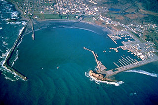
Del Norte County is a county at the far northwest corner of the U.S. state of California, along the Pacific Ocean adjacent to the Oregon border. As of the 2010 census, the population was 28,610. The county seat and only incorporated city is Crescent City. Del Norte was pioneered and settled by Azorean Portuguese explorers and dairy farmers, which may account for the local pronunciation of the county name. Residents pronounce the county name as Del Nort, not Del Nor-teh as would be expected in Spanish.

California State of the United States of America

California is a state in the Pacific Region of the United States. With 39.6 million residents, California is the most populous U.S. state and the third-largest by area. The state capital is Sacramento. The Greater Los Angeles Area and the San Francisco Bay Area are the nation's second- and fifth-most populous urban regions, with 18.7 million and 9.7 million residents respectively. Los Angeles is California's most populous city, and the country's second-most populous, after New York City. California also has the nation's most populous county, Los Angeles County, and its largest county by area, San Bernardino County. The City and County of San Francisco is both the country's second-most densely populated major city after New York City and the fifth-most densely populated county, behind only four of the five New York City boroughs.

Related Research Articles

Carp River is a 40.2-mile-long (64.7 km) river in Chippewa and Mackinac counties in the U.S. state of Michigan. 21.7 miles (34.9 km) of the river were added to the National Wild and Scenic Rivers System in 1992.

Coldwater River is a 29.5-mile-long (47.5 km) stream in the U.S. state of Michigan. Located in Branch County, the river rises in Ovid Township at 41°50′14″N84°59′13″W as the outflow of Coldwater Lake. Flowing north and west, it is joined by the outflow from the Lake of the Woods and continues north for several miles. West of the city of Coldwater, it flows through a series of lakes: South Lake, Messenger Lake, Cemetery Lake, North Lake, Randall Lake, Morrison Lake, Craig Lake, and Hodunk Pond. It then continues to the northwest and empties into the St. Joseph River in the village of Union City at 42°03′58″N85°07′48″W.

Bald Mountain (California) name given to over fifty summits in California

Bald Mountain is a name given to over fifty summits in California.

Adams Station, California Unincorporated community in California, United States

Adams Station is an unincorporated community in Del Norte County, California. It is located on the Smith River just west of Gasquet, at an elevation of 338 feet.

Darlingtonia, California Unincorporated community in California, United States

Darlingtonia is an unincorporated community in Del Norte County, California. It is located on the south bank of the Middle Fork of the Smith River 1.5 miles (2.4 km) east-southeast of Gasquet, at an elevation of 463 feet.

French Hill, California Unincorporated community in California, United States

French Hill is an unincorporated community in Del Norte County, California. It lies at an elevation of 1863 feet.

Klamath Glen, California Unincorporated community in California, United States

Klamath Glen is an unincorporated community in Del Norte County, California. It is located on the Klamath River 5 miles (8 km) from its mouth, at an elevation of 46 feet.

Lawyers Bar, California Former settlement in California, United States

Lawyers Bar was a settlement in Klamath County now Del Norte County, California, United States. It was located on the Middle Fork of the Smith River, at an elevation of 899 feet. It still appeared on maps as of 1922.

Rockland, California Unincorporated community in California, United States

Rockland is an unincorporated community in Del Norte County, California. It is located on the North Fork of the Smith River 9 miles (14 km) north of Gasquet, at an elevation of 912 feet.

Scaath, California Unincorporated community in California, United States

Scaath is an unincorporated community in Del Norte County, California. It was located on the north bank of the Klamath River 1.25 miles (2.0 km) east of Klamath Glen, at an elevation of 79 feet.

Brock Creek, California Former settlement in California, United States

Brock Creek is a former settlement in Humboldt County, California. It was located on the Northwestern Pacific Railroad 7.5 miles (12 km) northwest of Alderpoint, at an elevation of 279 feet. It still appeared on maps as of 1949.

Erner, California Former settlement in California, United States

Erner is a former Yurok settlement in Humboldt County, California. It was located on the Klamath River at the mouth of Blue Creek, at an elevation of 105 feet.

Opegoi, California Former settlement in California, United States

Opegoi is a former Karok settlement in Humboldt County, California. It was located on the Klamath River opposite the mouth of Red Cap Creek, at an elevation of 341 feet.

Pecwan is a locality in Humboldt County, California. It is located on the Klamath River near the mouth of Pecwan Creek 1 mile (1.6 km) east-southeast of Johnsons, at an elevation of 869 feet (265 m).

Pekwan, California Former settlement in California, United States

Pekwan is a former Yurok settlement in Humboldt County, California. It is located on the Lower Klamath River at the mouth of Pecwan Creek, at an elevation of 85 feet.

Shregegon, California Former Settlement in California, United States

Shregegon is a former Yurok settlement in Humboldt County, California. It was located about 1 mile (1.6 km) above the mouth of Pecwan Creek, at an elevation of 125 feet.

Black Bear is a populated place, originally a gold mining town in Klamath County, now in unincorporated Siskiyou County, California.

Angle Creek is a stream in Lake and Peninsula Borough, Alaska, in the United States.

Tenmile Creek is a stream in the U.S. state of West Virginia. It is a tributary of Buckhannon River.

Gibson is an unincorporated community in Pemiscot County, in the U.S. state of Missouri.

References

  1. U.S. Geological Survey Geographic Names Information System: Patrick Creek, California
  2. Durham, David L. (1998). California's Geographic Names: A Gazetteer of Historic and Modern Names of the State. Clovis, Calif.: Word Dancer Press. p. 119. ISBN   1-884995-14-4.