Related Research Articles

Volcanism is the phenomenon of eruption of molten rock (magma) onto the surface of the Earth or a solid-surface planet or moon, where lava, pyroclastics and volcanic gases erupt through a break in the surface called a vent. It includes all phenomena resulting from and causing magma within the crust or mantle of the body, to rise through the crust and form volcanic rocks on the surface. Magmas, that reach the surface and solidify, form extrusive landforms.

The Ring of Fire is a region around much of the rim of the Pacific Ocean where many volcanic eruptions and earthquakes occur. The Ring of Fire is a horseshoe-shaped belt about 40,000 km (25,000 mi) long and up to about 500 km (310 mi) wide.

Volcanology is the study of volcanoes, lava, magma and related geological, geophysical and geochemical phenomena (volcanism). The term volcanology is derived from the Latin word vulcan. Vulcan was the ancient Roman god of fire.

The Yellowstone Caldera, sometimes referred to as the Yellowstone Supervolcano, is a volcanic caldera and supervolcano in Yellowstone National Park in the Western United States. The caldera and most of the park are located in the northwest corner of Wyoming. The caldera measures 43 by 28 miles, and postcaldera lavas spill out a significant distance beyond the caldera proper.
Tectonophysics, a branch of geophysics, is the study of the physical processes that underlie tectonic deformation. The field encompasses the spatial patterns of stress, strain, and differing rheologies in the lithosphere and asthenosphere of the Earth; and the relationships between these patterns and the observed patterns of deformation due to plate tectonics.

Mountain formation refers to the geological processes that underlie the formation of mountains. These processes are associated with large-scale movements of the Earth's crust. Folding, faulting, volcanic activity, igneous intrusion and metamorphism can all be parts of the orogenic process of mountain building. The formation of mountains is not necessarily related to the geological structures found on it.

Cordón del Azufre is a small, inactive complex volcano located in the Central Andes, at the border of Argentina and Chile.

In geology, aseismic creep or fault creep is measurable surface displacement along a fault in the absence of notable earthquakes. Aseismic creep may also occur as "after-slip" days to years after an earthquake. Notable examples of aseismic slip include faults in California.
Earthscope was an National Science Foundation (NSF) funded earth science program that, from 2003-2018, used geological and geophysical techniques to explore the structure and evolution of the North American continent and to understand the processes controlling earthquakes and volcanoes. The project had three components: USArray, the Plate Boundary Observatory, and the San Andreas Fault Observatory at Depth. Organizations associated with the project included UNAVCO, the Incorporated Research Institutions for Seismology (IRIS), Stanford University, the United States Geological Survey (USGS) and National Aeronautics and Space Administration (NASA). Several international organizations also contributed to the initiative. EarthScope data are publicly accessible.
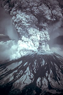
Prediction of volcanic eruption, or volcanic eruption forecasting, is an interdisciplinary monitoring and research effort to predict the time and severity of a volcano's eruption. Of particular importance is the prediction of hazardous eruptions that could lead to catastrophic loss of life, property, and disruption of human activities.
QuakeSim is a NASA project for modeling earthquake fault systems. It was started in 2001 with NASA funding as a follow up to the General Earthquake Models (GEM) initiative. The multi-scale nature of earthquakes requires integrating data types and models to fully simulate and understand the earthquake process. QuakeSim is a computational framework for modeling and understanding earthquake and tectonic processes.
Gregory C. Beroza is a seismologist and the Wayne Loel Professor of Earth Sciences at Stanford University. He is also the Co-Director of the Southern California Earthquake Center. He was elected to the fellow of American Geophysical Union in 2008.

The geology of New Zealand is noted for its volcanic activity, earthquakes and geothermal areas because of its position on the boundary of the Australian Plate and Pacific Plates. New Zealand is part of Zealandia, a microcontinent nearly half the size of Australia that broke away from the Gondwanan supercontinent about 83 million years ago. New Zealand's early separation from other landmasses and subsequent evolution have created a unique fossil record and modern ecology.
Mary Lou Zoback is an American geophysicist who led the world stress map project of the International Lithosphere Program. Zoback is currently a member of the U.S. Nuclear Waste Technical Review Board.
Kiyoo Mogi was a prominent seismologist. He was regarded as Japan's foremost authority on earthquake prediction and was a chair of the Japanese Coordinating Committee for Earthquake Prediction (CCEP). Mogi was also a director of the University of Tokyo's Earthquake Research Institute, was a professor at Nihon University and was professor emeritus at Tokyo University. Due to the seismic activity in Japan, Mogi also took an interest in safety of nuclear power in Japan.
Volcano tectonics is a scientific field that uses the techniques and methods of structural geology, tectonics, and physics to analyse and interpret physical processes and the associated deformation in volcanic areas, at any scale.

The Tengchong Volcanic Field (TVF) is a Cenozoic volcanic field located in the Southeastern margin of the Tibetan Plateau around 40 km from the Chinese border with Myanmar. The TVF is uniquely the only region affected by Quaternary volcanism that is part of the Himalayan Geothermal Belt caused by the Indo-Asian continent-continent collision. The TVF is characterized by hydrothermal activity and large-scale eruptions last recorded in 1609CE. Although the volcanoes themselves are considered extinct, several geothermal fields geographically linked to the TVF are still highly active. Evidence for geothermal activity can be linked to several prevalent active hot-springs located predominantly within the vicinity of the volcanoes in the TVF. Holocene eruptions occurred predominantly in the three largest volcanoes in the TVF named the Dayingshan, Maa'nshan and Heikongshan, the highest of which (Dayingshan) reaches 2865 meters above sea level. The volcanoes are distributed in a string-like pattern clustered from North to South in the middle on the Tengchong basin and are characterized by post-collisional high-Potassium (K) calc-alkaline series eruptions. The TVF provides unique geographical and geological knowledge as understanding the geological processes of creation provides insight into aspects such as the history of volcanism during the Quaternary Era in the region and as well as compositional information of its source and crustal assimilants. The TVF can be visited in the Tengchong Volcanic Geothermal National Geological Park.`

The geological deformation of Iceland is the way that the rocks of the island of Iceland are changing due to tectonic forces. The geological deformation explains the location of earthquakes, volcanoes, fissures, and the shape of the island. Iceland is the largest landmass (102,775 km²) situated on an oceanic ridge. It is an elevated plateau of the sea floor, situated at the crossing of the Mid-Atlantic Ridge and the Greenland-Iceland-Faeroe Ridge. It lies along the oceanic divergent plate boundary of North American Plate and Eurasian Plate. The western part of Iceland sits on the North American Plate and the eastern part sits on the Eurasian Plate. The Reykjanes Ridge of the Mid-Atlantic ridge system in this region crosses the island from southwest and connects to the Kolbeinsey Ridge in the northeast.
Kunlun Volcanic Group, also known as Ashikule Volcanic Field, is a volcanic field in northwestern Tibet. Eight other volcanic fields are also in the area. The field is within a basin that also contains three lakes.
References
- ↑ "Paul Segall 2014 Charles A. Whitten Medal |". honors.agu.org. Retrieved 2022-01-13.
- ↑ "paul segall". scholar.google.com. Retrieved 2022-01-12.
- 1 2 3 "Paul Segall". www.nasonline.org. Retrieved 2022-01-12.
- ↑ "segall | Southern California Earthquake Center". www.scec.org. Retrieved 2022-01-12.
- ↑ "Volcano expert explains the science behind Kilauea's ongoing eruption". NBC News. Retrieved 2022-01-12.
- ↑ "Crustal Deformation and Fault Mechanics Research Group". pangea.stanford.edu. Retrieved 2022-01-12.
- ↑ "Segall, Paul". press.princeton.edu. Retrieved 2022-01-12.
| General | |
|---|---|
| National libraries | |
| Scientific databases | |
| Other | |