Pelkie, Michigan

Last updated

Pelkie, Michigan
Pelkie (CDP), MI location.png
Location within Baraga County
USA Michigan location map.svg
Red pog.svg
Pelkie
Location within the state of Michigan
Usa edcp location map.svg
Red pog.svg
Pelkie
Location within the United States
Coordinates: 46°48′48″N88°38′11″W / 46.81333°N 88.63639°W / 46.81333; -88.63639
CountryFlag of the United States.svg United States
State Flag of Michigan.svg  Michigan
County Flag of Baraga County, Michigan.svg Baraga
Township Baraga
Area
[1]
  Total1.34 sq mi (3.48 km2)
  Land1.33 sq mi (3.46 km2)
  Water0.01 sq mi (0.03 km2)
Elevation
[2]
669 ft (204 m)
Population
 (2020)
  Total51
  Density38.20/sq mi (14.76/km2)
Time zone UTC-5 (Eastern (EST))
  Summer (DST) UTC-4 (EDT)
ZIP code(s)
49958
Area code 906
GNIS feature ID1621187 [2]

Pelkie is a unincorporated community and census-designated place (CDP) in Baraga County in the U.S. state of Michigan. [2] The CDP had a population of 51 at the 2020 census, which ranks it the second-least populated CDP in the state of Michigan. The community is located along the Sturgeon River in the northeast portion of Baraga Township.

Contents

History

Pelkie was settled by French Canadians in about 1885, and was first known as "King's Landing" and was renamed Pelkie after an early settler, William Pelkie. [3] [4] Finns who settled there initially called the place Kyrö, after the place they came from in Finland; however, Kyro Location is now regarded as a distinct town from Pelkie. The name became Kuro after a railroad was built through the area. [5] Because many Finns settled in the area, the Finnish name Pelkinen has been suggested as the original. However, the name actually was derived from a former French-Canadian settler. [6] It was a station on the Mineral Range Railroad, and a post office was established on April 30, 1903. [7] The Pelkie ZIP code 49958 serves areas in the north and northwest of Baraga Township in Baraga County, as well as an area of northeast Laird Township, southwest Elm River Township, and southern Portage Township in Houghton County. [8]

Demographics

Historical population
CensusPop.Note
2020 51
U.S. Decennial Census [9]

Historic sites

The Historic Pelkie Grade School museum, constructed in 1909, is the only one-room schoolhouse still standing in Baraga County, and is listed on the State Register of Historic Sites on June 10, 1980. The building was used as a school until 1932, then as a town hall, and underwent restoration beginning in 1979. The museum also houses a horse-drawn school bus.[ citation needed ]

Today, Pelkie is home to the Baraga County Fair, which is held every year on the second weekend in August. The community's primary economic activity is dairy farming, and most of the milk is shipped to processors in Wisconsin.[ citation needed ]

Related Research Articles

<span class="mw-page-title-main">Arvon Township, Michigan</span> Civil township in Michigan, United States

Arvon Township is a civil township of Baraga County in the U.S. state of Michigan. As of the 2020 census, the township population was 492. Despite its name, Mount Arvon, the highest point in Michigan, is located just south of the township, in neighboring L'Anse Township.

<span class="mw-page-title-main">Baraga Township, Michigan</span> Civil township in Michigan, United States

Baraga Township is a civil township of Baraga County in the U.S. state of Michigan. As of the 2020 census, the township population was 3,478. The village of Baraga is located in the southeast corner of the township.

<span class="mw-page-title-main">Covington Township, Michigan</span> Civil township in Michigan, United States

Covington Township is a civil township of Baraga County in the U.S. state of Michigan. The population was 375 at the 2020 census.

<span class="mw-page-title-main">L'Anse Township, Michigan</span> Civil township in Michigan, United States

L'Anse Township is a civil township of Baraga County in the U.S. state of Michigan. As of the 2020 census, the township population was 3,551. The township contains Mount Arvon and Mount Curwood, Michigans highest and second-highest points, as well as the village of L'Anse.

Clarendon Township is a civil township of Calhoun County in the U.S. state of Michigan. The population was 1,139 at the 2010 census. The township is part of the Battle Creek Metropolitan Statistical Area.

<span class="mw-page-title-main">Newberg Township, Michigan</span> Civil township in Michigan, United States

Newberg Township is a civil township of Cass County in the U.S. state of Michigan. The population was 1,632 at the 2010 census.

<span class="mw-page-title-main">Gwinn, Michigan</span> Census-designated place & unincorporated community in Michigan, United States

Gwinn is an unincorporated community in Marquette County in the U.S. state of Michigan. It is a census-designated place (CDP) for statistical purposes and has no legal status as an incorporated municipality. The population of the CDP was 1,784 at the 2020 census. The community is located within Forsyth Township.

<span class="mw-page-title-main">Freeland, Michigan</span> Census-designated place & unincorporated community in Michigan, United States

Freeland is a census-designated place in Tittabawassee Township, Saginaw County in the U.S. state of Michigan. It is part of the Saginaw-Midland-Bay Metropolitan Area. As of the 2000 census, the CDP population was 5,147. The CDP covers an area in the central portion of Tittabawassee Township. The Freeland post office, ZIP code 48623, serves nearly the entire township, as well as portions of Midland and Williams townships to the north, Frankenlust and Kochville townships to the east, Thomas and Richland townships to the south, and Ingersoll Township to the west.

<span class="mw-page-title-main">Hemlock, Michigan</span> Census-designated place & unincorporated community in Michigan, United States

Hemlock is an unincorporated community in Richland Township, Saginaw County in the U.S. state of Michigan. It is also a census-designated place (CDP) for statistical purposes, but without any legal status as an incorporated municipality. The population of the CDP was 1,585 at the 2000 census. The area included in the CDP is in the south central portion of Richland Township. The Hemlock post office, with ZIP code 48626, serves nearly all of Richland Township, as well as portions of Fremont Township to the south, small areas of Thomas and Swan Creek townships to the southeast, and part of Ingersoll Township to the north in Midland County.

Juniata Township is a civil township of Tuscola County in the U.S. state of Michigan. The population was 1,567 at the 2010 Census.

Alto is an unincorporated community in Bowne Township, Kent County, in the U.S. state of Michigan.

Nunica is an unincorporated community in the U.S. state of Michigan. The community is located near the center of Crockery Township in Ottawa County, close to the junction of Interstate 96 (I-96) M-104 and M-231 at 43°04′47″N86°04′02″W. The first white settlers were Manley Patchin in 1836 and William Hathaway, Jr., in 1839. Hathaway became the first postmaster of Crockery Creek on February 7, 1848. The name of the post office was changed to Nunica on January 8, 1859. The settlement was first platted by Henry Ernst in 1865. The name Nunica is derived from the Native American word menonica, meaning "clay earth", from which pottery was made. This clay was also the origin for the name of Crockery Creek. The Nunica ZIP code 49448 serves most of Crockery Township, as well as portions of Sullivan Township in Muskegon County to the north and small areas of Polkton Township to the east.

<span class="mw-page-title-main">Marne, Michigan</span> Unincorporated community in Michigan, United States

Marne is an unincorporated community in Wright Township of Ottawa County in the U.S. state of Michigan.
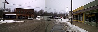
<span class="mw-page-title-main">Covington, Michigan</span> Census-designated place & unincorporated community in Michigan, United States

Covington is a unincorporated community and census-designated place (CDP) in Baraga County in the U.S. state of Michigan. The CDP had a population of 99 at the 2020 census. The community is located within Covington Township along US Highway 141 (U&snbsp;141) near the junction with M-28, which is a few miles west of US 41.

Aura is a small unincorporated community in Arvon Township of Baraga County in the U.S. state of Michigan. The area is approximately 12 miles (19 km) northeast of L'Anse and four miles (6 km) east of Pequaming.

Herman is an unincorporated community in L'Anse Township of Baraga County in the U.S. state of Michigan. It was established in 1901 along a branch of the Duluth, South Shore and Atlantic Railway approximately midway between Nestoria and L'Anse. A post office opened January 13, 1903, and was discontinued on December 5, 1970.

Stronach is an unincorporated community and census-designated place (CDP) in Stronach Township, Manistee County, Michigan, United States. Its population was 170 as of the 2020 census. The community is located at the southeast end of Manistee Lake.

<span class="mw-page-title-main">Falmouth, Michigan</span> Census-designated place & unincorporated community in Michigan, United States

Falmouth is an unincorporated community and census-designated place (CDP) in Missaukee County in the U.S. state of Michigan. The community is located within Clam Union Township. Its population was 183 at the 2020 census.

Silverwood is an unincorporated community on the border of Rich Township, Lapeer County and Dayton Township, Tuscola County in Michigan at 43°19′24″N83°14′53″W.

<span class="mw-page-title-main">Nisula, Michigan</span> Unincorporated community in Michigan, United States

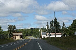
Nisula is an unincorporated community in Houghton County, Michigan, United States. Nisula is located in Laird Township along M-38, 14.5 miles (23.3 km) west of Baraga. Nisula has a post office with ZIP code 49952. Today, Nisula is a farming community, and all that remains are the smooth, rolling and transparent countryside, the extensive foundations of various bygone dwellings and households, and a few homes which still stand along with a couple of modern-day farm buildings and structures.

References

  1. "2020 U.S. Gazetteer Files". United States Census Bureau. Retrieved May 21, 2022.
  2. 1 2 3 U.S. Geological Survey Geographic Names Information System: Pelkie, Michigan
  3. Woertman, Elizabeth (1991). Pelkie-King Family Sketch. p. 1. Retrieved June 11, 2016.
  4. Thurner, Arthur W. (1995). "Ethnicity and Singularity". Strangers and Sojourners: A History of Michigan's Keweenaw Peninsula. Detroit: Wayne State University Press. p. 142. ISBN   0-8143-2396-0 . Retrieved September 1, 2008. French Canadian woodsmen settled at a place in Baraga County in 1885 known as King's Land; but when farmers arrived to till the cutover land, the place became Pelkie, named after an early settler.
  5. Holmio, Armas K. E. (2001). "The Copper County: Kyro and Nisula". History of the Finns in Michigan. Trans. Ellen M. Ryynanen. Detroit: Wayne State University Press. p. 101. ISBN   0-8143-2974-8 . Retrieved September 1, 2008. Johnson and the other settlers decided to call the community Kyrö, after the place they came from in Finland. After the railroad was built through the cleared land, the name of the place was changed to Kuro when the station was so named. Later it was called Pelkie, which Järnefelt-Rauanheimo thinks may have come from the name Pelkinen. No one of that name, however, is known to have lived there.
  6. "Michigan History Magazine". Michigan History Magazine. Michigan Historical Commission. 51–52: 341–342. 1967. Retrieved September 1, 2009. Interpreting and identifying place-names solely by the resemblance of sound is futile. For example, Pelkie, the ... Baraga County, is commonly thought of as a Finnish name. But contrary to popular belief, Pelkie derives its name from the surname of one of its former French Canadian settlers.
  7. Romig, Walter (1986) [1973]. Michigan Place Names. Detroit, Michigan: Wayne State University Press. ISBN   0-8143-1838-X.
  8. 49958 5-Digit ZCTA, 499 3-Digit ZCTA - Reference Map - American FactFinder [ permanent dead link ], U.S. Census Bureau, 2000 census
  9. "Census of Population and Housing". Census.gov. Retrieved June 4, 2016.