Skanee, Michigan

Last updated
Skanee, Michigan
Skanee School.jpg
Skanee School
USA Michigan location map.svg
Red pog.svg
Skanee
Location within the state of Michigan
Usa edcp location map.svg
Red pog.svg
Skanee
Location within the United States
Coordinates: 46°52′35″N88°12′51″W / 46.87639°N 88.21417°W / 46.87639; -88.21417
CountryFlag of the United States.svg United States
State Flag of Michigan.svg  Michigan
County Flag of Baraga County, Michigan.svg Baraga
Township Arvon
Established1870
Named for Skåne
Area
[1]
  Total4.83 sq mi (12.5 km2)
  Land4.73 sq mi (12.3 km2)
  Water0.10 sq mi (0.3 km2)
Elevation
745 ft (227 m)
Population
 (2020)
  Total102
  Density21.56/sq mi (8.32/km2)
Time zone UTC-5 (Eastern (EST))
  Summer (DST) UTC-4 (EDT)
ZIP code(s)
49962
Area code 906
GNIS feature ID638047 [2]

Skanee is an unincorporated community and census-designated place (CDP) in Baraga County in the U.S. state of Michigan. [3] The CDP had a population of 102 at the 2020 census. Skanee is located in Arvon Township on the shore of Huron Bay, a bay of Lake Superior.

Contents

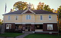
As an unincorporated community, Skanee has no legal autonomy of its own, however it does have its own post office with the 49962 ZIP Code. [4] The community is home to the historic Arvon Township Hall.

History

Skanee was established in 1870 when Captain Walfred Been sailed into Huron Bay during a storm, and settled in the area. Been named the settlement after Skåne in Sweden, his home province. [5]

For the 2020 census, Skanee was included as a newly-listed census-designated place. [6] [7]

Geography

According to the U.S. Census Bureau, the Skanee CDP has a total area of 4.83 square miles (12.51 km2), of which 4.73 square miles (12.25 km2) is land and 0.10 square miles (0.26 km2) (2.1%) is water. [1]

Skanee is located in Arvon Township, in northeastern Baraga County. The community is located at the base of the Huron Mountains, a relatively small range shared between Baraga and Marquette counties. About 8.5 miles (13.7 km) southeast of Skanee is Mount Arvon, which at 1,979 feet (603 m), is the highest point in Michigan. The community is located on the shore of Huron Bay, a bay of Lake Superior.

Demographics

Historical population
CensusPop.Note
2020 102
U.S. Decennial Census [8]

Education

Skanee is zoned within the Arvon Township School District. [9] The district operates the K-8 Skanee School, while high school students attend school in L'Anse.

Images

Related Research Articles

<span class="mw-page-title-main">Baraga County, Michigan</span> County in Michigan, United States

Baraga County is a county in the Upper Peninsula in the U.S. state of Michigan. As of the 2020 census, the population was 8,158, making it Michigan's fifth-least populous county. The county seat is L'Anse. The county is named after Bishop Frederic Baraga, a Catholic missionary who ministered to the Ojibwa Indians in the Michigan Territory.

<span class="mw-page-title-main">Arvon Township, Michigan</span> Civil township in Michigan, United States

Arvon Township is a civil township of Baraga County in the U.S. state of Michigan. As of the 2020 census, the township population was 492. Despite its name, Mount Arvon, the highest point in Michigan, is located just south of the township, in neighboring L'Anse Township.

<span class="mw-page-title-main">Baraga, Michigan</span> Village in Michigan, United States

Baraga is a village in Baraga County in the U.S. state of Michigan. The population was 1,883 at the 2020 census. The village is named after Bishop Frederic Baraga.

<span class="mw-page-title-main">Baraga Township, Michigan</span> Civil township in Michigan, United States

Baraga Township is a civil township of Baraga County in the U.S. state of Michigan. As of the 2020 census, the township population was 3,478. The village of Baraga is located in the southeast corner of the township.

<span class="mw-page-title-main">Covington Township, Michigan</span> Civil township in Michigan, United States

Covington Township is a civil township of Baraga County in the U.S. state of Michigan. The population was 375 at the 2020 census.

<span class="mw-page-title-main">Waverly, Michigan</span> Census-designated place & unincorporated community in Michigan, United States

Waverly is an unincorporated community in Eaton County in the U.S. state of Michigan. It is a census-designated place (CDP) for statistical purposes and has no legal status as a municipality. The population was 23,925 at the 2010 census, up from 16,194 at the 2000 census. Waverly is home to the Lansing Mall and Waverly Community Schools.

<span class="mw-page-title-main">Argentine, Michigan</span> Census-designated place & unincorporated community in Michigan, United States

Argentine is an unincorporated community and census-designated place (CDP) in Argentine Township, Genesee County, in the U.S. state of Michigan. The population was 2,685 as of the 2020 census, up from 2,525 at the 2010 census. It was first settled in 1836.

<span class="mw-page-title-main">Beecher, Michigan</span> Census-designated place & unincorporated community in Michigan, United States

Beecher is a census-designated place (CDP) in Genesee County in the U.S. state of Michigan. It was first listed as a CDP in 2000. Per the 2020 census, the population was 8,840.

<span class="mw-page-title-main">Clark Township, Michigan</span> Civil township in Michigan, United States

Clark Township is a civil township of Mackinac County in the U.S. state of Michigan. As of the 2020 census, the population was 1,917, down from 2,256 in 2010.

<span class="mw-page-title-main">Big Bay, Michigan</span> Census-designated place & unincorporated community in Michigan, United States

Big Bay is an unincorporated community in Marquette County of the U.S. state of Michigan. It is a census-designated place (CDP) for statistical purposes and does not have any legal status as an incorporated municipality. As of the 2020 census, the CDP had a population of 257, down from 319 in 2010. The community is located within Powell Township near the shore of Big Bay on Lake Superior.

<span class="mw-page-title-main">Michigamme, Michigan</span> Census-designated place & unincorporated community in Michigan, United States

Michigamme is an unincorporated community in Marquette County in the U.S. state of Michigan. It is located within Michigamme Township on the north shores of Lake Michigamme. For statistical purposes, the United States Census Bureau has defined Michigamme as a census-designated place (CDP). The CDP had a population of 255 at the 2020 census.

<span class="mw-page-title-main">Powell Township, Michigan</span> Civil township in Michigan, United States

Powell Township is a civil township of Marquette County in the U.S. state of Michigan. The population was 732 at the 2020 census, down from 816 in 2010.

<span class="mw-page-title-main">Republic, Michigan</span> Census-designated place & unincorporated community in Michigan, United States

Republic is an unincorporated community in Marquette County in the U.S. state of Michigan. It is also a census-designated place (CDP) for statistical purposes and no legal status as an incorporated municipality. The CDP had a population of 470 at the 2020 census, down from 570 in 2010. The community is located mostly within Republic Township with a small portion extending north into Humboldt Township.

<span class="mw-page-title-main">Canadian Lakes, Michigan</span> Census-designated place & unincorporated community in Michigan, United States

Canadian Lakes is an unincorporated community in Mecosta County in the U.S. state of Michigan. The area is mostly within the southwest portion of Morton Township, southwest of Mecosta and east of Stanwood.

<span class="mw-page-title-main">Bridgeport, Michigan</span> Census-designated place & unincorporated community in Michigan, United States

Bridgeport is an unincorporated community in Bridgeport Charter Township, Saginaw County in the U.S. state of Michigan. It is also a census-designated place (CDP) for statistical purposes. The population was 6,571 at the 2020 census. Bridgeport is also the name of a post office with ZIP code 48722. The area served by the ZIP code includes the southeast portion of the CDP and includes southeastern portions of Bridgeport Charter Township outside of the CDP as well as portions of southwest Frankenmuth Township and a small area of northeastern Birch Run Township. The remainder of the CDP area is served by the Saginaw ZIP code 48601.

<span class="mw-page-title-main">Hemlock, Michigan</span> Census-designated place & unincorporated community in Michigan, United States

Hemlock is an unincorporated community in Richland Township, Saginaw County in the U.S. state of Michigan. It is also a census-designated place (CDP) for statistical purposes, but without any legal status as an incorporated municipality. The population of the CDP was 1,585 at the 2000 census. The area included in the CDP is in the south central portion of Richland Township. The Hemlock post office, with ZIP code 48626, serves nearly all of Richland Township, as well as portions of Fremont Township to the south, small areas of Thomas and Swan Creek townships to the southeast, and part of Ingersoll Township to the north in Midland County.

Hurontown is an unincorporated community and census-designated place (CDP) in Houghton County in the U.S. state of Michigan. The community is located immediately south of the city of Houghton. The CDP had a population of 244 at the 2020 census.

<span class="mw-page-title-main">Brimley, Michigan</span> Census-designated place & unincorporated community in Michigan, United States

Brimley is an unincorporated community and census-designated place (CDP) in Chippewa County in the U.S. state of Michigan. The CDP had a population of 504 at the 2020 census. Brimley is located in Michigan's Upper Peninsula, and is located along the southern shore of Lake Superior. The community is located within Superior Township.

Three Lakes is an unincorporated community and census-designated place (CDP) in Baraga County in the U.S. state of Michigan. The CDP had a population of 167 at the 2020 census. Three Lakes is located within Spurr Township.

<span class="mw-page-title-main">Pelkie, Michigan</span> Census-designated place & unincorporated community in Michigan, United States

Pelkie is a unincorporated community and census-designated place (CDP) in Baraga County in the U.S. state of Michigan. The CDP had a population of 51 at the 2020 census, which ranks it the second-least populated CDP in the state of Michigan. The community is located along the Sturgeon River in the northeast portion of Baraga Township.

References

  1. 1 2 "2020 U.S. Gazetteer Files". United States Census Bureau. Retrieved September 25, 2023.
  2. U.S. Geological Survey Geographic Names Information System: Skanee, Michigan
  3. "Geographic Names Information System". edits.nationalmap.gov. Retrieved 2023-09-26.
  4. 49962 5-Digit ZCTA, 499 3-Digit ZCTA - Reference Map - American FactFinder [ permanent dead link ], U.S. Census Bureau, 2000 census
  5. Romig, Walter (1986). Michigan Place Names: The History of the Founding and the Naming of More Than Five Thousand Past and Present Michigan Communities. Detroit: Wayne State University Press. p. 517. ISBN   0-8143-1838-X.
  6. "State of Michigan Census Designated Places - Current/TAB20 - Data as of January 1, 2020". tigerweb.geo.census.gov. Retrieved 2023-09-26.
  7. "Geographic Names Information System". edits.nationalmap.gov. Retrieved 2023-09-26.
  8. "Census of Population and Housing". Census.gov. Retrieved September 25, 2023.
  9. "2020 CENSUS - SCHOOL DISTRICT REFERENCE MAP: Baraga County, MI" (PDF). U.S. Census Bureau . Retrieved 2023-09-26. - Text list