Member libraries
Peninsula Library System is a consortium of libraries, whose members are the branches of the San Mateo County Libraries, individual city libraries and their branches, and area community college libraries.
There are two branches in Burlingame: one main library, and one at Easton. The PLS includes the libraries at Cañada College, College of San Mateo, and Skyline College. There are four branches in Daly City: the John D. Daly branch on Hillside, the Bayshore branch, the Serramonte branch, and the Westlake branch. Menlo Park has both a main branch and a branch at Belle Haven. The Downtown Library, Schaberg Branch Library, and Redwood Shores Branch Library comprise the three library locations in the community of Redwood City. San Mateo has a main downtown location plus two minor branches, while South San Francisco has two self-titled branches, both a main branch and one on Grand Avenue. Pacifica has two branches at Sanchez and Sharp Park. The remaining cities—San Bruno, Atherton, Belmont, Brisbane, East Palo Alto, Foster City, Half Moon Bay, Millbrae, San Carlos, Woodside, and Portola Valley—have one location each.
| Member system | Branch | Street address | City | ZIP | Telephone | Image |
|---|
| Burlingame Public Library [5] | Burlingame Main | 480 Primrose Road | Burlingame | 94010 | (650)558‑7400 |  |
| Easton | 1800 Easton Drive | Burlingame | 94010 | (650)340‑6180 | 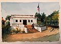 |
| Community College Libraries | Cañada College [6] | 4200 Farm Hill Boulevard | Redwood City | 94061 | (650)306‑3267 |  |
| College of San Mateo [7] | 1700 West Hillsdale Boulevard | San Mateo | 94402 | (650)574‑6100 |  |
| Skyline College [8] | 3300 College Drive | San Bruno | 94066 | (650)738‑4311 | 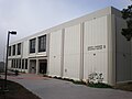 |
| Daly City Public Library [9] | Bayshore | 460 Martin Street | Daly City | 94014 | (650)991‑8074 | |
| John Daly | 134 Hillside Boulevard | Daly City | 94014 | (650)991‑8073 | |
| Serramonte Main | 40 Wembley Drive | Daly City | 94015 | (650)991‑8023 | |
| Westlake | 275 Southgate Avenue | Daly City | 94015 | (650)991‑8071 | |
| Menlo Park Library [10] | Menlo Park | 800 Alma Street | Menlo Park | 94025 | (650)330‑2500 |  |
| Belle Haven | 413 Ivy Drive | Menlo Park | 94025 | (650)330‑2540 | |
| Redwood City Public Library [11] | Downtown | 1044 Middlefield Road | Redwood City | 94063 | (650)780‑7018 |  |
| Redwood Shores | 399 Marine Parkway | Redwood City | 94065 | (650)780‑5740 | |
| Schaberg | 2140 Euclid Avenue | Redwood City | 94061 | (650)780‑7010 |  |
| San Bruno Public Library [12] | San Bruno | 701 Angus Avenue West | San Bruno | 94066 | (650)616‑7078 | |
| San Mateo City Library [13] | Hillsdale | 205 West Hillsdale Boulevard | San Mateo | 94403 | (650)522‑7880 |  |
| San Mateo Main | 55 West 3rd Avenue | San Mateo | 94402 | (650)522‑7800 |  |
| Marina | 1530 Susan Court | San Mateo | 94403 | (650)522‑7890 | 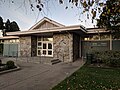 |
| San Mateo County Libraries [14] | Atherton | 2 Dinkelspiel Station Lane | Atherton | 94027 | (650)328‑2422 | |
| Belmont | 1110 Alameda de las Pulgas | Belmont | 94002 | (650)591‑8286 |  |
| Bookmobile | 620 Correas Street | Half Moon Bay | 94019 | (650)726‑2316 | |
| Brisbane | 250 Visitacion Avenue | Brisbane | 94005 | (415)467‑2060 | |
| East Palo Alto | 2415 University Avenue | East Palo Alto | 94303 | (650)321‑7712 | |
| Foster City | 1000 East Hillsdale Boulevard | Foster City | 94404 | (650)574‑4842 | |
| Half Moon Bay | 620 Correas Street | Half Moon Bay | 94019 | (650)726‑2316 | |
| Millbrae | 1 Library Avenue | Millbrae | 94030 | (650)697‑7607 | |
| North Fair Oaks | 2510 Middlefield Road | Redwood City | 94063 | 650-670-8778 | |
| Pacifica – Sanchez | 1111 Terra Nova Boulevard | Pacifica | 94044 | (650)359-3397 |  |
| Pacifica – Sharp Park | 104 Hilton Way | Pacifica | 94044 | (650)355‑5196 |  |
| Portola Valley | 765 Portola Road | Portola Valley | 94028 | (650)851‑0560 | 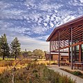 |
| San Carlos | 610 Elm Street | San Carlos | 94070 | (650)591‑0341 | |
| Woodside | 3140 Woodside Road | Woodside | 94062 | (650)851‑0147 |  |
| South San Francisco Public Library [15] | Grand Avenue | 306 Walnut Avenue | South San Francisco | 94080 | (650)877‑8530 | 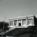 |
| South San Francisco Main | 901 Civic Campus Way | South San Francisco | 94080 | (650)829‑3860 | 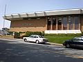 |
This page is based on this
Wikipedia article Text is available under the
CC BY-SA 4.0 license; additional terms may apply.
Images, videos and audio are available under their respective licenses.


