Penton, Alabama | |
|---|---|
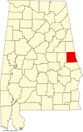
 Location of Penton in Chambers County, Alabama. | |
| Coordinates: 33°00′20″N85°29′36″W / 33.00556°N 85.49333°W [1] | |
| Country | United States |
| State | Alabama |
| County | Chambers |
| Area | |
• Total | 9.17 sq mi (23.76 km2) |
| • Land | 9.14 sq mi (23.66 km2) |
| • Water | 0.035 sq mi (0.09 km2) |
| Elevation | 807 ft (246 m) |
| Population (2020) | |
• Total | 163 |
| • Density | 17.8/sq mi (6.89/km2) |
| Time zone | UTC-6 (Central (CST)) |
| • Summer (DST) | UTC-5 (CDT) |
| Area code | 334 |
| GNIS feature ID | 2582693 [1] |
Penton is a census-designated place and unincorporated community in Chambers County, Alabama, United States. Its population was 163 as of the 2020 census which is down from a population of 201 people at the 2010 census. [3]