Penumudi | |
|---|---|
Village | |
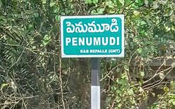 A signboard of Penumudi village | |
 Interactive map of Penumudi | |
 Penumudi Location in Andhra Pradesh, India | |
| Coordinates: 16°01′59″N80°52′13″E / 16.0330°N 80.8703°E | |
| Country | India |
| State | Andhra Pradesh |
| District | Guntur |
| Mandal | Repalle |
| Government | |
| • Type | Panchayati raj |
| • Body | Penumudi gram panchayat |
| Area | |
• Total | 553 ha (1,370 acres) |
| Population (2011) [3] | |
• Total | 3,534 |
| • Density | 639/km2 (1,660/sq mi) |
| Languages | |
| • Official | Telugu |
| Time zone | UTC+5:30 (IST) |
| PIN | 522xxx |
| Area code | +91– |
| Vehicle registration | AP |
Penumudi is a village in the Guntur district of the Indian state of Andhra Pradesh. It is located on the banks of the Krishna River, in Repalle mandal of Tenali revenue division. [4] [2]