Pergamino Partido

Last updated
Pergamino
Partido de Pergamino
Bandera del Partido de Pergamino.svg
Escudo de Pergamino.svg
Argentina - Buenos Aires - Pergamino.svg
location of Pergamino Partido in Buenos Aires Province
Coordinates: 33°53′S60°35′W / 33.883°S 60.583°W / -33.883; -60.583
Country Argentina
Established1626
Founded by?
Seat Pergamino
Government
  MayorJavier Martínez (PRO-JxC)
Area
  Total2,950 km2 (1,140 sq mi)
Population
  Total99,193
  Density34/km2 (87/sq mi)
Demonym(s) pergaminense
Postal Code
B2700
IFAM
Area Code02477
Patron saintNuestra Señora de la Merced
Website www.pergamino.gov.ar

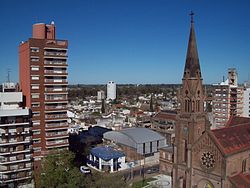
Pergamino Partido is a partido in the north of Buenos Aires Province in Argentina.

The provincial subdivision has a population of about 100,000 inhabitants in an area of 2,950 km2 (1,140 sq mi), and its capital city is Pergamino, which is around 225 km (140 mi) from Buenos Aires.

Settlements

Pergamino has 23 cuarteles (districts):

  1. Pergamino: capital
  2. Francisco Ayerza
  3. Ortíz Basualdo
  4. Rancagua
  5. Urquiza
  6. Maguire
  7. Villa Dafonte
  8. Fontezuela
  9. Manantiales Grande
  10. Manantiales Chico
  11. La Violeta
  12. Pujol
  13. Guerrico
  14. Manuel Ocampo
  15. Colonia Buena Vista
  16. J.A. de la Peña
  17. Acevedo
  18. Mariano Benítez
  19. El Socorro
  20. Arroyo del Medio
  21. Colonia Santa Rosa]
  22. Mariano H. Alfonzo
  23. Pinzón


Related Research Articles

Saavedra Partido Department in Argentina

Saavedra Partido is a partido of Buenos Aires Province in Argentina.

Olavarría Partido Department in Argentina

Olavarría Partido is a partido in the central region of Buenos Aires Province in Argentina.

Adolfo Alsina Partido Department in Argentina

Adolfo Alsina is a western partido of the Buenos Aires Province, Argentina, found at coordinates 37°10′S62°44′W.

Carlos Casares Partido Department in Argentina

Carlos Casares Partido is a partido of Buenos Aires Province in Argentina.

Carlos Tejedor Partido Department in Argentina

Carlos Tejedor Partido is a partido in the north-west of Buenos Aires Province in Argentina.

Benito Juárez Partido Department in Argentina

Benito Juárez is a partido in the south-central part of Buenos Aires Province in Argentina.

Ensenada Partido Department in Argentina

Ensenada Partido is a district of Buenos Aires Province, Argentina, belonging to the Greater La Plata area, just south of the Gran Buenos Aires urban conglomerate.

Villarino Partido Department in Argentina

Villarino Partido is a partido in the south of Buenos Aires Province in Argentina.

Capitán Sarmiento Partido Department in Argentina

Capitán Sarmiento Partido is a partido of Buenos Aires Province in Argentina.

Carmen de Areco Partido Department in Argentina

Carmen de Areco is a partido of Buenos Aires Province in Argentina.

Esteban Echeverría Partido Department in Argentina

Esteban Echeverría Partido is a partido in the Gran Buenos Aires urban area, in Buenos Aires Province in Argentina.

Ezeiza Partido Department in Argentina

Ezeiza Partido is a partido located in the southern part of Gran Buenos Aires in Buenos Aires Province, Argentina.

General Guido Partido Department in Argentina

General Guido Partido is a partido in the eastern part of Buenos Aires Province in Argentina.

General Las Heras Partido Department in Argentina

General Las Heras Partido is a small partido in the northeast of Buenos Aires Province in Argentina.

General Pinto Partido Department in Argentina

General Pinto Partido is a partido on the northern border of Buenos Aires Province in Argentina.

General Viamonte Partido Department in Argentina

General Viamonte Partido is a partido in the north of Buenos Aires Province in Argentina.

Pila Partido Department in Argentina

Pila Partido is a partido of Buenos Aires Province in Argentina.

Rojas Partido Department in Argentina

Rojas Partido is a partido in the north of Buenos Aires Province in Argentina.

Tandil Partido Department in Argentina

Tandil Partido is a partido of Buenos Aires Province in Argentina.

National Route 8 (Argentina)

National Route 8 is a highway located in Argentina, that connects the provinces of Buenos Aires, Santa Fe, Córdoba and San Luis. The route starts at the link with National Route 9 in the northwest of Greater Buenos Aires, between the towns of El Talar, El Triángulo, Ricardo Rojas and Ingeniero Pablo Nogués, to the link with Provincial Route 55 in Villa Mercedes, San Luis Province at 695 km (432 mi).