Lomas de Zamora is a partido (district) of Buenos Aires Province, Argentina, and part of the Greater Buenos Aires urban agglomeration.
Florencio Varela is a partido in the south of Gran Buenos Aires urban area in Buenos Aires Province, Argentina.

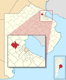
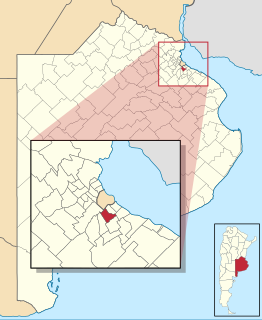
Berazategui is a partido in Buenos Aires Province, Argentina. With an area of 188 km2 (73 sq mi) and a population of 320,224, it is at the southeast of the Greater Buenos Aires urban conglomerate, and its capital is Berazategui city.

Ituzaingó is a partido of Buenos Aires Province. It is in the Gran Buenos Aires urban area, Argentina, 10 kilometres (6.2 mi) west of Buenos Aires city. It has an area of 38.51 km2 (14.9 sq mi) and a population of 168,419. Its capital, the city of Ituzaingó, and the other districts in Ituzaingó Partido were part of the Morón Partido until 1995.

Villa Gesell Partido is a partido on the Atlantic coast of Buenos Aires Province in Argentina.

La Matanza is a partido located in the urban agglomeration of Greater Buenos Aires, Buenos Aires Province, Argentina.

National Route 9 is a major road in Argentina, which runs from the center-east to the northwest of the country, crossing the provinces of Buenos Aires, Santa Fe, Córdoba, Santiago del Estero, Tucumán, Salta and Jujuy. It starts on Avenida General Paz, which marks the border between the Autonomous City of Buenos Aires and the surrounding province of the same name, and ends at the Horacio Guzmán International Bridge, on the La Quiaca River, traversing 1,967 km (1,222 mi). The road is a limited access motorway from Buenos Aires to Rosario.
Morón is a partido of the Buenos Aires Province, Argentina. Located in the Greater Buenos Aires urban area, its head town is Morón which is located around 17 km (11 mi) from Buenos Aires.

Balcarce Partido is a partido of Buenos Aires Province in Argentina.

Baradero Partido is a partido of Buenos Aires Province in Argentina.

Ensenada Partido is a district of Buenos Aires Province, Argentina, belonging to the Greater La Plata area, just south of the Gran Buenos Aires urban conglomerate.
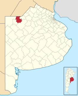
General Pinto Partido is a partido on the northern border of Buenos Aires Province in Argentina.

Hurlingham Partido is a partido of Buenos Aires Province, Argentina. It is in the Greater Buenos Aires urban area.

Presidente Perón Partido is a partido located in the Greater Buenos Aires urban area in Buenos Aires Province, Argentina.

Ramallo is a partido in the far north of Buenos Aires Province in Argentina.
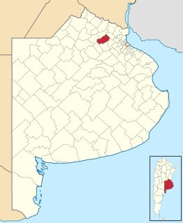
San Andres de Giles Partido is a partido of Buenos Aires Province in Argentina. The capital of the partido is San Andrés de Giles, 103 kilometres (64 mi) west of Buenos Aires and 170 kilometres (110 mi) west of the provincial capital La Plata. The provincial subdivision has a population of 20,829 inhabitants (2001) in an area of 1,132 square kilometres (437 sq mi).

San Nicolás de los Arroyos Partido is the northernmost partido in Buenos Aires Province, Argentina.

Tornquist Partido is a partido in the southwest of Buenos Aires Province in Argentina and is named after Ernesto Tornquist, founder of Tornquist, the partido's main city.

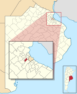
Capilla del Señor, is a city located 82 kilometres (51 mi) in the northern part of Buenos Aires Province, Argentina. It is the administrative seat of Exaltación de la Cruz Partido; which is bounded by the Zárate, Campana, Pilar, Luján, San Antonio de Areco, San Andrés de Giles partidos. It has been designated by the former president Carlos Saúl Menem as the "First National Historical Town" in Argentina. It is located 82 km from Buenos Aires, 24 km from Zárate, 27 km from Pilar, 30 km from Campana and Luján, 47 km from San Antonio de Areco, and 49 km from San Andrés de Giles.

National Route 8 is a highway located in Argentina, that connects the provinces of Buenos Aires, Santa Fe, Córdoba and San Luis. The route starts at the link with National Route 9 in the northwest of Greater Buenos Aires, between the towns of El Talar, El Triángulo, Ricardo Rojas and Ingeniero Pablo Nogués, to the link with Provincial Route 55 in Villa Mercedes, San Luis Province at 695 km (432 mi).