Piatypillia

Last updated

Piatypillia
П'ятипілля
Donetsk Oblast location map.svg
Red pog.svg
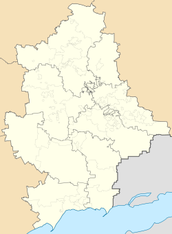
Piatypillia
Location of Piatypillia within Donetsk Oblast
Ukraine under russian occupation grey.svg
Red pog.svg
Piatypillia
Piatypillia (Ukraine)
Coordinates: 48°00′43″N38°05′31″E / 48.01194°N 38.09194°E / 48.01194; 38.09194
CountryFlag of Ukraine.svg  Ukraine
Oblast Donetsk Oblast
Raion Donetsk Raion
Elevation
[1]
220 m (720 ft)
Population
 (2022) [2]
  Total3,155
Time zone UTC+2 (EET)
  Summer (DST) UTC+3 (EEST)
Postal code
86192
Area code +380 6232

Piatypillia [lower-alpha 1] or Proletarske [lower-alpha 2] is a rural settlement in Makiivka urban hromada, Donetsk Raion, Donetsk Oblast, Ukraine. Population: 3,155 (2022 estimate). [2]

Contents

Geography

The town is located in the central part of Donetsk Oblast, in the Donetsk-Makiivka conurbation. It is located 21 kilometres (13 mi) east of Donetsk city center, and 4 kilometres (2.5 mi) southwest of Khartsyzk. It has an elevation of 220 metres (720 ft). [1]

History

Proletarske was founded in 1937. It received urban-type settlement status in 1956. [1]

The town, when it was known as Proletarske, was taken over by Russian proxy forces during the war in Donbas that began in 2014. In 2016, the Verkhovna Rada of Ukraine issued an edict renaming it to Piatypillia in accordance with decommunization laws. [3]

Economy

The town contains a bituminous coal mine and a structural steel plant. [1]

Demographics

Native language as of the Ukrainian Census of 2001: [4]

Notes

  1. Ukrainian: П'ятипілля; Russian: Пятиполье, romanized: Pyatipole
  2. /prlɛˈtɑːrskɛ/ ; [1] Ukrainian: Пролета́рське; Russian: Пролетарское, romanized: Proletarskoye

Related Research Articles

<span class="mw-page-title-main">Yasynuvata</span> City in Donetsk Oblast, Ukraine

Yasynuvata is a city in Donetsk Oblast, eastern Ukraine. It was incorporated as a city of oblast significance until the 2020 administrative reform. It also served as the administrative center of Yasynuvata Raion until it was dissolved in 2020. It is located 21 kilometres (13 mi) from Donetsk, the administrative center of the oblast. Yasynuvata is a large railway crossroad. Its population is approximately 34,144.

<span class="mw-page-title-main">Amvrosiivka Raion</span> Former subdivision of Donetsk Oblast, Ukraine, in use by Russia

Amvrosiivka Raion was a raion (district) within the eastern part of Donetsk Oblast in eastern Ukraine. The raion was abolished on 18 July 2020 as part of the administrative reform of Ukraine, which reduced the number of raions of Donetsk Oblast to eight. However, since 2014 the raion was not under control of Ukrainian government and has been part of the Donetsk People's Republic which continues using it as an administrative unit. The administrative center of the raion is the town of Amvrosiivka. The last estimate of the raion population, reported by the Ukrainian government, was 43,759. In 2022, the Donetsk People's Republic including the Amvrosiivka Raion was annexed by Russia.

<span class="mw-page-title-main">Bakhmut Raion</span> Subdivision of Donetsk Oblast, Ukraine

Bakhmut Raion, known as Artemivsk Raion between 1924 and 2016, is a raion (district) within the northeastern part of Donetsk Oblast in eastern Ukraine. Its administrative center is Bakhmut. Its area is 1,687 square kilometres (651 sq mi), and its population is approximately 220,275.

<span class="mw-page-title-main">Dobropillia Raion</span> Former subdivision of Donetsk Oblast, Ukraine

Dobropillia Raion was a raion (district) within the southwestern part of Donetsk Oblast in eastern Ukraine. Its administrative center was Dobropillia, which was incorporated separately as the town of oblast significance and did not belong to the raion. Its area was 949 km2 (366 sq mi). The raion was abolished on 18 July 2020 as part of the administrative reform of Ukraine, which reduced the number of raions of Donetsk Oblast to eight, of which only five were controlled by the government. The last estimate of the raion population was 14,901.

<span class="mw-page-title-main">Pokrovsk Raion</span> Subdivision of Donetsk Oblast, Ukraine

Pokrovsk Raion is a raion (district) within Donetsk Oblast in eastern Ukraine. Its administrative center is Pokrovsk. It has an area of 1,316 square kilometres (508 sq mi) and its population is approximately 386,451.

<span class="mw-page-title-main">Khartsyzk</span> City in Donetsk Oblast, Ukraine

Khartsyzk or Khartsyzsk is a city in Donetsk Raion, Donetsk Oblast, Ukraine. The city has a population of Population: 56,182.

<span class="mw-page-title-main">Kalmiuske</span> City in Donetsk Oblast, Ukraine

Kalmiuske or Komsomolske is a city in Donetsk Oblast (province), Ukraine. It is a limestone mining city, located on the Kalmius river of eastern Ukraine. It has a population of 11,422.

<span class="mw-page-title-main">Biriukove</span> Urban-type settlement in Luhansk Oblast, Ukraine

Biriukove or Krynychne is an urban-type settlement in Dovzhansk Raion, Luhansk Oblast, Ukraine. Population: 3,951 , 4,027 (2013 est.).

<span class="mw-page-title-main">Volnovakha Raion</span> Subdivision of Donetsk Oblast, Ukraine

Volnovakha Raion is one of the eight raions of Donetsk Oblast, in southeastern Ukraine. Its administrative center is in the city of Volnovakha. The raion's population is 139,014.

<span class="mw-page-title-main">Kopani, Donetsk Raion, Donetsk Oblast</span> Rural settlement in Donetsk Oblast, Ukraine

Kopani or Voikovskyi is a rural settlement in Donetsk Oblast in eastern Ukraine. Its population is 1,102.

<span class="mw-page-title-main">Talakivka</span> Urban locality in Donetsk Oblast, Ukraine

Talakivka is an rural settlement in Mariupol Raion, Donetsk Oblast, eastern Ukraine. It is located 89.4 kilometres (55.6 mi) south-southwest from the centre of Donetsk city, at a distance of 19 kilometres (12 mi) north from the centre of Mariupol, on the right bank of the Kalmius River. Population: 3,832.

Demuryne is a rural settlement in Synelnykove Raion, Dnipropetrovsk Oblast, Ukraine. It is located at the east of the oblast, approximately 150 kilometres (93 mi) east of Dnipro. Demuryne belongs to Mezhova settlement hromada, one of the hromadas of Ukraine. Population: 966.

<span class="mw-page-title-main">Donetsk Raion</span> Subdivision of Donetsk Oblast, Ukraine

Donetsk Raion is a prospective raion (district) of Donetsk Oblast, Ukraine. It was formally created in July 2020 as part of the reform of administrative divisions of Ukraine. The center of the raion is in the city of Donetsk. Population: 1,484,514. Most of the area of the raion is occupied by Russia, which continues to use the old, pre-2020 administrative divisions of Ukraine. Much of the raion was occupied by Russian-controlled militias during the Donbas war until the village of Kruta Balka was the only unoccupied locality. In the 2022 Russian invasion, the remainder was occupied.

Myrne is an urban-type settlement in Volnovakha Raion, Donetsk Oblast, eastern Ukraine. Myrne is the administrative center of Myrne settlement hromada, one of the hromadas of Ukraine. Its population is 1,631.

Lypske or Krasnyi Oktiabr is a rural settlement in Donetsk Oblast, eastern Ukraine. Population: 886.

Huselske is a rural settlement in Makiivka urban hromada, Donetsk Oblast, eastern Ukraine. Population: 457.

Krynychna is a rural settlement in Makiivka urban hromada, Donetsk Oblast, Ukraine. Population: 4,459.

Mezhove is a rural settlement in Makiivka urban hromada, Donetsk Raion, Donetsk Oblast, Ukraine. Population: 1,193.

Kholodne or Sverdlove is a rural settlement in Makiivka urban hromada, Donetsk Raion, Donetsk Oblast, Ukraine. Population: 1,423.

Zemlianky is a rural settlement in Makiivka urban hromada, Donetsk Raion, Donetsk Oblast, eastern Ukraine. Population: 1,691.

References

  1. 1 2 3 4 5 Cohen, Saul B., ed. (17 February 2024). The Columbia Gazetteer of the World: A to G. Columbia University Press. p. 3081. ISBN   978-0-231-14554-1.
  2. 1 2 Чисельність наявного населення України на 1 січня 2022 [Number of Present Population of Ukraine, as of January 1, 2022](PDF) (in Ukrainian and English). Kyiv: State Statistics Service of Ukraine. Archived (PDF) from the original on 4 July 2022.
  3. "Про перейменування окремих населених пунктів та районів на тимчасово окупованих територіях Донецької та Луганської областей".
  4. Розподіл населення за рідною мовою на ukrcensus.gov.ua Archived 31 July 2014 at the Wayback Machine