Pica, Jayuya, Puerto Rico

Last updated
Pica
Barrio
Pica, Jayuya, Puerto Rico locator map.png
Location of Pica within the municipality of Jayuya shown in red
Caribbean location map.svg
Red pog.svg
Pica
Location of Puerto Rico
Coordinates: 18°09′52″N66°38′42″W / 18.164547°N 66.645021°W / 18.164547; -66.645021 [1]
Commonwealth Flag of Puerto Rico.svg  Puerto Rico
Municipality Flag of Jayuya.svg Jayuya
Area
[1]
  Total0.94 sq mi (2.4 km2)
  Land0.94 sq mi (2.4 km2)
  Water0.00 sq mi (0.0 km2)
Elevation
[2]
2,418 ft (737 m)
Population
 (2010)
  Total153
  Density168.8/sq mi (65.2/km2)
 Source: 2010 Census
Time zone UTC−4 (AST)

Pica (Barrio Pica) is a barrio in the municipality of Jayuya, Puerto Rico. Its population in 2010 was 153. [3] [4] [5] In 1948, Pica was established from part of what was Jayuya Arriba (Jayuya barrio-pueblo). [6]

Contents

Historical population
CensusPop.Note
1950 179
1960 22425.1%
1980 142
1990 303113.4%
2000 35617.5%
2010 153−57.0%
U.S. Decennial Census
1950 [7] 1980-2000 [8] 2010 [9]

See also

Related Research Articles

<span class="mw-page-title-main">Monacillo Urbano, San Juan, Puerto Rico</span> Barrio of San Juan, Puerto Rico

Monacillo Urbano is one of 18 barrios in the municipality of San Juan, Puerto Rico. The barrio was originally part of Monacillo. In 2010, it had a population of 22,342 living in a land area of 3.23 square miles (8.68 km2). Monacillo Urbano is surrounded by Gobernador Piñero barrio to the north, El Cinco barrio to the east, Monacillo barrio to the south, and the municipality of Guaynabo to the west.

<span class="mw-page-title-main">Río Grande, Jayuya, Puerto Rico</span> Barrio of Puerto Rico

Río Grande is a barrio in the municipality of Jayuya, Puerto Rico. Its population in 2010 was 879.

<span class="mw-page-title-main">Buena Vista, Hatillo, Puerto Rico</span> Barrio of Puerto Rico

Buena Vista is a rural barrio in the municipality of Hatillo, Puerto Rico. Its population in 2010 was 2,490.

<span class="mw-page-title-main">Collores, Jayuya, Puerto Rico</span> Barrio of Puerto Rico

Collores is a barrio in the municipality of Jayuya, Puerto Rico. Its population in 2010 was 1,666. In 1948, Collores was established from part of what was Jayuya Arriba .

<span class="mw-page-title-main">Mameyes Abajo</span> Barrio of Utuado, Puerto Rico

Mameyes Abajo is a barrio in the municipality of Utuado, Puerto Rico. Its population in 2010 was 1,136. The corresponding Mameyes Arriba is located in neighbouring Jayuya at a higher elevation, but was once part of Utuado as well.

<span class="mw-page-title-main">Campo Alegre, Hatillo, Puerto Rico</span> Barrio of Puerto Rico

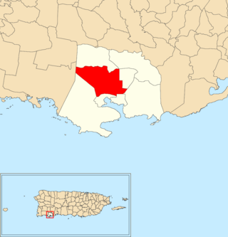
Campo Alegre is a rural barrio in the municipality of Hatillo, Puerto Rico. Its population in 2010 was 5,210.

<span class="mw-page-title-main">Coabey</span> Barrio of Jayuya, Puerto Rico

Coabey is a barrio in the municipality of Jayuya, Puerto Rico. Its population in 2010 was 2,166. Coabey is a newer barrio which was formed from areas of Jayuya barrio-pueblo and its first census was done in 1930.

<span class="mw-page-title-main">Jauca</span> Barrio of Jayuya, Puerto Rico

Jauca is a barrio in the municipality of Jayuya, Puerto Rico. Its population in 2010 was 116. In 1948, Jauca was established from part of what was Jayuya Arriba .

<span class="mw-page-title-main">Jayuya Abajo</span> Barrio of Jayuya, Puerto Rico

Jayuya Abajo is a barrio in the municipality of Jayuya, Puerto Rico. Its population in 2010 was 3,367.

<span class="mw-page-title-main">Mameyes Arriba</span> Barrio of Jayuya, Puerto Rico

Mameyes Arriba is a barrio in the municipality of Jayuya, Puerto Rico. Its population in 2010 was 2,240.

<span class="mw-page-title-main">Saliente</span> Barrio in Jayuya, Puerto Rico

Saliente is a barrio in the municipality of Jayuya, Puerto Rico. Its population in 2010 was 649.

<span class="mw-page-title-main">Veguitas, Jayuya, Puerto Rico</span> Barrio of Puerto Rico

Veguitas is a barrio in the municipality of Jayuya, Puerto Rico. Its population in 2010 was 3,685.

<span class="mw-page-title-main">Zamas, Jayuya, Puerto Rico</span> Barrio of Puerto Rico

Zamas is a barrio in the municipality of Jayuya, Puerto Rico. Its population in 2010 was 499.

<span class="mw-page-title-main">Carenero</span> Barrio of Guánica, Puerto Rico

Carenero is a barrio in the municipality of Guánica, Puerto Rico. Its population in 2010 was 2,670.

<span class="mw-page-title-main">Ciénaga, Guánica, Puerto Rico</span> Barrio of Puerto Rico

Ciénaga is a barrio in the municipality of Guánica, Puerto Rico. Its population in 2010 was 2,231.

<span class="mw-page-title-main">Montalva</span> Barrio of Guánica, Puerto Rico

Montalva is a barrio in the municipality of Guánica, Puerto Rico. Its population in 2010 was 3,181.

<span class="mw-page-title-main">Jayuya barrio-pueblo</span> Historical and administrative center (seat) of Jayuya, Puerto Rico

Jayuya barrio-pueblo is a barrio and the administrative center (seat) of Jayuya, a municipality of Puerto Rico. Its population in 2010 was 1,222.

<span class="mw-page-title-main">Guamaní</span> Barrio of Guayama, Puerto Rico

Guamaní is a barrio in the municipality of Guayama, Puerto Rico. Its population in 2010 was 1,455.

<span class="mw-page-title-main">St. Just, Trujillo Alto, Puerto Rico</span> Barrio of Puerto Rico

St. Just is a barrio in the municipality of Trujillo Alto, Puerto Rico. A newer barrio, its population is counted starting with the 2000 Census, and in 2010 was 14,635.

<span class="mw-page-title-main">Lajas, Lajas, Puerto Rico</span> Barrio of Puerto Rico

Lajas is a barrio in the municipality of Lajas, Puerto Rico. Its population in 2010 was 2,694.

References

  1. 1 2 "US Gazetteer 2019". US Census. US Government.
  2. U.S. Geological Survey Geographic Names Information System: Pica Barrio
  3. Picó, Rafael; Buitrago de Santiago, Zayda; Berrios, Hector H. Nueva geografía de Puerto Rico: física, económica, y social, por Rafael Picó. Con la colaboración de Zayda Buitrago de Santiago y Héctor H. Berrios. San Juan Editorial Universitaria, Universidad de Puerto Rico,1969.
  4. Gwillim Law (20 May 2015). Administrative Subdivisions of Countries: A Comprehensive World Reference, 1900 through 1998. McFarland. p. 300. ISBN   978-1-4766-0447-3 . Retrieved 25 December 2018.
  5. Puerto Rico: 2010 Population and Housing Unit Counts.pdf (PDF). U.S. Dept. of Commerce, Economics and Statistics Administration, U.S. Census Bureau. 2010.
  6. Mapa de Municipios y Barrios (PDF). Santurce, Puerto Rico: Junta de Planificación. 1955. p. 27. Retrieved 10 April 2021.
  7. "Table 4-Area and Population of Municipalities Urban and Rural: 1930 to 1950" (PDF). United States Census Bureau. Archived (PDF) from the original on August 30, 2015. Retrieved September 21, 2014.
  8. "Table 2 Population and Housing Units: 1960 to 2000" (PDF). United States Census Bureau. Archived (PDF) from the original on July 24, 2017. Retrieved September 21, 2017.
  9. Puerto Rico: 2010 Population and Housing Unit Counts.pdf (PDF). U.S. Dept. of Commerce Economics and Statistics Administration U.S. Census Bureau. 2010. Archived (PDF) from the original on 2017-02-20. Retrieved 2019-08-02.