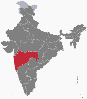
Buldhana district is located in the Amravati division of Maharashtra, India. It is situated at the western border of Vidarbha region and is 500 km away from the state capital, Mumbai. The district has towns and cities like Shegaon, Malkapur, Khamgaon, Lonar, Mehkar, and Chikhli. It is surrounded by Madhya Pradesh in the north, Akola, Washim, and Amravati districts on the east, Jalna district on the south, and Jalgaon and Aurangabad districts on the west.Latitudes are 19.51° to 21.17° N and Longitudes are 75.57° to 76.59° E. Bounded on the north by Madhya Pradesh state, to the east by Akola and Washim, to the south by Parbhani and Jalna districts, and to the west by Jalna and Jalgaon districts.

Jalna district is an administrative district in the state of Maharashtra in western India. Jalna town is the district headquarters. The district is part of Aurangabad division.

Muktainagar is a small town situated near the National Highway 6, in Jalgaon district near the northern border of Maharashtra State, India. Muktainagar is located in the Khandesh region of North Maharashtra.
Chalisgaonpronunciation (help·info) is a town and a municipal council located in Jalgaon district in the state of Maharashtra, India.

Mundgod is a panchayat town in Uttara Kannada district in the Indian state of Karnataka. It lies on the route to Hubli from Sirsi. It is a Main road town. It is at a distance of 132 km from the District headquarters i.e. Karwar. The town is bounded by Maje-Pur village in the north, Malagankoppa village in the south, Kyasanakeri village in the west, Kundergi and Nesargi village in the east. The Mundgod town is characterized by paddy fields. The land on either side of the Hubli-Sirsi road is very much suitable for development. To the northeast the town is surrounded by forest. It is suitable at an altitude of 564 m above the mean sea level. The climate of Mundgod is moderate except during the rainy season. Mundgod Town Panchayath has been divided into 16 wards and from each ward there will be representative of people. Latest council came into force on 18-02-2008. There are 16 elected members. Town limit is 11.99 sq km with population of 18,866 according to 2011 census. The number of residential houses remunerated by the town Panchayath is 5223. The main occupation of the people of Mundgod town is agriculture. Rice is the major crop.

Savda is a city and a municipal council in Jalgaon district in the Indian state of Maharashtra. It is also known as Banana City for production of bananas at a good scale.

Jalgaon Jamod is a town in Buldhana district, in the Indian state of Maharashtra.

Jalgaon is a census town in Ratnagiri district in the Indian state of Maharashtra.
Warwat Bakal is a Gram Panchayat, in Sangrampur tehsil of Buldhana district, includes in Vidarbha region in the state of Maharashtra, India.
Asoda is a village in Jalgaon District, Maharashtra state in western India, located on the northern Deccan Plateau. It is 5 kilometres (3.1 mi) from Jalgaon, located within the irrigated agricultural region of Khandesh. The main occupation of people in Asoda is farming of cotton, black gram, green gram.

Pashtane is a well-known village in Jalgaon District, India, situated nearly 30 km from Jalgaon and 7 km from Dharangaon a nearest Railway station.
Kasoda is a village in Erandol, Jalgaon district, Maharashtra, India. Kasoda is 48 km distance from its district main city Jalgaon and 322 km distance from its state main city Mumbai. It is second biggest village in Jalgaon district. Population is about 35,000.

Pimpalgaon Tarf Khed is a panchayat village in the state of Maharashtra, India, on the left (east) bank of the Bhima River. Administratively, Pimpalgaon Tarf Khed is under Khed Taluka of Pune District in Maharashtra. The village of Pimpalgaon Tarf Khed is 11 km east of the town of Chakan, and 23 km by road south of the town of Rajgurunagar (Khed).
Tongaon is a village in Bhadgaon tehsil of Jalgaon district in the Maharashtra state, India.
Nagardeole Budruk is a village in Pachora tehsil of Jalgaon district in the Maharashtra state, India.

Pal is a village situated in Satpura range on the bank of the Suki River in Raver tehsil in Jalgaon district of Maharashtra state of India.
Pimpalgaon is a village in the Thane district of Maharashtra, India. It is located in the Bhiwandi taluka.
Pilode is a village is located in Amalner Tehsil of Jalgaon district in Maharashtra, India. It is situated 10 km away from sub-district headquarter Amalner and 65 km away from district headquarter Jalgaon.


