
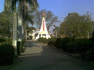
Nongpoh {IPA: nɒŋˈpɒ(ə)} is the administrative centre of Ri-Bhoi district in the Indian state of Meghalaya in the Republic of India. Nongpoh is located on National Highway 40, fifty-two kilometers from the state capital Shillong and forty-eight kilometers from Guwahati in the state of Assam.

Memari is a town and a municipality in Purba Bardhaman district in the Indian state of West Bengal.
Bhandardaha is a census town in Domjur CD Block of Howrah Sadar subdivision in Howrah district in the state of West Bengal, India. It is close to Makardaha and also a part of Kolkata Urban Agglomeration.
Bhikangaon is a village and a nagar parishad in Khargone district in the state of Madhya Pradesh, India.
Bhuban is a town and a NAC, located in the subdivision of Kamakhyanagar, Dhenkanal district in the state of Odisha, India.
Chakpara is a census town in Bally Jagachha CD Block of Howrah Sadar subdivision in Howrah district in the Indian state of West Bengal. It is a part of Kolkata Urban Agglomeration.

Chamrail is a census town in Bally Jagachha CD Block of Howrah Sadar subdivision in Howrah district in the Indian state of West Bengal. It is a part of Kolkata Urban Agglomeration.
Dhola is a census town and former petty Rajput princely state in Bhavnagar district, in the state of Gujarat, western India.
Eksara is a census town in Bally Jagachha CD Block of Howrah Sadar subdivision in Howrah district in the Indian state of West Bengal. It is a part of Kolkata Urban Agglomeration.
Faizpur is town in Tahasil of Yawal in Jalgaon district of Maharashtra India.
Hatgachha is a census town in Sankrail CD Block of Howrah Sadar subdivision in Howrah district in the Indian state of West Bengal. It is a part of Kolkata Urban Agglomeration.
Makardah is a census town in Domjur CD Block of Howrah Sadar subdivision in Howrah district in the Indian state of West Bengal. It is a part of Kolkata Urban Agglomeration.
Pairagachha is a census town in Chanditala II CD Block in Srirampore subdivision of Hooghly district in the Indian state of West Bengal.
Panchpara is a census town in Sankrail CD Block of Howrah Sadar subdivision in Howrah district in the Indian state of West Bengal. It is a part of Kolkata Urban Agglomeration.
Raghunathpur is a village in Chinsurah Mogra CD Block in Chinsurah subdivision of Hooghly district in the Indian state of West Bengal. It is a part of Kolkata Urban Agglomeration.
Raybag is a taluka in Belgaum district in the Indian state of Karnataka. It derives its name from the two words namely "Rai" and "bagh" in which "Rai" means king and "bagh" means tiger.
Sarenga is a census town in Sankrail CD Block of Howrah Sadar subdivision in Howrah district in the Indian state of West Bengal. It is a part of Kolkata Urban Agglomeration.
Sendhwa is a city with a municipal government in Barwani district in the Indian state of Madhya Pradesh. It is the headquarters for Sendhwa Tehsil.

Tentulkuli is a census town in Domjur CD Block of Howrah Sadar subdivision in Howrah district in the Indian state of West Bengal. It is close to Salap and also a part of Kolkata Urban Agglomeration.
Raver is a city and municipal council in Jalgaon district in the Indian state of Maharashtra. It is the administrative center of Raver Taluka. Raver is famous for the Bhagvan Dattatreya-temple which is 200 years old and was founded by Sachidanand Swami Maharaj. Built in the old Mughal Kaleen tradition, it also has some ancient photos of Bhagvan Dattreyay in form of Malaang Fakir, Bhagwan Dattreyay's Charan Paduka. It is part of the Khandesh region.


