Smith County is a county in the U.S. state of Texas. As of the 2020 census, its population was 233,479. Its county seat is Tyler. Smith County is named for James Smith, a general during the Texas Revolution.

Tyler is a city in and the county seat of Smith County, Texas, United States. As of 2020, the population is 105,995. Tyler was the 38th most populous city in Texas and 289th in the United States. It is the principal city of the Tyler metropolitan statistical area, which is the 198th most populous metropolitan area in the U.S. and 16th in Texas after Waco and the College Station–Bryan areas, with a population of 233,479 in 2020. The city is named for John Tyler, the tenth President of the United States.

Northeast Texas is a cultural and geographic region in the northeast corner of the U.S. state of Texas. Geographically centered on two metropolitan areas strung along Interstate 20—Tyler in the west and Longview/Marshall to the east, the areas of Greenville, Mount Pleasant, Sulphur Springs, Paris, and Texarkana in the north primarily along Interstate 30, and Jacksonville and Palestine to the south are also major cities within the region. Most of Northeast Texas is included in the interstate region of the Ark-La-Tex.

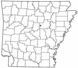
Romance is an unincorporated community in west-central White County, Arkansas, United States. The community is located approximately halfway between the town of Rose Bud to the north, and the unincorporated community of El Paso to the south. Alternately, the community is about 16 miles (26 km) northwest of Beebe, and less than 5 miles (8 km) east of Mount Vernon.
Huffman is an unincorporated community of northeastern Harris County, Texas, United States, within the Greater Houston metropolitan area.

Reese is a rural unincorporated community in Cherokee County, in the U.S. state of Texas, situated in the East Texas region. Its population was last estimated at 75, but no current U.S. Census data is available. It is located within the Tyler-Jacksonville combined statistical area.
Medina is an unincorporated community in Bandera County, Texas, United States. It is part of the San Antonio Metropolitan Statistical Area. Medina is famous for its apples. The community's population was estimated to be 515 in 2000.

Klondike is an unincorporated community in Delta County, Texas, United States. According to the Handbook of Texas, its population was estimated at 135 in 2000.
Tennessee Colony is an unincorporated community in Anderson County, in the U.S. state of Texas. According to the Handbook of Texas, the community had a population of 300 in 2000. It is located within the Palestine, Texas micropolitan area.

The Tyler metropolitan area, or Greater Tyler area centered on the city of Tyler, Texas, is one of the largest Texan metropolitan areas in East Texas. It had a combined population of 216,080 according to the 2010 U.S. census, and 233,479 in 2020. The Tyler metropolitan area encompasses all of Smith County.
Pine Grove is an unincorporated community in Hood River County, Oregon, United States on Oregon Route 35 in the middle Hood River Valley near Neal Creek. It is about five miles south of the city of Hood River and has a Hood River ZIP code.

Brashear is an unincorporated community located on Interstate Highway 30 and Farm to Market Road 2653 in west central Hopkins County, Texas, United States. Brashear has a post office, church, farm buildings, a radio building, and other buildings.

Hillje is an unincorporated community in Wharton County, Texas, United States. According to the Handbook of Texas, the community had an estimated population of 51 in 2000. It is located within the Greater Houston metropolitan area.
Mixon is a small unincorporated community in northern Cherokee County, Texas, United States. According to the Handbook of Texas, the community had a population of 50 in 2000. It is located within the Tyler-Jacksonville combined statistical area.
Hagansport is an unincorporated community in Franklin County, Texas, United States. According to the Handbook of Texas, the community had a population of 40 in 2000.
Phillipsburg is an unincorporated community in southern Washington County, in the U.S. state of Texas. The very small rural community is located along State Highway 36 (SH 36) south of Brenham. Aside from the names of two local roads, the name Phillipsburg is no longer marked on modern maps. The cemetery and Lutheran church, which is still open for worship, are actually slightly to the south in neighboring Austin County.
New Taiton is an unincorporated community in northwestern Wharton County, Texas, United States. The community is situated at the intersection of State Highway 71 (SH 71) and Farm to Market Road 961, (FM 961) north-northwest of El Campo, Texas. New Taiton is identified by road signs on SH 71 and FM 961. The area around the community is intensively farmed and several oil and gas wells are located nearby.
Bostick is an unincorporated community in Smith County, Texas, United States.
Owentown is an unincorporated community in Smith County, located in the U.S. state of Texas.
Cypress is an unincorporated community in Franklin County, in the U.S. state of Texas. According to the Handbook of Texas, the community had a population of 20 in 2000.


