Jackson County is a county located in the U.S. state of Michigan. Its population was 160,366 as of the 2020 Census. The county seat is Jackson. The county was set off in 1829 and organized in 1832. It is named for U.S. President Andrew Jackson and considered to be one of Michigan's "Cabinet counties", named for members of Jackson's Cabinet.

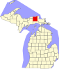
Luce County is a county located in the Upper Peninsula in the U.S. state of Michigan. As of the 2020 Census, the population was 5,339, making it the second-least populous county in Michigan. The county seat is Newberry. The county was set off and organized in 1887 and named after former Michigan Governor Cyrus G. Luce.

Loghill Village is an unincorporated community and a census-designated place (CDP) located in and governed by Ouray County, Colorado, United States. The CDP is a part of the Montrose, CO Micropolitan Statistical Area. The population of the Loghill Village CDP was 521 at the United States Census 2010. The Ridgway post office (Zip Code 81432) serves Loghill Village postal addresses.

Grayling is a city and the county seat of Crawford County in the U.S. state of Michigan. It is the only incorporated community in Crawford County. The population was 1,884 at the 2010 census. The city is surrounded by Grayling Charter Township, but the two are administered autonomously.
Boulder Junction is a town in Vilas County, Wisconsin, United States. The population was 958 at the 2000 census.

Paradise is an unincorporated community in Whitefish Township, Chippewa County in the U.S. state of Michigan.
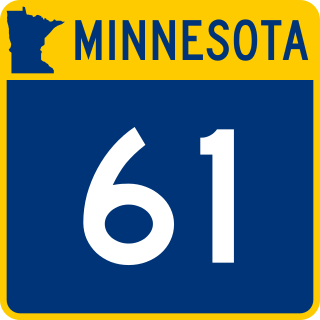
Minnesota State Highway 61 is a 148.843-mile-long (239.540 km) highway in northeast Minnesota, which runs from a junction with Interstate 35 (I-35) in Duluth at 26th Avenue East, and continues northeast to its northern terminus at the Canadian border near Grand Portage, connecting to Ontario Highway 61 at the Pigeon River Bridge. The route is a scenic highway, following the North Shore of Lake Superior, and is part of the Lake Superior Circle Tour designation that runs through Minnesota, Ontario, Michigan, and Wisconsin.

Interlochen is an unincorporated community and census-designated place (CDP) in Grand Traverse County in the U.S. state of Michigan. At the 2010 census, the population was 583. The community is located within Green Lake Township.
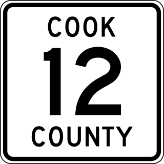
County State-Aid Highway 12 (CSAH 12), also known as the Gunflint Trail, or County Road 12 (CR 12), is a 57-mile (92 km) paved roadway and National Scenic Byway in Cook County, Minnesota, that begins in Grand Marais and ends at Saganaga Lake in the Boundary Waters Canoe Area Wilderness (BWCAW), near the U.S. border with Ontario. It provides access to many of the entry points in the BWCAW.
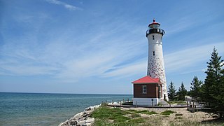
Crisp Point was one of five U.S. Life-Saving Service Stations along the coast of Lake Superior between Munising and Whitefish Point in the Upper Peninsula of Michigan. The lighthouse is within McMillan Township in Luce County.

M-123 is a state trunkline highway in the eastern Upper Peninsula of the US state of Michigan. It is one of only a few highways in Michigan that curve around and form a U-shape. In fact, M-123 has three intersections with only two state trunklines; it meets M-28 twice as a result of its U-shaped routing. M-123 also has a rare signed concurrency with a County-Designated Highway in Michigan; in Trout Lake, there is a concurrency with H-40. All of M-123 north of M-28 is a Scenic Heritage Route within the Michigan Heritage Route system.

Muskallonge Lake State Park is a state park located in Luce County in the U.S. state of Michigan. It is located in Deer Park about 16 miles (25.7 km) west of Grand Marais along H-58.

The Mount Trumbull Wilderness is a 7,880 acre (31 km2) wilderness area located on the Uinkaret Plateau in the Arizona Strip. It is managed by the Bureau of Land Management.

Yosemite West is an unincorporated community of resort homes located just outside the southern area of Yosemite National Park, just off Wawona Road, a continuation of State Route 41 from Fresno. It is a census-designated place (CDP), with a population of 47 as of the 2020 census. It is situated one mile (1.6 km) south of the Chinquapin intersection of Wawona Road with Glacier Point Road, at an altitude of 5,100 to 6,300 feet. The elevation reported by the USGS is 5,866 feet (1,788 m). The community is part of Henness Ridge, nearly 3,000 feet (910 m) above the southern banks of the Merced River and State Route 140 from Mariposa. Addresses in this area are shown as "Yosemite National Park, CA 95389".

H-58 is a county-designated highway in the US state of Michigan that runs east–west for approximately 69 miles (111 km) between the communities of Munising and Deer Park in the Upper Peninsula. The western section is routed through Pictured Rocks National Lakeshore, along the southern shore of Lake Superior, and the adjacent Lake Superior State Forest in Alger County while connecting Munising to the communities of Van Meer and Melstrand. At Grand Marais, H-58 exits the national lakeshore area and runs through town. The segment running east of Grand Marais to Deer Park in Luce County is a gravel road that connects to H-37 in Muskallonge Lake State Park.

The Pine Creek Rail Trail is a rail trail in the Appalachian Mountains of north-central Pennsylvania.

Schroeder is an unincorporated community in Schroeder Township, Cook County, Minnesota, United States.

Deer Park is an unincorporated community in Luce County in the U.S. state of Michigan. The community is located within McMillan Township. As an unincorporated community, Deer Park has no legally defined boundaries or population statistics of its own.

McMillan Township is a civil township of Luce County in the U.S. state of Michigan. The population was 2,692 at the 2010 census. At 588.78 square miles (1,524.9 km2) of total land area, McMillan Township occupies 65.5% of Luce County's land area and is also the largest municipality by area in the state of Michigan.

Silver Lake is an unincorporated community in Preston County, West Virginia, United States. Silver Lake is located along U.S. Route 219, 7.5 miles (12.1 km) north of Thomas in Tucker County.