
Kenton County is a county located in the northern part of the Commonwealth of Kentucky. As of the 2020 census, the population was 169,064, making it the third most populous county in Kentucky. Its county seats are Covington and Independence. It was, until November 24, 2010, the only county in Kentucky to have two legally recognized county seats. The county was formed in 1840 and is named for Simon Kenton, a frontiersman notable in the early history of the state.

Harlan County is a county located in southeastern Kentucky. As of the 2020 census, the population was 26,831. Its county seat is Harlan. It is classified as a moist county—one in which alcohol sales are prohibited, but containing a "wet" city—in this case Cumberland, where package alcohol sales are allowed. In the city of Harlan, restaurants seating 100+ may serve alcoholic beverages.

Pembroke Pines is a city in southern Broward County, Florida, United States. The city is located 22 miles (35 km) north of Miami. It is a suburb of and the fourth-most populous city in the Miami metropolitan area. The population of Pembroke Pines was 171,178 at the 2020 census.
Henryville is a census-designated place (CDP) in Monroe Township, Clark County, in the U.S. state of Indiana. The population was 1,905 at the 2010 census.

Madisonville is a home rule-class city in and the county seat of Hopkins County, Kentucky, United States, located along Interstate 69 in the state's Western Coal Fields region. The population was 19,591 at the 2010 census. Madisonville is a commercial center of the region and is home to Madisonville Community College.
Elsmere is a home rule-class city in Kenton County, Kentucky, in the United States. The population was 9,159 at the 2020 census.

Erlanger is a home rule-class city in Kenton County, Kentucky, United States. It had a 2020 census population of 19,611. Erlanger is part of the Cincinnati-Middletown, OH-KY-IN Metropolitan Statistical Area.
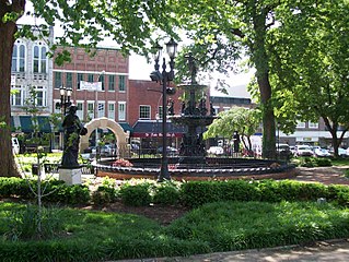
Independence is a home rule-class city in Kenton County, Kentucky, in the United States. It is one of its county's two seats of government. The population was 28,676 at the time of the 2020 U.S. census. It is the third largest city in Northern Kentucky after Covington and Florence.
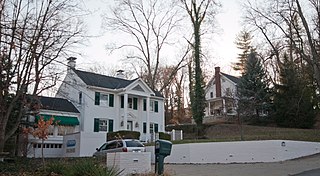
Park Hills is a home rule-class city in Kenton County, Kentucky, United States. The population was 3,162 at the 2020 census. It is a suburb of the Cincinnati metropolitan area. Much of the city was listed on the National Register of Historic Places in 2008 as the Park Hills Historic District.

Taylor Mill is a home rule-class city in Kenton County, Kentucky, in the United States. The population was 6,873 at the 2020 census.

Salyersville is a home rule-class city on the Licking River in Magoffin County, Kentucky, in the United States. It is the seat of its county. As of the 2020 census, the population was 1,591, down from 1,883 in 2010.

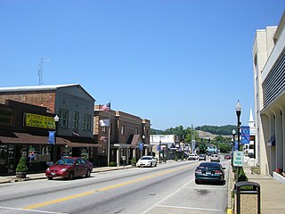
Maysville is a home rule-class city in Mason County, Kentucky, United States, and is the seat of Mason County. The population was 8,873 as of the 2020 census. Maysville is on the Ohio River, 66 miles (106 km) northeast of Lexington. It is the principal city of the Maysville Micropolitan Statistical Area, which comprises Mason County. Two bridges cross the Ohio from Maysville to Aberdeen, Ohio: the Simon Kenton Memorial Bridge built in 1931 and the William H. Harsha Bridge built in 2001.
West Liberty is a home rule-class city in Morgan County, Kentucky, United States. It is the county seat of Morgan County. As of the 2020 census, the city population was 3,215. It is located along the Licking River at the junction of Kentucky Route 7 and U.S. Route 460.
Bowling Green is a home rule-class city and the county seat of Warren County, Kentucky, United States. Founded by pioneers in 1798, Bowling Green was the provisional capital of Confederate Kentucky during the American Civil War. As of the 2020 census, its population of 72,294 made it the third-most-populous city in the state after Louisville and Lexington; its metropolitan area, which is the fourth largest in the state after Louisville, Lexington, and Northern Kentucky, had an estimated population of 179,240; and the combined statistical area it shares with Glasgow has an estimated population of 233,560.

Howell Township is a township in Monmouth County, in the U.S. state of New Jersey. The township is the largest municipality in the county by total area, comprised of about 61.21 square miles (158.5 km2). It is located in the New York metropolitan area and has been a steadily growing bedroom community of New York City. As of the 2020 United States census, the township's population was 53,537, its highest decennial count ever and an increase of 2,462 (+4.8%) from the 2010 census count of 51,075, which in turn reflected an increase of 2,172 (+4.4%) from the 48,903 counted in the 2000 census.

Xenia is a city in and the county seat of Greene County, Ohio, United States. Located in southwestern Ohio, it is 15 miles (24 km) east of Dayton and is part of the Dayton metropolitan area as well as the Miami Valley region. The name comes from the Greek word Xenia (ξενία), which means "hospitality".

Kenton is a city in and the county seat of Hardin County, Ohio, United States, located in the west-central part of Ohio about 57 mi (92 km) northwest of Columbus and 70 mi (113 km) south of Toledo. Its population was 7,947 at the 2020 census. The city was named for frontiersman Simon Kenton of Kentucky and Ohio.

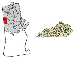
Walton is a home rule-class city in Boone and Kenton counties in the U.S. state of Kentucky. The population was 5,460 at the 2020 census.
Sweden is an unincorporated community in Jefferson County, Arkansas, United States. Sweden is located on Arkansas Highway 88, 16.1 miles (25.9 km) east of Pine Bluff. On January 22, 2012, an EF2 tornado struck Sweden, damaging grain bins and metal buildings; the tornado continued to a point northeast of Lodge Corner in Arkansas County.
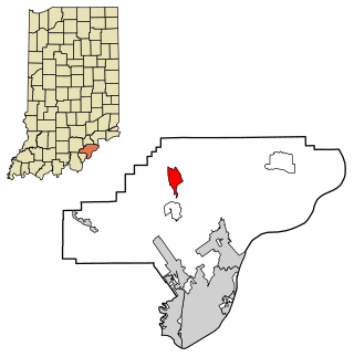
Kenton is an unincorporated community in Kenton County, Kentucky, United States. The community is located along Kentucky Route 177 and the Licking River 7 miles (11 km) southeast of Independence. Kenton has a post office with ZIP code 41053, which opened on February 23, 1858.


