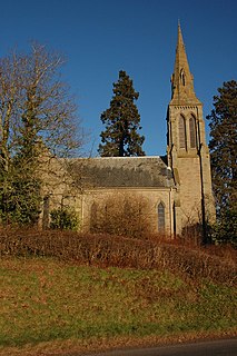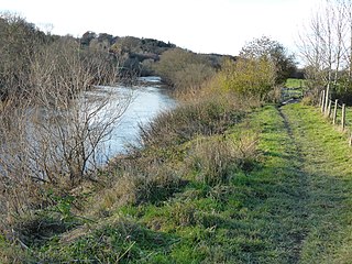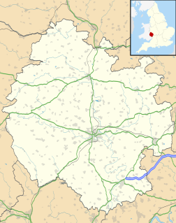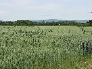
Edvin Loach, also Edwin Loach, is a village in eastern Herefordshire, England, about four miles north of the town of Bromyard, and near the village of Edwyn Ralph. It is part of the modern civil parish of Edvin Loach and Saltmarshe.

Moreton on Lugg is a village and civil parish in Herefordshire, England. The city and county town of Hereford is approximately 3 miles (5 km) to the south; the market and minster town of Leominster 8 miles (13 km) to the north.

Yazor is a small village and civil parish in the English county of Herefordshire. The parish includes the hamlet of Yarsop about 1 mile (2 km) to the north. Yazor is some 8 miles (13 km) north west of the city of Hereford on the A480 road and about 1 mile (2 km) east of Offa's Dyke. It was formerly served by Moorhampton railway station located in the parish. The population of the parish at the 2011 Census was 122.

Little Hereford is a small village and civil parish in Herefordshire, England. The civil parish includes the hamlet of Middleton. The population of the civil parish at the 2011 census was 394.

Breinton is a civil parish in Herefordshire, England. Breinton lies just to the west of Hereford. The population of this civil parish was at the 2011 Census 836. The name Breinton appears to be a modernised form of the word Bruntone, meaning a village near a flowing stream.
Haywood is a civil parish in Herefordshire, England, which is south-west of Hereford. The population of this civil parish at the 2011 census was 216. The parish has no substantial settlements. However, it is home to one of the largest poultry farms in Great Britain, which is run by Cargill Meats Europe.
Grafton is a village and civil parish in Herefordshire, England. The population of this civil parish was 258 at the 2011 census. The parish includes the villages of Grafton and Bullinghope, and is immediately to the south of Hereford city.

Lugwardine is a village and civil parish in Herefordshire, England, to the east of Hereford. It lies on the north-east bank of the River Lugg, which gives the village its name. The population of the civil parish taken at the 2011 Census was 1,721.

Aunsby and Dembleby is a civil parish in the North Kesteven district of Lincolnshire, England. According to the 2001 Census it had a population of 125. The parish includes Aunsby and Dembleby, which were separate parishes until 1931, and the hamlet of Scott Willoughby.

Bishopstone is a village and civil parish in Herefordshire, England, 10 km (6.2 mi) west of Hereford, near the River Wye and the Roman town of Magnis. According to the 2001 census it had a population of 199, increasing to 208 at the 2011 Census.

Byford is a village and civil parish on the River Wye in Herefordshire, England, about 11 km (7 mi) west of Hereford. According to the 2001 census it had a population of 119, increasing to 201 at the 2011 Census.

North Herefordshire is a constituency represented in the House of Commons of the UK Parliament since its 2010 creation by Bill Wiggin, a Conservative.

Fownhope is a village in Herefordshire, England, an area of outstanding natural beauty on the banks of the River Wye. The population of the village at the 2011 Census was 999.

Walford, Letton and Newton is a civil parish in north Herefordshire, England, close to the border with Shropshire. The population of this civil parish at the 2011 census was 179.

Tedstone Delamere is a village in Herefordshire, England, 5.5 km (3.4 mi) north east of Bromyard. The population of the village at the 2011 census was 138.

Moccas is a village and civil parish in the English county of Herefordshire. It is located 14 miles (23 km) west of Hereford. The population of the civil parish taken at the 2011 census was 105.

Upper Sapey is a small village and civil parish in Herefordshire, England. It is located 4 miles (6 km) northeast of Bromyard. The population of this civil parish as taken at the 2011 census was 460.

Lower Lyde is a small village in Herefordshire, around 3 miles (5 km) north of Hereford city centre. It forms part of the Pipe and Lyde civil parish. The village can be easily accessed from the A49 road.

Upper Lyde is a small village in Herefordshire, England, around 4 miles (6 km) north of Hereford city centre. It forms part of the Pipe and Lyde civil parish.

Staunton on Arrow is a village and civil parish in the county of Herefordshire, England, and is 17 miles (27 km) north-west from the city and county town of Hereford. The closest large town is the market and minster town of Leominster, 8 miles (13 km) to the east. Within the parish is the site of the Iron Age hill fort of Wapley Hill.


