
Rameswaram is a municipality in the Ramanathapuram district of the Indian state of Tamil Nadu. It is on Pamban Island separated from mainland India by the Pamban channel and is about 40 kilometres from Mannar Island, Sri Lanka. It is in the Gulf of Mannar, at the tip of the Indian peninsula. Pamban Island, also known as Rameswaram Island, is connected to mainland India by the Pamban Bridge. Rameswaram is the terminus of the railway line from Chennai and Madurai. Together with Varanasi, it is considered to be one of the holiest places in India to Hindus and is part of the Char Dham pilgrimage.

Aruppukottai is a town and a municipality in Virudhunagar district in the state of Tamil Nadu, India. Aruppukottai's classical name is "Sengattu Aravakotai". Aruppukottai is about 50 km from Madurai. It is in the middle of Madurai-Tuticorin National Highways NH-38. The villages and towns surrounding Aruppukottai makes this as a major town as well as a major transit hub and they are also famous for production of jasmine. Aruppukottai is always famous for producing yarn. Sri Ramana Maharishi was born in Tiruchuli near Aruppukottai town. Aruppukottai was part of king Sethupathi of Ramnad. King Sethupathi has Zamin Palace in Palyampatti. As of 2011, the town had a population of 87,722. The town also hosts two famous temples – Arulmigu Meenakshi Chokkanatha Swamy Temple built in 13th century by Pandiya King Maravarma Sundarapandiya Thevar and Malaiyarasan Temple..
Ramanathapuram, also known as Ramnad, is a town and a municipality in Ramanathapuram district in the Indian state of Tamil Nadu. It is the administrative headquarters of Ramanathapuram district and the second largest town in Ramanathapuram district.

Sivaganga is a town and headquarters of the Sivaganga district in the Indian state of Tamil Nadu. The town is located at a distance of 48 km (30 mi) from Madurai and 449 km (279 mi) from the state capital Chennai.
Sattur or Saathur is a town in Virudhunagar district in the Indian state of Tamil Nadu. As of 2011, the town had a population of 29,398.

Jayankondam is a Second Grade Municipality in Ariyalur district of Tamil Nadu in India. As of 2011, the town had a population of 33,945.

Manamadurai is a Basic Stage Municipality in Sivaganga district in the Indian state of Tamil Nadu. Manamadurai falls under Manamadurai Legislative assembly.
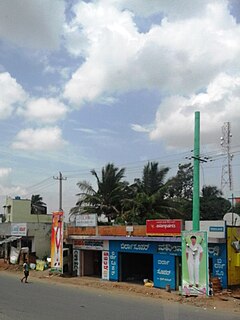
Mandapam is a panchayat town in Ramanathapuram district in the Indian state of Tamil Nadu. The famed Pamban Railway bridge and Vehicular bridge lie to the East of this Panchayat Town.

Suchindram is a panchayat town in Kanyakumari district in the Indian state of Tamil Nadu with Indian postal code as 629704. It is an important pilgrim centre and the site of the famous Thanumalayan Temple. There is an Anjaneya,, statue which stands at 22 feet and is carved of a single granite block.

The Vaigai Dam is built across the Vaigai River near Andipatti, in the Theni district of Tamil Nadu, southern India. Near the dam, the Government of Tamil Nadu has constructed an Agricultural Research Station for researching the growing of a variety of crops, including rice, sorghum, blackgram, cowpea and cotton.
Uchipuli or Uchippuli is a locality in the Mandapam block of Ramanathapuram district, Tamil Nadu, India. It is a major source of water supply for the Ramanathapuram town. An Indian Navy air station, INS Parundu, is located near Uchipuli.
Kadakola is a Town and a suburb of Mysuru metropolitan area in the southern state of Karnataka, India. It is located in the Mysore taluk of Mysore district. In November 2020, Kadakola was upgraded from a Gram Panchayat to a Town Panchayat and a gazetted notification was passed on November 26, 2020.2. The combined population of the newly formed town is 19,969.
Adirampattinam is a newly established Municipality in the Pattukottai taluk of the Thanjavur district in the Indian state of Tamil Nadu. It is also short known by Adirai. It is the largest coastal town in the district and fourth largest town in the Thanjavur district.
Pamban is a town in the Rameswaram taluk of Ramanathapuram district, Tamil Nadu. It is at the west edge of Pamban Island and is a popular fishing port. The town gives its name to the whole island. Pamban railway station is the first station on the island for pilgrims travelling to Rameswaram.
Veeravanoor is a village in Ramanathapuram District in the Indian state of Tamil Nadu.

Podanur Junction(station code: PTJ) is a railway station in Podanur, Coimbatore, Tamil Nadu, India

Alampattu is a village in the state of Tamil Nadu, Sivaganga District, India. It is 20 km from the town Karaikudi.
Appanur, is a village in the Kadaladi Taluk of Ramanathapuram District in Tamil Nadu, India. It is located between Mudukulathur and Sayalgudi, on the State Highway 29 (SH29).
Parukkaikudi is a village in the Ramanathapuram district of the Indian state of Tamil Nadu.
Pandrimalai is a village panchayat located in the Dindigul district of Tamil Nadu, India. The latitude 10.3627476 and longitude 77.99234 are the geocoordinate of the Pandrimalai. Chennai is the state capital for Pandrimalai village. It is located around 393.6 kilometer away from Pandrimalai. The other nearest state capital from Pandrimalai is Thiruvananthapuram and its distance is 226.6 km. The other surrounding state capitals are Thiruvananthapuram 226.6 km., Pondicherry 266.4 km., Bangalore 294.4 km.,

