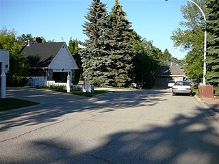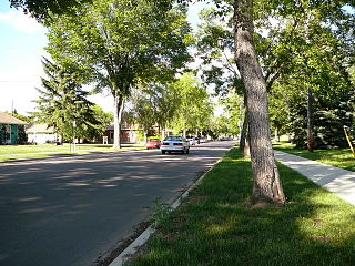
Boyle Street is a neighbourhood located in central Edmonton, Alberta, Canada, immediately east of the downtown core. The neighbourhood is bounded by Grierson Hill to Rowland Road until Alex Taylor Road and then Jasper Avenue east until 82 Street by the south, 82 Street by the east, 97 Street by the west, and the LRT tracks to the north, with Jasper Avenue and 103A Avenue running through the neighbourhood.
York is a neighbourhood in north east Edmonton, Alberta, Canada located just to the west of the District of Clareview. It is bounded on the north by 144 Avenue, the east by 50 Street, the south east by Manning Drive, the south by 137 Avenue, and on the west by 66 Street.

Oliver is one of the oldest residential neighbourhoods in the City of Edmonton, Alberta, Canada. The neighbourhood is named after Frank Oliver, an early Edmonton resident, businessman, and politician. The south east portion of the neighbourhood is also known as Grandin, with both Grandin station (now known as Government Centre station and Grandin School located in this part of the neighbourhood.

Britannia Youngstown is a residential neighbourhood in west Edmonton, Alberta, Canada. Originally part of the Town of Jasper Place, it became part of Edmonton when Jasper Place amalgamated with Edmonton in 1964.

Spruce Avenue is an irregular shaped residential neighbourhood in Edmonton, Alberta, Canada. The neighbourhood is home to Kingsway Mall, the Glenrose Rehabilitation Hospital, the Northern Alberta Institute of Technology, the Norwood Extended Care Hospital, Spruce Avenue Community Center, Spruce Avenue Junior High School, and St. Basil Catholic Junior High School. The neighbourhood takes its name from the former designation of 114 Avenue.
High Park is a neighbourhood in west Edmonton, Alberta, Canada. The neighbourhood became a part of Edmonton when the Town of Jasper Place amalgamated with Edmonton in 1964.
Terra Losa is a mixed residential and commercial neighbourhood located in west Edmonton, Alberta, Canada.

Laurier Heights is a residential neighbourhood in west Edmonton, Alberta, Canada overlooking the North Saskatchewan River valley. A portion of the neighbourhood along Buena Vista Road is located in the river valley, and this portion is sometimes called Buena Vista.

Holyrood is a residential neighbourhood in the Bonnie Doon area of south east Edmonton, Alberta, Canada. The name, Holyrood, is an anglicisation of the Scots haly ruid.
Kenilworth is a residential neighbourhood in south east Edmonton, Alberta, Canada located just to the north of Whyte Avenue.
Royal Gardens is a residential neighbourhood in south west Edmonton, Alberta, Canada. The neighbourhood is bounded on the north by Whitemud Drive, on the east by 111 Street, on the south by 40 Avenue, and on the west by 119 Street/121 Street.
Lendrum Place is a residential neighbourhood located in south west Edmonton, Alberta, Canada. It is named for Robert Lendrum, an early land surveyor.
Bellevue is a smaller residential neighbourhood located in north east Edmonton, Alberta, Canada. The neighbourhood overlooks the North Saskatchewan River.

La Perle is a residential neighbourhood in west Edmonton, Alberta, Canada. The neighbourhood is named for a resident who operated a general store in the area in the early. 20th century.
Kildare is a mixed residential/commercial neighbourhood in northeast Edmonton, Alberta, Canada. It is named after Kildare in Ireland.
Athlone is a residential neighbourhood in north west Edmonton, Alberta, Canada. The neighbourhood is named after the Earl of Athlone, Canada's governor-general from 1940 to 1946. The western portion of the neighbourhood is also called Dunvegan, after the Dunvegan Yards a railway depot that existed on the site for some 70 years.
Fulton Place is a residential neighbourhood in east Edmonton, Alberta, Canada. It is named for the creek which runs along the neighbourhood's west boundary. It is part of a broader area of surrounding communities known as Greater Hardisty.
Rosslyn is a residential neighbourhood in north west Edmonton, Alberta, Canada. The neighbourhood has good access to shopping services at Northgate Centre and North Town Mall.
Killarney is a residential neighbourhood located in north east Edmonton, Alberta, Canada. While the area became part of Edmonton in 1913, residential development did not occur until the 1950s and 1960s.
Rideau Park is a residential neighbourhood in southwest Edmonton, Alberta, Canada. The name Rideau means curtain in the French Language.


