
Bogoroditsk is a town and the administrative center of Bogoroditsky District in Tula Oblast, Russia, located on the Upyorta River, a tributary of the Upa. Population: 31,897 (2010 Census); 30,884 (2002 Census); 33,552 (1989 Census).

Plavsk is a town and the administrative center of Plavsky District in Tula Oblast, Russia, located on the Plava River. Population: 16,165 (2010 Census); 16,750 (2002 Census); 16,559 (1989 Census).

Arsenyevsky District is an administrative district (raion), one of the twenty-three in Tula Oblast, Russia. It is located in the west of the oblast. The area of the district is 1,096 square kilometers (423 sq mi). Its administrative center is the urban locality of Arsenyevo. Population: 12,209 ; 12,730 (2002 Census); 13,382 (1989 Census). The population of Arsenyevo accounts for 39.3% of the district's total population.

Belyovsky District is an administrative district (raion), one of the twenty-three in Tula Oblast, Russia. Within the framework of municipal divisions, it is incorporated as Belyovsky Municipal District. It is located in the west of the oblast. The area of the district is 1,190 square kilometers (460 sq mi). Its administrative center is the town of Belyov. Population: 20,952 ; 24,912 (2002 Census); 30,124 (1989 Census). The population of Belyov accounts for 66.4% of the district's total population.

Chernsky District is an administrative district (raion), one of the twenty-three in Tula Oblast, Russia. As a municipal division, it is incorporated as Chernsky Municipal District. It is located in the southwest of the oblast. The area of the district is 1,614 square kilometers (623 sq mi). Its administrative center is the urban locality of Chern. Population: 20,476 ; 23,006 (2002 Census); 22,605 (1989 Census). The population of Chern accounts for 31.3% of the district's total population.

Dubensky District is an administrative district (raion), one of the twenty-three in Tula Oblast, Russia. Within the framework of municipal divisions, it is incorporated as Dubensky Municipal District. It is located in the northwest of the oblast. The area of the district is 799 square kilometers (308 sq mi). Its administrative center is the urban locality of Dubna. Population: 14,618 ; 15,011 (2002 Census); 15,130 (1989 Census). The population of Dubna accounts for 40.9% of the district's total population.

Kamensky District is an administrative district (raion), one of the twenty-three in Tula Oblast, Russia. As a municipal division, it is incorporated as Kamensky Municipal District. It is located in the south of the oblast. The area of the district is 795 square kilometers (307 sq mi). Its administrative center is the rural locality of Arkhangelskoye. Population: 9,548 ; 10,720 (2002 Census); 11,007 (1989 Census). The population of Arkhangelskoye accounts for 25.0% of the district's total population.

Kireyevsky District is an administrative district (raion), one of the twenty-three in Tula Oblast, Russia. Within the framework of municipal divisions, it is incorporated as Kireyevsky Municipal District. It is located in the center of the oblast. The area of the district is 931 square kilometers (359 sq mi). Its administrative center is the town of Kireyevsk. Population: 75,142 ; 79,142 (2002 Census); 93,073 (1989 Census). The population of Kireyevsk accounts for 34.0% of the district's total population.

Kurkinsky District is an administrative district (raion), one of the twenty-three in Tula Oblast, Russia. As a municipal division, it is incorporated as Kurkinsky Municipal District. It is located in the southeast of the oblast. The area of the district is 949.25 square kilometers (366.51 sq mi). Its administrative center is the urban locality of Kurkino. Population: 10,830 ; 13,077 (2002 Census); 15,457 (1989 Census). The population of Kurkino accounts for 50.0% of the district's total population.

Odoyevsky District is an administrative district (raion), one of the twenty-three in Tula Oblast, Russia. Within the framework of municipal divisions, it is incorporated as Odoyevsky Municipal District. It is located in the west of the oblast. The area of the district is 1,182 square kilometers (456 sq mi). Its administrative center is the urban locality of Odoyev. Population: 13,184 ; 14,149 (2002 Census); 15,312 (1989 Census). The population of Odoyev accounts for 46.6% of the district's total population.

Shchyokinsky District is an administrative district (raion), one of the twenty-three in Tula Oblast, Russia. Within the framework of municipal divisions, it is incorporated as Shchyokinsky Municipal District. It is located in the center of the oblast. The area of the district is 1,393.4 square kilometers (538.0 sq mi). Its administrative center is the town of Shchyokino. Population: 106,595 ; 43,064 (2002 Census); 48,434 (1989 Census). The population of the administrative center accounts for 54.5% of the district's total population.

Suvorovsky District is an administrative district (raion), one of the twenty-three in Tula Oblast, Russia. Within the framework of municipal divisions, it is incorporated as Suvorovsky Municipal District. It is located in the west of the oblast. The area of the district is 1,065 square kilometers (411 sq mi). Its administrative center is the town of Suvorov. Population: 37,637 ; 41,838 (2002 Census); 48,061 (1989 Census). The population of Suvorov accounts for 50.4% of the district's total population.

Tyoplo-Ogaryovsky District is an administrative district (raion), one of the twenty-three in Tula Oblast, Russia. As a municipal division, it is incorporated as Tyoplo-Ogaryovsky Municipal District. It is located in the south of the oblast. The area of the district is 1,014 square kilometers (392 sq mi). Its administrative center is the urban locality of Tyoploye. Population: 12,705 ; 14,111 (2002 Census); 15,493 (1989 Census). The population of Tyoploye accounts for 40.3% of the district's total population.

Venyovsky District is an administrative district (raion), one of the twenty-three in Tula Oblast, Russia. Within the framework of municipal divisions, it is incorporated as Venyovsky Municipal District. It is located in the northeast of the oblast. The area of the district is 1,620 square kilometers (630 sq mi). Its administrative center is the town of Venyov. Population: 33,940 ; 37,612 (2002 Census); 38,527 (1989 Census). The population of Venyov accounts for 44.9% of the district's total population.
Volovsky District is an administrative district (raion), one of the twenty-three in Tula Oblast, Russia. As a municipal division, it is incorporated as Volovsky Municipal District. It is located in the southeast of the oblast. The area of the district is 1,080 square kilometers (420 sq mi). Its administrative center is the urban locality of Volovo. Population: 13,596 ; 15,957 (2002 Census); 18,419 (1989 Census). The population of Volovo accounts for 28.3% of the district's total population.
Yasnogorsky District is an administrative district (raion), one of the twenty-three in Tula Oblast, Russia. Within the framework of municipal divisions, it is incorporated as Yasnogorsky Municipal District. It is located in the north of the oblast. The area of the district is 1,299.7 square kilometers (501.8 sq mi). Its administrative center is the town of Yasnogorsk. Population: 31,152 ; 34,926 (2002 Census); 39,606 (1989 Census). The population of Yasnogorsk accounts for 53.9% of the district's total population.

Yefremovsky District is an administrative district (raion), one of the twenty-three in Tula Oblast, Russia. As a municipal division, it is incorporated as Yefremov Urban Okrug. It is located in the southeast of the oblast. The area of the district is 1,649 square kilometers (637 sq mi). Its administrative center is the town of Yefremov. Population: 64,227 ; 23,436 (2002 Census); 25,057 (1989 Census). The population of Yefremov accounts for 65.9% of the district's total population.

Zaoksky District is an administrative district (raion), one of the twenty-three in Tula Oblast, Russia. As a municipal division, it is incorporated as Zaoksky Municipal District. It is located in the north of the oblast. The area of the district is 918.4 square kilometers (354.6 sq mi). Its administrative center is the urban locality of Zaoksky. Population: 22,368 ; 19,406 (2002 Census); 20,429 (1989 Census). The population of the administrative center accounts for 31.8% of the district's total population.

Arsenyevo is an urban locality and the administrative center of Arsenyevsky District of Tula Oblast, Russia. Population: 4,803 (2010 Census); 5,995 (2002 Census); 5,773 (1989 Census).
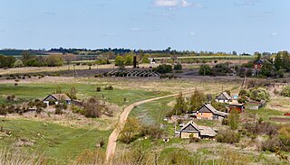
Arkhangelskoye is a rural locality and the administrative center of Kamensky District of Tula Oblast, Russia. Population: 2,391 (2010 Census); 2,768 (2002 Census); 2,956 (1989 Census).


