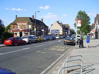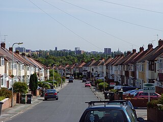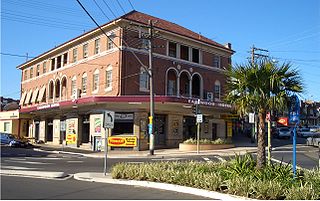
Winchmore Hill is a suburb and electoral ward in the London Borough of Enfield, north London, England, in the N21 postal district. The Winchmore Hill conservation area serves as the focal point of the district. Geographically, it is bounded on the east by Green Lanes, Barrowell Green, Firs Lane and Fords Grove. To the northwest, it is bordered by Grovelands Park. The southern boundary extends to part of Aldermans Hill, while the northern boundary reaches Vicars Moor Lane and Houndsden Road. Winchmore Hill is 8.9 miles (14.3 km) northeast of Charing Cross.

Albert Park is an inner suburb of Melbourne, Victoria, Australia, 4 km (2.5 mi) south of Melbourne's Central Business District. The suburb is named after Albert Park, a large lakeside urban park located within the City of Port Phillip local government area. Albert Park recorded a population of 6,044 at the 2021 census.

Surrey Hills is a suburb of Melbourne, Victoria, Australia, 11 km east of Melbourne's Central Business District, located within the Cities of Boroondara and Whitehorse local government areas. Surrey Hills recorded a population of 13,655 at the 2021 census.
Blackburn North is a suburb of Melbourne, Victoria, Australia, 17 km east of Melbourne's Central Business District, located within the City of Whitehorse local government area. Blackburn North recorded a population of 7,627 at the 2021 census.

Quinton is a suburb and ward of Birmingham, in the county of the West Midlands, England, 5 miles (8 km) west of the city centre. Formerly part of Halesowen parish, Quinton became part of Birmingham in 1909. Quinton was a village and the surrounding area was farmland until the 1930s when the first housing estates were developed. Most of the farmland had been built on by 1980 but some countryside remains in the form of Woodgate Valley Country Park. Along with Bartley Green, Harborne and Edgbaston, Quinton is within the Birmingham Edgbaston constituency.

Orleans is a community in Ottawa, Ontario, Canada. It is located in the east end of the city along the Ottawa River, about 16 km (10 mi) from Downtown Ottawa. The Canada 2021 Census determined that Orléans' population was 125,937. Before being amalgamated into Ottawa in 2001, the community of Orléans was spread over two municipal jurisdictions, the eastern portion being in the pre-amalgamation City of Cumberland, the western portion in the City of Gloucester. According to the 2021 census, 75,453 people lived in the Cumberland portion of Orleans, while 50,484 lived in the Gloucester portion. Today, Orléans spans the municipal wards of Orléans East-Cumberland, Orléans West-Innes, and Orléans South-Navan. Orléans contains a significant francophone population.

Thornleigh is a suburb in the Upper North Shore region of Sydney in the state of New South Wales, Australia. Thornleigh is located 22 kilometres north-west of the Sydney central business district in the local government area of Hornsby Shire. The source of the Lane Cove River is located in Thornleigh.

Raynes Park is a residential suburb, railway station and local centre near Wimbledon, London, and is within the London Borough of Merton. It is situated southwest of Wimbledon Common, to the northwest of Wimbledon Chase and to the east of New Malden, in South West London. It is 7.8 miles (12.5 km) southwest of Charing Cross. Towards the north and west, either side of the borough boundary with the Royal Borough of Kingston upon Thames are the areas of Copse Hill and Coombe with their large detached houses, golf courses and gated lands. Raynes Park had a population of 19,619 in 2011, which refers to the populations of the wards of Raynes Park and West Barnes.

Padstow, a suburb of local government area City of Canterbury-Bankstown, is located 21 kilometres south-west of the Sydney central business district, in the state of New South Wales, Australia, and is a part of the South-western Sydney region. Padstow is a mostly residential suburb bounded on the north by Bankstown and on the east by Salt Pan Creek, which is a stream feeding into the Georges River. The M5 South Western Motorway traverses the northern end of the suburb, which is also the location of a number of light industrial facilities.

Motspur Park, also known locally as West Barnes, is a residential suburb in south-west London, in the New Malden district. It straddles the boroughs of Kingston upon Thames and Merton.

Shirecliffe is a suburb of the City of Sheffield. It lies three kilometres north of the city centre, it is now a residential neighbourhood consisting mostly of public housing. In the past it was a rural area made up of farmland and scattered small country houses. The name of the suburb derives from "Scir-clifff" meaning a bright steep hillside, this is appropriate as it is located at the top of a steep escarpment which rises out of the Don valley at Neepsend.

Worcester Park is a suburban town in South London, England. It lies in the London boroughs of Sutton and Kingston, and partly in the Surrey borough of Epsom and Ewell. The area is 10 miles (16 km) southwest of Charing Cross. The suburb's population was 16,031 at the time of the 2001 census. The suburb comprises the Worcester Park ward, an electoral area of the London Borough of Sutton with a population in 2011 of 11,655, as well as the Cuddington ward, an electoral area of Epsom and Ewell, which had a population of 5,791 at the time of the 2001 census.

St Clair is a suburb of Sydney, in the state of New South Wales, Australia. It is 44 kilometres west of the Sydney central business district, in the local government area of the City of Penrith and is part of the Greater Western Sydney region. St Clair is within view of the Blue Mountains.

Kellyville is a suburb of Sydney, in the state of New South Wales, Australia 36 kilometres north-west of the Sydney central business district in the local government area of The Hills Shire. It is part of the Hills District region.

Baldivis is a semi-rural residential suburb 46 kilometres (29 mi) south of Perth, Western Australia, and 11 kilometres (6.8 mi) southeast of the regional centre of Rockingham. It is located within the City of Rockingham local government area.

Claregate is a suburb of Wolverhampton, West Midlands, England. It is north west of Wolverhampton city centre, within the Tettenhall Regis ward.

Earlwood is a suburb of Sydney, in the state of New South Wales, Australia. Earlwood is located 10 kilometres south-west of the Sydney central business district, and is part of the Canterbury-Bankstown area. It is in the local government area of the City of Canterbury-Bankstown.

Pennington is a northern suburb of Adelaide, South Australia, located about 10 km from the Adelaide city centre, it is located in the City of Charles Sturt. The suburb is named after Pennington, the name of multiple areas in England.

Longley is a suburb of the City of Sheffield, in South Yorkshire, England. It lies four km north of the city centre and is a residential neighbourhood made up mostly of housing built by Sheffield City Council in the late 1920s. The suburb falls within the Firth Park ward of the City.

Fresh Pond Parkway is a historic park and parkway on the western end of Cambridge, Massachusetts. It is part of the Metropolitan Park System of Greater Boston. The parkway was built in 1899 and added to the National Register of Historic Places in 2005.


