Polar seas

Last updated
Polar bear in Manitoba, Canada. November 2004. Polar Bear 2004-11-15.jpg
Polar bear in Manitoba, Canada. November 2004.

Polar seas is a collective term for the Arctic Ocean (about 4-5 percent of Earth's oceans) and the southern part of the Southern Ocean (south of Antarctic Convergence, about 10 percent of Earth's oceans). In the coldest years, sea ice can cover around 13 percent of the Earth's total surface at its maximum, but out of phase in the two hemispheres. The polar seas contain a huge biome with many organisms.

Contents

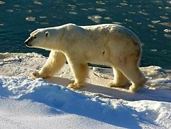
Among the species that inhabit various polar seas and surrounding land areas are polar bear, reindeer (caribou), muskox, wolverine, ermine, lemming, Arctic hare, Arctic ground squirrel, whale, harp seal, and walrus. [1] These species have unique adaptations to the extreme conditions. Many might be endangered if they cannot adapt to changing conditions. Contrary to popular opinion, the World Wildlife Fund studies for polar bears show that this species has prospered since 1950, attaining five times the numbers found in 1950. In general, Arctic ecosystems are relatively fragile and slow to recover from serious damage.

Arctic

A large amount of the land in the north polar region is part of Earth's tundra biome. South of the Arctic tundra, where temperatures are a little less cold, are the vast forests of conifer trees of the taiga biome. North of the Arctic tundra are polar bears and the unique marine life of the Arctic Ocean. [2]

The Arctic Ocean has relatively abundant plant life. Nutrients from rivers along with mixing and upwelling from storms contribute mixed layer nutrients which are essential for Arctic phytoplankton development. During summer, nearly continuous solar insolation encourages phytoplankta blooms. The Arctic Ocean is surrounded by continents and has a few narrow, relatively shallow connections to the large ocean basins to the south. Large amounts of riverine fresh water as well as abundant nutrients (gelbstoff) flow into the Arctic basin from Siberian rivers. The widest continental shelf on the planet is found in the Arctic Ocean, extending more than 1000 kilometers outward from Siberia and Alaska. Consequently, much of the basin is very shallow. On the other hand, the Arctic Ocean contains the deepest, slowest spreading mid-ocean ridge on the planet which, until 2003, was thought to be inactive volcanically. Since then, however, a dozen active volcanoes have been discovered, illustrating the limited information available for the difficult-to-study Arctic Ocean. The numerous Siberian rivers flowing onto the shallow continental shelf freshen the seawater. These rivers have shown increased flow recently, possibly due to increased global rainfall as a result of climate change. A flow increase may raise the level of riverine nutrients. Severe Siberian drought, as experienced in 2010, could, however, decrease flows. There is an interest in a potential release of methane gas, a potent greenhouse gas, from methane clathrates present in the Arctic continental shelf sediments, if sufficient ocean warming were to occur. As much as 80% of the ocean surface is covered by ice in winter, declining to about 60% in summer; ice cover has been declining at a steady and rapid pace. A large fraction of the ice is multi-year ice, and in the far North the thickness can be more than 2m. In summer, ice tends to melt at the air-sea interface. Surface melt ponds are formed, increasing the albedo.

Antarctic

Most of Antarctica is covered with a thick layer of ice, with few species permanently living in the ice-covered areas. There are many species of penguins in the south polar region. Almost all animals in Antarctica find their food in the Southern Ocean surrounding the continent, and there is abundant marine life in the Southern Ocean. [2]

Because of the extreme but constant habitats, small disruption or damage could alter the polar systems. Although they are remote from human world, polar seas are not 'pristine' environments. Compared with the Antarctic region, the Arctic has long history of interaction with man. The polar food web structure can be sensitive to man's 'top-down' control especially with the development and growth of industrial fishing. Climate change is a natural phenomenon that influences life in polar areas. There is observational evidence that the Antarctica climate is a bellwether for climate change in the northern hemisphere, leading by about 1000 years. The study of Antarctic ice, its distribution, changes in ice volume, and other indicators of the continental climate in Antarctica are at an early stage of development and even earlier stage of understanding. Techniques for studying the terrain beneath the ice are just being explored. Lake Vostok, buried under miles of ice, has not been penetrated to date. There is evidence that it has been out of contact with the atmosphere for millions of years, making it a possible treasure trove of information.

Arctic Ocean Arctic Ocean.png
Arctic Ocean
Antarctic and Southern Ocean Southern Hemi Antarctica.png
Antarctic and Southern Ocean

Relatively, the Antarctic seas and Southern Ocean surround the highest, driest, coldest and windiest continent on the Earth - Antarctica. Due to the low mean temperature, there is no riverine input into the Antarctic seas. And little input DOM, POC from land. In addition to relatively thin sea ice, thick and extensive ice shelves (floating glaciers) are present in the Antarctic region. More than 90% of the sea ice is first year (annual) ice and less than 2m thick. The first confirmed sighting of Antarctica can date back to the 1820. [3]

Role in global climate

The polar seas play an important role in the global climate:

Models predict a latitudinal effect in response to climate change. These would be expected to be first obvious in polar and subpolar regions. The decline of arctic ocean summer ice coverage was assumed to be one such sign, however, the reversal of that trend leaves the question open as the origins of the now reversed 30 year trend. In 1979, the cover of Time magazine was illustrated with an image of arctic ice covering and expanding BEYOND the arctic basin, opinion seems to have little value. Real data reveal the trend of ice coverage to be on the increase. If this increase will continue, only time will tell. Developed nations ceased the production and use of chlorofluorocarbons and the atmospheric abundance and consequent ozone depletion are generally on the decrease. ozone hole Breaking-off of polar ice shelves is a continuing process with increases in Western Antarctica balanced by decreases in Eastern Antarctica. Careful study has revealed that the volume of ice in Western Antarctica was incorrectly estimated and shows no significant change attributable to climate change over the observation period.

Characteristics

Extreme oscillations in irradiance occur in these regions, for months it may be totally dark (in winter) or light (in summer). Because of the existence of polar ice, surface reflectance of sunlight is very high. In addition the solar angle are relatively quite low. So less light can penetrate into water and becomes bio available to the plants in polar water under the ice cover. Water temperatures are low, but do not change much seasonally. The low temperature and low available high irradiance together limit primary production. Major nutrients (N, P, Si) are often not limiting primary production. Blooming of Phytoplankton happens in summer, because of the decreased salinity (sea ice melt-water), lower mixing, higher stratification, higher temperature and more bio available light.

Ice is very important in structuring environment. It regulates the physics, chemistry and biology of the water column, air-sea exchange, and is also an important habitat.

Development

There is an expected rise in the exploration and development of the Polar Seas due to an increasing demand for fuel and commodities. The emergence of China and India's economy is considered one of the main drivers of this phenomenon due to an unprecedented appetite for raw materials and fuel. [5]

Presently, there are still no exact figures that define the oil and gas reserves in the Polar Seas. Initial explorations, however, have resulted in the identification of its potential. For example, Canada's explorations discovered gas and oil in several Arctic locations such as Beaufort, High Arctic (Arctic Islands), Labrador, and Newfoundland. [6] The Arctic Islands alone has an estimated 4.3 billion barrels of oil reserve while those locations that fall within the Alaskan continental shelf have potential recoverable reserves worth $18 billion. [7]

There are now 46 nations that are parties to cooperation and treaties covering the polar regions. Several of these, either individually or with partners, conduct research and explorations in the Arctic and Antarctic seas. [8] These activities are governed by international environmental protocols. However, countries like China, which faces a future oil shortage, are aggressively exploring the region for the purpose of oil extraction despite an international ban on such activity. [9]

Related Research Articles

<span class="mw-page-title-main">Tundra</span> Biome where plant growth is hindered by frigid temperatures

In physical geography, tundra is a type of biome where tree growth is hindered by frigid temperatures and short growing seasons. The term is a Russian word adapted from Sámi languages. There are three regions and associated types of tundra: Arctic tundra, alpine tundra, and Antarctic tundra.

<span class="mw-page-title-main">Cryosphere</span> Those portions of Earths surface where water is in solid form

The cryosphere is an all-encompassing term for the portions of Earth's surface where water is in solid form, including sea ice, lake ice, river ice, snow cover, glaciers, ice caps, ice sheets, and frozen ground. Thus, there is a wide overlap with the hydrosphere. The cryosphere is an integral part of the global climate system. It also has important feedbacks on the climate system. These feedbacks come from the cryosphere's influence on surface energy and moisture fluxes, clouds, the water cycle, atmospheric and oceanic circulation.

<span class="mw-page-title-main">Polar climate</span> Climate classification

The polar climate regions are characterized by a lack of warm summers but with varying winters. Every month a polar climate has an average temperature of less than 10 °C (50 °F). Regions with a polar climate cover more than 20% of the Earth's area. Most of these regions are far from the equator and near the poles, and in this case, winter days are extremely short and summer days are extremely long. A polar climate consists of cool summers and very cold winters, which results in treeless tundra, glaciers, or a permanent or semi-permanent layer of ice. It is identified with the letter E in the Köppen climate classification.

<span class="mw-page-title-main">Climate of Antarctica</span> Overview of climactic conditions in Antarctica

The climate of Antarctica is the coldest on Earth. The continent is also extremely dry, averaging 166 mm (6.5 in) of precipitation per year. Snow rarely melts on most parts of the continent, and, after being compressed, becomes the glacier ice that makes up the ice sheet. Weather fronts rarely penetrate far into the continent, because of the katabatic winds. Most of Antarctica has an ice-cap climate with extremely cold and dry weather.

<span class="mw-page-title-main">Sea ice</span> Outcome of seawater as it freezes

Sea ice arises as seawater freezes. Because ice is less dense than water, it floats on the ocean's surface. Sea ice covers about 7% of the Earth's surface and about 12% of the world's oceans. Much of the world's sea ice is enclosed within the polar ice packs in the Earth's polar regions: the Arctic ice pack of the Arctic Ocean and the Antarctic ice pack of the Southern Ocean. Polar packs undergo a significant yearly cycling in surface extent, a natural process upon which depends the Arctic ecology, including the ocean's ecosystems. Due to the action of winds, currents and temperature fluctuations, sea ice is very dynamic, leading to a wide variety of ice types and features. Sea ice may be contrasted with icebergs, which are chunks of ice shelves or glaciers that calve into the ocean. Depending on location, sea ice expanses may also incorporate icebergs.

<span class="mw-page-title-main">Ice shelf</span> Large floating platform of ice caused by glacier flowing onto ocean surface

An ice shelf is a large platform of glacial ice floating on the ocean, fed by one or multiple tributary glaciers. Ice shelves form along coastlines where the ice thickness is insufficient to displace the more dense surrounding ocean water. The boundary between the ice shelf (floating) and grounded ice is referred to as the grounding line; the boundary between the ice shelf and the open ocean is the ice front or calving front.

<span class="mw-page-title-main">Antarctic Peninsula</span> Peninsula located in northern Antarctica

The Antarctic Peninsula, known as O'Higgins Land in Chile and Tierra de San Martín in Argentina, and originally as Graham Land in the United Kingdom and the Palmer Peninsula in the United States, is the northernmost part of mainland Antarctica.

<span class="mw-page-title-main">Byrd Polar and Climate Research Center</span>

The Byrd Polar and Climate Research Center (BPCRC) is a polar, alpine, and climate research center at Ohio State University founded in 1960.

<span class="mw-page-title-main">Polar desert</span> Region of the Earth

Polar deserts are the regions of Earth that fall under an ice cap climate. Despite rainfall totals low enough to normally classify as a desert, polar deserts are distinguished from true deserts by low annual temperatures and evapotranspiration. Most polar deserts are covered in ice sheets, ice fields, or ice caps, and they are also called white deserts.

<span class="mw-page-title-main">West Antarctica</span> Part of Antarctica that lies within the Western Hemisphere

West Antarctica, or Lesser Antarctica, one of the two major regions of Antarctica, is the part of that continent that lies within the Western Hemisphere, and includes the Antarctic Peninsula. It is separated from East Antarctica by the Transantarctic Mountains and is covered by the West Antarctic Ice Sheet. It lies between the Ross Sea, and the Weddell Sea. It may be considered a giant peninsula, stretching from the South Pole towards the tip of South America.

Polar ecology is the relationship between plants and animals in a polar environment. Polar environments are in the Arctic and Antarctic regions. Arctic regions are in the Northern Hemisphere, and it contains land and the islands that surrounds it. Antarctica is in the Southern Hemisphere and it also contains the land mass, surrounding islands and the ocean. Polar regions also contain the subantarctic and subarctic zone which separate the polar regions from the temperate regions. Antarctica and the Arctic lie in the polar circles. The polar circles are imaginary lines shown on maps to be the areas that receives less sunlight due to less radiation. These areas either receive sunlight or shade 24 hours a day because of the earth's tilt. Plants and animals in the polar regions are able to withstand living in harsh weather conditions but are facing environmental threats that limit their survival.

<span class="mw-page-title-main">Nordenskjöld Coast</span> Coast in Antarctica

The Nordenskjöld Coast is located on the Antarctic Peninsula, more specifically Graham Land, which is the top region of the Peninsula. The Peninsula is a thin, long ice sheet with an Alpine-style mountain chain. The coast consists of 15m tall ice cliffs with ice shelves.

<span class="mw-page-title-main">Climate change in the Arctic</span> Impacts of climate change on the Arctic

Major environmental issues caused by contemporary climate change in the Arctic region range from the well-known, such as the loss of sea ice or melting of the Greenland ice sheet, to more obscure, but deeply significant issues, such as permafrost thaw, as well as related social consequences for locals and the geopolitical ramifications of these changes. The Arctic is likely to be especially affected by climate change because of the high projected rate of regional warming and associated impacts. Temperature projections for the Arctic region were assessed in 2007: These suggested already averaged warming of about 2 °C to 9 °C by the year 2100. The range reflects different projections made by different climate models, run with different forcing scenarios. Radiative forcing is a measure of the effect of natural and human activities on the climate. Different forcing scenarios reflect things such as different projections of future human greenhouse gas emissions.

<span class="mw-page-title-main">Ross Gyre</span> Circulating system of ocean currents in the Ross Sea

The Ross Gyre is one of three gyres that exists within the Southern Ocean around Antarctica, the others being the Weddell Gyre and Balleny Gyre. The Ross Gyre is located north of the Ross Sea, and rotates clockwise. The gyre is formed by interactions between the Antarctic Circumpolar Current and the Antarctic Continental Shelf. The Ross Gyre is bounded by the Polar Front of the Antarctic Circumpolar Current to the north, the Antarctic Slope Current to the south, the Balleny Gyre to the west, and a variable boundary to the east from semiannual changes in sea surface height (SSH) in the Amundsen Sea. Circulation in the Ross Gyre has been estimated to be 20 ± 5 Sverdrup (Sv) and plays a large role in heat exchange in this region.

<span class="mw-page-title-main">Arctic Ocean</span> Ocean in the north polar region

The Arctic Ocean is the smallest and shallowest of the world's five major oceans. It spans an area of approximately 14,060,000 km2 (5,430,000 sq mi) and is known as one of the coldest of oceans. The International Hydrographic Organization (IHO) recognizes it as an ocean, although some oceanographers call it the Arctic Mediterranean Sea. It has also been described as an estuary of the Atlantic Ocean. It is also seen as the northernmost part of the all-encompassing World Ocean.

<span class="mw-page-title-main">Ice–albedo feedback</span> Positive feedback climate process

Ice–albedo feedback is a climate change feedback, where a change in the area of ice caps, glaciers, and sea ice alters the albedo and surface temperature of a planet. Because ice is very reflective, it reflects far more solar energy back to space than open water or any other land cover. It occurs on Earth, and can also occur on exoplanets.

<span class="mw-page-title-main">Ice cap climate</span> Polar climate where no mean monthly temperature exceeds 0 °C (32 °F)

An ice cap climate is a polar climate where no mean monthly temperature exceeds 0 °C (32 °F). The climate generally covers areas at high altitudes and polar regions, such as Antarctica and some of the northernmost islands of Canada and Russia. Most of Greenland is under the influence of an ice cap climate, although the coasts are prone to more influence from the sea, providing more tundra climates. Some regions on the islands of Norway's Svalbard Archipelago facilitate an ice cap climate. Areas with ice cap climates are normally covered by a permanent layer of ice and have no vegetation. There is limited animal life in most ice cap climates, which are usually found near the oceanic margins. Although ice cap climates are inhospitable to human life and no civilian communities lie in such climates, there are some research stations scattered in Antarctica and interior Greenland.

<span class="mw-page-title-main">Circumpolar deep water</span> Water mass in the Pacific and Indian oceans formed by mixing of other water masses in the region

Circumpolar Deep Water (CDW) is a designation given to the water mass in the Pacific and Indian oceans that is a mixing of other water masses in the region. It is characteristically warmer and saltier than the surrounding water masses, causing CDW to contribute to the melting of ice shelves in the Antarctic region.

<span class="mw-page-title-main">Arctic ice pack</span> The sea ice cover of the Arctic Ocean and its vicinity

The Arctic ice pack is the sea ice cover of the Arctic Ocean and its vicinity. The Arctic ice pack undergoes a regular seasonal cycle in which ice melts in spring and summer, reaches a minimum around mid-September, then increases during fall and winter. Summer ice cover in the Arctic is about 50% of winter cover. Some of the ice survives from one year to the next. Currently, 28% of Arctic basin sea ice is multi-year ice, thicker than seasonal ice: up to 3–4 m (9.8–13.1 ft) thick over large areas, with ridges up to 20 m (65.6 ft) thick. Besides the regular seasonal cycle there has been an underlying trend of declining sea ice in the Arctic in recent decades as well.

<span class="mw-page-title-main">Climate change in Antarctica</span> Impacts of climate change on Antarctica

Climate change caused by greenhouse gas emissions from human activities occurs everywhere on Earth, and while Antarctica is less vulnerable to it than any other continent, climate change in Antarctica has already been observed. There has been an average temperature increase of >0.05 °C/decade since 1957 across the continent, although it had been uneven. While West Antarctica warmed by over 0.1 °C/decade from the 1950s to the 2000s and the exposed Antarctic Peninsula has warmed by 3 °C (5.4 °F) since the mid-20th century, the colder and more stable East Antarctica had been experiencing cooling until the 2000s. Around Antarctica, the Southern Ocean has absorbed more heat than any other ocean, with particularly strong warming at depths below 2,000 m (6,600 ft) and around the West Antarctic, which has warmed by 1 °C (1.8 °F) since 1955.

References

  1. "ARCTIC WILDLIFE". Archived from the original on 2009-01-16.
  2. 1 2 "Life in the Polar Regions: Animals, Plants, and Others in Extreme Environments". Archived from the original on 2008-12-08.
  3. "10 years of Antarctic protection!". Archived from the original on 2008-12-22.
  4. Broeker, W. (2010). The Great Ocean Conveyor: Discovering the Trigger for Abrupt Climate Change. Princeton, New Jersey: Princeton University Press.
  5. Zellen, Barry (2009). Arctic Doom, Arctic Boom: The Geopolitics of Climate Change in the Arctic. Santa Barbara: ABC CLIO. p. 89. ISBN   9780313380129.
  6. Polar Research Board (1986). Antarctic Treaty System: An Assessment : Proceedings of a Workshop Held at Beardmore South Field Camp, Antarctica, January 7-13, 1985. Washington, D.C.: National Academies Press. p. 246. ISBN   0309036402.
  7. Polar Research Board, p. 246.
  8. United Nations Environmental Programme (2007). Global Environment Outlook: Environment for Development, GEO 4. Valletta: UNEP/Progress Press. pp.  277. ISBN   9789280728729.
  9. Brady, Anne-Marie (2012). The Emerging Politics of Antarctica. London: Routledge. p. 43. ISBN   9780415531399.