Pondok Aren (often abbreviated as Pd Aren) is a town and an administrative district (kecamatan) in the city of South Tangerang, in Banten Province on Java, Indonesia. It is located on the south-western outskirts of Jakarta. The district covers 29.80 km2 and had a population of 303,093 at the 2010 Census[2] and 294,996 at the 2020 Census;[3] the official estimate as at mid 2023 was 295,812.[1]
Pondok Aren District is sub-divided into eleven urban communities (kelurahan), listed below with their areas and their officially-estimated populations as at mid 2021,[4] together with their postcodes.
Kode Wilayah
Name of kelurahan
Area in km2
Population mid 2021 estimate
Post code
36.74.03.1001
Pondok Betung
1.98
33,326
15221
36.74.03.1002
Pondok Pucung
3.00
27,327
15229
36.74.03.1003
Pondok Karya
2.78
26,226
15225
36.74.03.1004
Pondok Jaya
2.39
10,803
15220
36.74.03.1005
Pondok Aren (town)
2.24
31,217
15224
36.74.03.1006
Pondok Kacang Barat
2.58
23,659
15226
36.74.03.1007
Pondok Kacang Timur
2.59
37,157
15226
36.74.03.1008
Perigi (Perigi Lama)
3.94
20,955
15227
36.74.03.1009
Perigi Baru
3.15
12,452
15228
36.74.03.1010
Jurang Manggu Barat
2.59
37,149
15223
36.74.03.1011
Jurang Manggu Timur
2.65
30,494
15222
36.74.03
Totals
29.89
290,765 (a)
Notes: (a) comprising 145,222 males and 145,543 females.
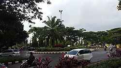
Pondok Aren District covers most of the area of Bintaro Jaya and borders South Jakarta to the east. Pondok Aren District office is located at Jl. Graha Raya Bintaro, Perigi Baru behind the Pondok Aren Sectoral Police office (Polsek Pondok Aren).
Sectors 3-9 housing of Bintaro Jaya real estate lies within this district, while sectors 1-2 of Bintaro Jaya are partly located in South Jakarta and in East Ciputat District.
There are also other national and public schools in this district.
Hospitals
Pondok Indah Bintaro Jaya hospital
Premier Bintaro Hospital
Ihsan Medical Center
Mitra Keluarga hospital
RSIA Bina Medika Bintaro
Police
POLSEK PONDOK AREN, is the district police of Pondok Aren which covers Bintaro Jaya sector 3–9. The police office is located at Jl. Graha Raya Bintaro, Perigi Baru.
POLSUBSEKTOR BINTARO 5, is a police station located at Jl. Bintaro Utama 5, Bintaro Jaya sector 5.
Fire and rescue
The South Tangerang Fire and Rescue service covers this area. A fire station is available for Pondok Aren district which is located beside the Bintaro Plaza.
Connecting BSD City Serpong, Bintaro, Ulujami, Pondok Indah, Jakarta, Jagorawi, Jakarta - Cikampek, Sheikh Mohammad Bin Zayed Elevated Toll Road In Jakarta - Cikampek
For Ulujami Serpong and JORR 1 toll roads
For JORR 2 Toll Road connecting Soekarno Hatta International Airport, Tangerang, Jakarta-Merak Toll Road, Perigi, Serpong, Pamulang, Depok, Jagorawi, Cikampek
↑Badan Pusat Statistik, 2023, Kecamatan Pondok Aren, Katalog/Catalog: 1102001.3574060.
↑"Contact Us." British School Jakarta, Retrieved on 11 February 2015. "Bintaro Sektor 9, Jl. Raya Jombang-Ciledug, Pondok Aren, Tangerang 15227, Jakarta • Indonesia, 15227"
↑Home pageArchived 2017-07-25 at the Wayback Machine . Jakarta Japanese School. Retrieved on 15 January 2015. "JL.Titihan Raya,Bintaro Jaya Sektor 9 Parigi-Pondok Aren,Tangerang Selatan 15227"
This page is based on this Wikipedia article Text is available under the CC BY-SA 4.0 license; additional terms may apply. Images, videos and audio are available under their respective licenses.