
Halifax is the capital and most populous municipality of the Canadian province of Nova Scotia, and the most populous municipality in Atlantic Canada. As of 2023, it is estimated that the population of the Halifax CMA was 518,711, with 348,634 people in its urban area. The regional municipality consists of four former municipalities that were amalgamated in 1996: Halifax, Dartmouth, Bedford, and Halifax County.

The Eastern Shore is a region of the Canadian province of Nova Scotia. It is the Atlantic coast running northeast from Halifax Harbour to the eastern end of the peninsula at the Strait of Canso.

The Diocese of Nova Scotia and Prince Edward Island is a diocese of the Ecclesiastical Province of Canada of the Anglican Church of Canada. It encompasses the provinces of Nova Scotia and Prince Edward Island and has two cathedrals: All Saints' in Halifax and St. Peter's in Charlottetown. Its de facto see city is Halifax, and its roughly 24 400 Anglicans distributed in 239 congregations are served by approximately 153 clergy and 330 lay readers according to the last available data. According to the 2001 census, 120,315 Nova Scotians identified themselves as Anglicans, while 6525 Prince Edward Islanders did the same.
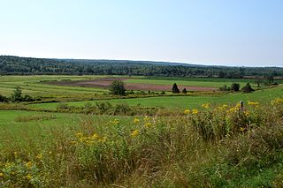
The Musquodoboit Valley is a valley and region in the Halifax Regional Municipality of Nova Scotia, Canada. It is administratively located in the municipality's Musquodoboit Valley & Dutch Settlement planning area and the western edge of the valley includes communities that are considered part of the commutershed for the urban area of the Halifax Regional Municipality. The picturesque Musquodoboit River flows through majority of the valley, passing by most of the communities in the valley. The river is approximately 97 kilometres (60 mi) long and originates in the extreme northeastern area of the valley. The three largest communities in the valley are Upper Musquodoboit, Middle Musquodoboit and Musquodoboit Harbour. The word "Musquodoboit" is derived from the Mi’kmaq language and means "rolling out in foam".

Nova Scotia Trunk 7 is part of the Canadian province of Nova Scotia's system of Trunk Highways. The route runs from Bedford to Antigonish, along the Eastern Shore for a distance of 269 kilometres (167 mi). Part of Trunk 7 is known as the Marine Drive.
The Marine Drive is a designated scenic route along Nova Scotia's Eastern Shore. It closely follows the coast of the Atlantic Ocean and the Strait of Canso from the Canso Causeway to the junction of Route 322 and Highway 111 in Dartmouth.
Sheet Harbour is a rural community in Nova Scotia, Canada. It is located in the eastern reaches of the Halifax Regional Municipality, approximately 117 km (73 mi) northeast of the central urban area of the municipality, concentrated on Downtown Halifax and Dartmouth. The community is located along the Marine Drive scenic route on Trunk 7 at its junctions with Route 224 and Route 374. Surrounding the branched harbour which its name is derived from, the community has a population of about 800 and its respective census tract, containing sizable amounts of land around the community, has a population of 3,478 as of the 2011 Census. Two rivers, West River and East River, flow through the community and into the Northwest and Northeast Arms of the harbour respectively. The coastline of the community is heavily eroded and the region in which the community is located has an abundance of lakes. The region has a humid continental climate, congruent with the majority of Nova Scotia, and the ocean significantly influences the temperature.

Moser River is a rural community on the Eastern Shore of Nova Scotia, Canada, in the Halifax Regional Municipality. The community lies along the Marine Drive on Trunk 7, 32 km (20 mi) east of Sheet Harbour and 51 km (32 mi) southwest of Sherbrooke. The community is located along the shores of Necum Teuch Harbour, an inlet of the Atlantic Ocean, and is at the mouth of Moser River. The area was called Noogoomkeak in the mi'kmaq language, translating to "soft sand place". The community is named for Henry Moser, who was the son of Jacob Moser, who settled the area in the early 1800s. The first school in the community was built in 1905, and another school, Moser River Consolidated School, was built in 1957. The school closed in 2015, due to its very low student population. Marine Drive Academy in Sheet Harbour serves the community and its surroundings at all grade levels. There is a small seaside park in the community near the former school, as well as a post office and convenience store.

Tangier is a rural community on the Eastern Shore of Nova Scotia, Canada, in the Halifax Regional Municipality. It lies along the Marine Drive on Nova Scotia Trunk 7 approximately 23 km (14 mi) west of Sheet Harbour. Tangier is situated at the head of Tangier Harbour. The Mi'kmaq name for the settlement was Wospegeak, translating to "the sunshine is reflected from the water". The community is located at the mouth of Tangier River. The present name of the community is most likely derived from the shipwreck of the schooner Tangier in 1830. In 1858, gold was discovered in the area, which sparked gold mining operations in the area for the next 30 years. The community has a church and several private fishing wharfs, as well as a post office.

Musquodoboit Harbour is a rural community located in Nova Scotia, Canada within the Halifax Regional Municipality. The community is situated on the Eastern Shore at the mouth of the Musquodoboit River. The community lies 45 kilometres east of downtown Halifax. With a hospital, RCMP detachment, postal outlet, schools, recreational center, library, municipal office and other services, Musquodoboit Harbour is a serve centre for many of the surrounding communities.

Nova Scotia is a province located in Eastern Canada fronting the Atlantic Ocean. One of the Maritime Provinces, Nova Scotia's geography is complex, despite its relatively small size in comparison to other Canadian provinces.
Beaver Harbour is a rural community on the Eastern Shore of Nova Scotia, Canada, in the Halifax Regional Municipality. It is located on the Marine Drive, along Trunk 7 approximately 11 km (6.8 mi) east of Sheet Harbour, Nova Scotia. The community is located on the shores of Beaver Harbour, an inlet of the Atlantic Ocean. The mi'kmaq name for the area was Kobelawakwemoode, translating to "beaver harbour". First Nations legends relay that a large rock in the harbour was thrown by Glooscap, a powerful figure in the First Nations' legends, at the mystical beaver. The land on which the community resides was part of a five thousand acre grant given to a surveyor on July 13, 1773. Five families lived here by the 1830s, and a post office was established in the community on October 1, 1887. A Trans-Atlantic cable station is located in the community, for the former CANTAT-2 cable.
Beaver Dam is a rural community on the Eastern Shore of Nova Scotia, Canada, in the Halifax Regional Municipality. It is located along Route 224, about 21 km (13 mi) northwest of Sheet Harbour and about 19 km (12 mi) southeast of Upper Musquodoboit. Beaver Lake 17, a small Mi'kmaq reserve, is located in the community as well. The community is located adjacent to Lower Beaver Lake.
West Quoddy is a rural community on the Eastern Shore of Nova Scotia, Canada, in the Halifax Regional Municipality. It is located along the Marine Drive on Nova Scotia Trunk 7 about 19 km (12 mi) east of Sheet Harbour, Nova Scotia. The community is located at the mouth of the Quoddy River and the head of Quoddy Harbour. Several small islands are located in the harbour.

Ship Harbour is a rural community located along the Eastern Shore of Nova Scotia, Canada, in the Halifax Regional Municipality. It is situated at the head of a natural harbour of the same name which opens into the Atlantic Ocean. The community is located along Trunk 7, approximately 80 kilometres (50 mi) east of Halifax, Nova Scotia and 45 kilometres (28 mi) west of Sheet Harbour, Nova Scotia. The area was settled in 1783 by a group of Loyalists from the Royal Nova Scotia Volunteer Regiment. The mi'kmaq referred to the area as Tedumunaboogwek, meaning "water-worn rock". The name of the community was derived from the name of the harbour, which in turn was derived from a rock at the entrance to the harbour, named Ship Rock, as it resembles a vessel from a distance. Ship Harbour is home to the Ship Harbour Mussel Farm, one of the largest mussel farm in North America. It is also home to Ralph's Downeast Diner, a small diner on Highway 7. It was previously Family Fries. There is also a community hall that hosts meeting for the Lake Charlotte region. West Ship Harbour Road collides with Nova Scotia Trunk 7 in Ship Harbour, which connects Ship Harbour with Owls Head, Little Harbour, Clam Harbour, Clam Harbour Beach Provincial Park and Lake Charlotte. Some minor roads include: Head Ship Harbour Loop Road, River Road, Bruce Drive, Newcombes Lane, Eisan Point Road and Goose Lane.
Malay Falls is a small rural community on the Eastern Shore of Nova Scotia, Canada, in the Halifax Regional Municipality. The community is located along Route 374 and is about 11 km (6.8 mi) northeast of Sheet Harbour. The community is located along East River, and is adjacent to the Malay Falls Flowage, a lake along the river's course. Malay Falls was first settled in 1784. Colin Malay acquired land here in 1849, when the area was called Salmon River. The Government of Canada maintains a weather station in the community.
West River Sheet Harbour is a river on the Eastern Shore of Nova Scotia, Canada, in the Halifax Regional Municipality. Its headwaters are near the Musquodoboit Valley and the river flows southeast and empties in to the Northwest Arm of Sheet Harbour, Nova Scotia. The river has three main tributaries: West River Main, Killag River and Little River. The river was suffering from acidification, so a lime doser was installed and has been in use since September 2005. It stabilized the river's pH at 5.5, a healthy level for aquatic life.
East River Sheet Harbour is a river on the Eastern Shore of Nova Scotia, Canada, in the Halifax Regional Municipality. Its headwaters are at the Marshall Flowage near Malay Falls and the mouth of the river is at the head of the Northeast Arm in Sheet Harbour, Nova Scotia.
