Colorado City Municipal Airport is a general aviation airport located 3 miles southwest of the central business district of Colorado City, in Mohave County, Arizona, United States. The airport is not served by any commercial airlines. There are both JET-A and 100LL fuel services at this airport.

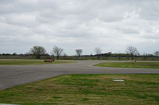
North Texas Regional Airport / Perrin Field is a county-owned airport in Grayson County, Texas between Sherman and Denison. Formerly Grayson County Airport, the airport was renamed in November 2007. Several buildings are occupied by businesses, Grayson County government agencies, and Grayson County College.

Brookhaven Calabro Airport is a public airport located one mile (1.6 km) north of the central business district of Shirley, in Suffolk County, New York, United States. This airport is publicly owned by the Town of Brookhaven.
St. Clair County International Airport is a public airport owned by the government of St. Clair County, Michigan, United States. It is located in Kimball Township, five miles (8 km) southwest of the central business district (CBD) of Port Huron. It is included in the Federal Aviation Administration (FAA) National Plan of Integrated Airport Systems for 2017–2021, in which it is categorized as a regional reliever airport facility.
Cecil Airport is a public airport and commercial spaceport located in Jacksonville, Florida, United States. It is owned by the Jacksonville Aviation Authority and services military aircraft, corporate aircraft, general aviation, and air cargo. The Florida Army National Guard's primary Army Aviation Support Facility and the U.S. Coast Guard's Helicopter Interdiction Tactical Squadron (HITRON) are also located here, the former operating CH-47 Chinook, UH-60 Blackhawk, UH-72 Lakota and C-12 Huron aircraft, and the latter operating the MH-65C Dolphin helicopter.
Houston Southwest Airport or Houston-Southwest Airport is a public-use airport located in Arcola, a city in Fort Bend County, Texas, United States, 15 miles (24 km) southwest of the central business district of Houston. It is privately owned by James Griffith, Jr.
Calhoun County Airport is a county-owned public-use airport located three miles (5 km) northwest of the central business district of Port Lavaca, a city in Calhoun County, Texas, United States.
Hannibal Regional Airport is a public use airport in Marion County, Missouri, United States. It is located four nautical miles (7 km) northwest of the central business district of Hannibal, Missouri, and is owned by the City of Hannibal. The airport is used for general aviation with no commercial airlines.
Hammond Northshore Regional Airport is a city-owned, public-use, joint civil-military, general aviation airport located three nautical miles (6 km) northeast of the central business district of Hammond, a city in Tangipahoa Parish, Louisiana, United States. The airport was previously an uncontrolled facility utilizing VHF-band UNICOM as a Common Traffic Advisory Frequency (CTAF). As a result of the relocation of Army National Guard flight operations from Lakefront Airport to Hammond, a new control tower was constructed at the airport. This tower, staffed by military air traffic controllers from the Air Operations Department of the Louisiana Army National Guard's Army Aviation Support Facility #1 at the airport, became operational on 15 December 2014.
Dallas South Port Airport is a privately owned public airport in Ferris, Ellis County, Texas, United States, that also serves the city Palmer, Texas, and is located approximately 3 nautical miles (5.6 km) north of the central business district. The airport has no IATA or ICAO designation.
Aero Country Airport is a privately owned public airport 4 nautical miles (7.4 km) west of the central business district of McKinney, Texas, United States. The airport has no IATA or ICAO designation.
Commerce Municipal Airport is a city-owned public airport 3 nautical miles (5.6 km) north of the central business district of Commerce, Texas, United States. The airport has no IATA nor ICAO designation.
Propwash Airport is a privately owned public airport in Justin, Denton County, Texas, United States, located approximately 3 nautical miles (5.6 km) west of the central business district. The airport has no IATA or ICAO designation.
Clark Airport is a privately owned public airport in Justin, Denton County, Texas, United States, located approximately 3 nautical miles (5.6 km) south of the central business district. The airport has no IATA or ICAO designation.
Canton-Hackney Airport is a city-owned public airport in Canton, Van Zandt County, Texas, United States, located about 2 nautical miles (3.7 km) north of the central business district. The airport has no IATA or ICAO designation.
Jacksboro Municipal Airport is a public airport in Jacksboro, Jack County, Texas, United States, located 1 nautical mile (1.9 km) northeast of the central business district. The airport has no IATA or ICAO designation.
Stonewall County Airport is a public airport in Aspermont, Stonewall County, Texas, United States, located 1 nautical mile (1.9 km) northeast of the central business district. The airport has no IATA or ICAO designation.
Hill-Miller Municipal Airport is a city-owned public airport 2 nautical miles (3.7 km) southwest of the central business district of Atlanta, Cass County, Texas, United States. Most U.S. airports use the same three-letter location identifier for the FAA and IATA, but Hall-Miller Municipal Airport is assigned ATA by the FAA and has no IATA designation. IATA assigned ATA to Comandante FAP Germán Arias Graziani Airport in Anta, Ancash Region, Peru.

