Porterville, Utah

Last updated
Porterville
Porterville Church 2009.jpg
Porterville Church in 2009
USA Utah location map.svg
Red pog.svg
Porterville
Location within the state of Utah
Coordinates: 40°58′53″N111°40′42″W / 40.98139°N 111.67833°W / 40.98139; -111.67833 Coordinates: 40°58′53″N111°40′42″W / 40.98139°N 111.67833°W / 40.98139; -111.67833
Country United States
State Utah
County Morgan
Settled1859
Founded bySanford and Warriner Porter
Elevation
[1]
5,151 ft (1,570 m)
Time zone UTC-7 (Mountain (MST))
  Summer (DST) UTC-6 (MDT)
ZIP code
84050
Area code 435
GNIS feature ID1444594 [1]

Porterville is an unincorporated community in Morgan County, Utah, United States.

Contents

Geography

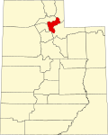
Porterville is located at the south end of Morgan County, four miles southwest of Morgan. It is situated at a junction between Hardscrabble Canyon and East Canyon. [2]

History

Porterville was first settled by Centerville residents Sanford and Nancy Warriner Porter in 1859. The area had abundant timber, so they built a sawmill, the first in Morgan County. [3] A town resident began teaching school out of her home in 1862, until a schoolhouse was built in 1867. [4]

Western Shoshone, led by Chief Washakie, continued to frequent the area to hunt and gather berries for several years after settlement began. [3]

Porterville Church

The original church house was erected in 1898 and subsequently dedicated in 1908 by President Joseph F. Smith. Eventually, costs of maintenance and needed repairs led the congregation to remodel the old school house and convert it for use as a church. Although the schoolhouse was sold to the ward in 1936, it was not until 1946 that regular meetings were held in the refinished space, mostly due to World War II. The church was sold to Marvin and Grace Kilbourn who, despite efforts at preservation, were unable to prevent vandalism over the next several decades. In 1970, the Bergman family purchased the church and remodeled it into a home while keeping the exterior intact. [5] In 1971, it was added to the Utah State Register of Historic Sites, which is now inactive. [6] In the conversion to a private home, the steeple tower that was wood framed with Gothic-arched frames on each side was removed. [7] After being seen in Troll 2 , filmed in the area in 1989, a fire in 2000 destroyed all but a shell of the original building. [8] The Crawlers (film) was also filmed in the area.

The Utah State Historical Society Classified Photo Collection contains a photograph of the "Porterville Meeting House" taken in 1920. [9] Also, there is a LeConte Stewart painting of the church from 1948 titled "Country Funeral, Porterville" that was featured in an LDS Church History Museum exhibit called Landscape & Life: The Rural Setting of Latter-day Saints from 24 October 2003 to 18 April 2004. [10] [11]

Mormon Flat Breastworks

Mormon Flat Breastworks
Mormon Flat Breastworks.jpeg
Nearest cityPorterville
Built1857
Architectural styleStone breastworks
MPS Utah War Fortifications MPS
NRHP reference No. 88001943 [12]
Added to NRHPOctober 27, 1988

The Mormon Flat Breastworks, fortification structures listed on the National Register of Historic Places, are located along the north side of Jeremy Ranch Road on both sides of the mouth of Little Emigration Canyon. They consist of horizontal rock breastworks built by Mormons in 1857 to defend against "Johnston's Army" in the Utah War. The walls were originally built about 4 feet (1.2 m) high, with trenches dug for riflemen.

Related Research Articles

<span class="mw-page-title-main">Morgan County, Utah</span> County in Utah, United States

Morgan County is a county in northern Utah, United States. As of the 2010 census, the population was 9,469. Its county seat and largest city is Morgan. Morgan County is part of the Ogden-Clearfield, UT Metropolitan Statistical Area as well as the Salt Lake City-Provo-Orem, UT Combined Statistical Area.

<span class="mw-page-title-main">Salt Lake County, Utah</span> County in Utah, United States

Salt Lake County is located in the U.S. state of Utah. As of the 2020 United States census, the population was 1,185,238, making it the most populous county in Utah. Its county seat and largest city is Salt Lake City, the state capital. The county was created in 1850. Salt Lake County is the 37th most populated county in the United States and is one of four counties in the Rocky Mountains to make it into the top 100. Salt Lake County is the only county of the first class in Utah – under the Utah Code is a county with a population of 700,000 or greater.

<span class="mw-page-title-main">Mormon Battalion</span> Military unit

The Mormon Battalion was the only religious unit in United States military history in federal service, recruited solely from one religious body and having a religious title as the unit designation. The volunteers served from July 1846 to July 1847 during the Mexican–American War of 1846–1848. The battalion was a volunteer unit of between 534 and 559 Latter-day Saint men, led by Mormon company officers commanded by regular U.S. Army officers. During its service, the battalion made a grueling march of nearly 2,100 miles from Council Bluffs, Iowa, to San Diego, California.

<span class="mw-page-title-main">Salt Lake Temple</span> LDS temple in Salt Lake City, Utah

The Salt Lake Temple is a temple of the Church of Jesus Christ of Latter-day Saints on Temple Square in Salt Lake City, Utah, United States. At 253,015 square feet (23,505.9 m2), it is the largest Latter-day Saint temple by floor area. Dedicated in 1893, it is the sixth temple completed by the church, requiring 40 years to complete, and the fourth temple built since the Mormon exodus from Nauvoo, Illinois, in 1846. The temple was closed in December 2019 for a general remodelling and seismic renovations that are anticipated to take approximately four years.

<span class="mw-page-title-main">Temple Square</span> United States historic place

Temple Square is a 10-acre (4.0 ha) complex, owned by the Church of Jesus Christ of Latter-day Saints, in the center of Salt Lake City, Utah. The usage of the name has gradually changed to include several other church facilities that are immediately adjacent to Temple Square. Contained within Temple Square are the Salt Lake Temple, Salt Lake Tabernacle, Salt Lake Assembly Hall, the Seagull Monument, and two visitors' centers. The square was designated a National Historic Landmark District in 1964, recognizing the Mormon achievement in the settlement of Utah.

<span class="mw-page-title-main">Salt Lake City Council Hall</span> Historic building in Salt Lake City, Utah, U.S.

The Salt Lake City Council Hall is currently home to offices of the Utah Office of Tourism and the Utah Film Commission and is located on Capitol Hill in Salt Lake City, Utah. Built in 1864-66, the building is historically important as the Old Salt Lake City Hall or just Old City Hall from 1866 to 1894. It was designated a National Historic Landmark in 1975, as an emblem of the conflicts between the governments of the Utah Territory and the United States in the 19th century.

<span class="mw-page-title-main">Capitol Hill, Salt Lake City</span> Landmark in Salt Lake City, Utah, United States

Capitol Hill in Salt Lake City gets its name from the Utah State Capitol prominently overlooking downtown. In addition, Capitol Hill can be considered a neighborhood of Salt Lake City.

<span class="mw-page-title-main">Buildings and sites of Salt Lake City</span>

Salt Lake City, Utah has many historic and notable sites within its immediate borders. Although the entire Salt Lake City metropolitan area is often referred to as "Salt Lake City", this article is concerned only with the buildings and sites within the official city limits of Salt Lake City.

<span class="mw-page-title-main">Parleys Canyon</span> Canyon in Utah, United States

Parleys Canyon is a canyon located in the U.S. state of Utah. The canyon provides the route of Interstate 80 (I-80) up the western slope of the Wasatch Mountains and is a relatively wide, straight canyon other than near its mouth. The mountain pass at the top of the canyon is known as Parleys Summit. With an elevation of 7,120 feet (2,170 m), the pass is the highest point along I-80 in the state of Utah. Both features are named for Parley P. Pratt, an early settler of the Salt Lake Valley and leader of the Church of Jesus Christ of Latter-day Saints who surveyed the area to find a better transportation route through the Wasatch Mountains than the previous route which traversed Emigration Canyon.

<span class="mw-page-title-main">Utah Territorial Statehouse</span> United States historic place

The Utah Territorial Statehouse, officially Territorial Statehouse State Park Museum, is a state park in Fillmore, Utah, preserving the original seat of government for the Utah Territory. Built from 1852 to 1855, the statehouse was initially intended as a larger structure, but only the south wing was completed before the project was abandoned due to lack of federal funding, and the Utah Territorial Legislature met in the building only once before the capital was moved to Salt Lake City in 1856.

<span class="mw-page-title-main">Utah State Capitol</span> State capitol building of the U.S. state of Utah

The Utah State Capitol is the house of government for the U.S. state of Utah. The building houses the chambers and offices of the Utah State Legislature, the offices of the Governor, Lieutenant Governor, Attorney General, the State Auditor and their staffs. The capitol is the main building of the Utah State Capitol Complex, which is located on Capitol Hill, overlooking downtown Salt Lake City.

<span class="mw-page-title-main">Manti Utah Temple</span> Historic church in Utah, United States

The Manti Utah Temple is the fifth constructed temple of the Church of Jesus Christ of Latter-day Saints. Located in the city of Manti, Utah, it was the third Latter-day Saint temple built west of the Mississippi River, after the Mormons' trek westward. The Manti Temple was designed by William Harrison Folsom, who moved to Manti while the temple was under construction. The temple dominates the Sanpete Valley, and can be seen from many miles. Like all Latter-day Saint temples, only church members in good standing may enter. It is one of only two remaining Latter-day Saint temples in the world where live actors are used in the endowment ceremonies ; all other temples use films in the presentation of the endowment, a practice that will end following renovations announced in 2021. It is an early pioneering example of four rooms representing the journey of life.

<span class="mw-page-title-main">Emigration Canyon, Utah</span> Metro Township

Emigration Canyon is a metro township and canyon in Salt Lake County, Utah, United States, located east of Salt Lake City in the Wasatch Range. Beginning at the southern end of the University of Utah, the canyon itself heads east and northeast between Salt Lake City and Morgan County. The boundaries of the metro township do not extend to the county line, nor do they encompass all of Emigration Canyon, as parts of it are within Salt Lake City. As of the 2010 census, the population was 1,568.

<span class="mw-page-title-main">Utah State Route 65</span>

State Route 65 (SR-65) is a 28.315-mile-long (45.569 km) state highway in northern Utah. It connects Interstate 80 (I-80) near the Mountain Dell Dam to I-84 in Henefer.

<span class="mw-page-title-main">Knightsville, Utah</span> Ghost town in Utah, United States

Knightsville is a ghost town located in the East Tintic Mountains on the northern slope of Godiva Mountain, approximately 2 miles (3.2 km) east of Eureka, in the northeastern corner of Juab County in central Utah, United States. A silver mining camp, Knightsville was established and operated as a company town by local mining entrepreneur Jesse Knight. The town was inhabited from 1896 until approximately 1940.

<span class="mw-page-title-main">Lake Point, Utah</span> City in Utah, United States

Lake Point is a city on the eastern edge of northern Tooele County, Utah, United States. It is located 17 miles southwest of Salt Lake City International Airport and 11 miles north of Tooele, Utah. At its location on the south shore of the Great Salt Lake, the city is served by Interstate 80 and Utah State Route 36.

<span class="mw-page-title-main">Provo Canyon Guard Quarters</span> United States historic place

The Provo Canyon Guard Quarters is a historic building located in Provo Canyon in northeastern Utah County, Utah, United States, that is listed on the National Register of Historic Places (NRHP).

<span class="mw-page-title-main">Alpine Stake Tabernacle</span> Historic church in Utah, United States

The Alpine Stake Tabernacle or Alpine Tabernacle, located at 110 East Main Street (US-89) in American Fork, Utah, United States, functions as a meeting place for large gatherings of members of the Church of Jesus Christ of Latter-day Saints in northern Utah County for worship services. The building is part of the American Fork Historic District listed on the National Register of Historic Places.

<span class="mw-page-title-main">Mormon Trail Center at Winter Quarters</span>

The Mormon Trail Center at Winter Quarters is a museum and visitors' center of the Church of Jesus Christ of Latter-day Saints located in the Florence neighborhood of Omaha, Nebraska, United States. The museum interprets the story of the Mormon Trail along with the history of a temporary Mormon settlement known as Winter Quarters, which was located in the Florence area between 1846–1848.

References

  1. 1 2 U.S. Geological Survey Geographic Names Information System: Porterville, Utah. Retrieved May 19, 2011.
  2. Van Cott, John W. (1990). Utah Place Names. Salt Lake City, Utah: University of Utah Press. p. 293. ISBN   0-87480-345-4.
  3. 1 2 Utah State History Markers and Monuments Database Archived 2012-12-14 at archive.today
  4. Morgan County Historical Society
  5. Kilbourn, Grace Bowen (1980). History of the old Porterville church, 1864-1948 : a delightful history and pictures of Porterville, Morgan County, Utah. Porterville, Utah: G.B. Kilbourn.
  6. Utah State Register of Historic Sites (compiled 1988) Archived 2009-08-28 at the Wayback Machine
  7. Roberts, Allen D. (1974). A Survey of L.D.S. Architecture in Utah, 1847-1930. Salt Lake City, Utah: A.D. Roberts.
  8. Salt Lake Tribune, "State of the State: Morgan County," April 28, 2000
  9. Utah State History Digital Collections, Porterville Meeting House
  10. Church History Museum, Previous Exhibits
  11. Landscape & Life: The Rural Setting of Latter-day Saints
  12. "National Register Information System". National Register of Historic Places . National Park Service. March 13, 2009.

Commons-logo.svg Media related to Porterville, Utah at Wikimedia Commons