Enterprise, Morgan County, Utah

Last updated

Enterprise
CDP
Morgan County Utah incorporated and unincorporated areas Enterprise highlighted.svg
Location in Morgan County and the state of Utah
Coordinates: 41°06′25″N111°43′51″W / 41.10694°N 111.73083°W / 41.10694; -111.73083
Country United States
State Utah
County Morgan
Settled1861
Founded byHenry and Stephen Hales
Area
[1]
  Total3.8 sq mi (10 km2)
  Land3.8 sq mi (10 km2)
  Water0.0 sq mi (0 km2)
Elevation
[2]
5,246 ft (1,599 m)
Population
 (2010) [3]
  Total605
  Density160/sq mi (61/km2)
Time zone UTC-7 (Mountain (MST))
  Summer (DST) UTC-6 (MDT)
ZIP code
84050
Area code(s) 385, 801
GNIS feature ID2584766 [2]

Enterprise is a census-designated place (CDP) in northwestern Morgan County, Utah, United States. The population was 605 at the 2010 census.

Contents

Geography

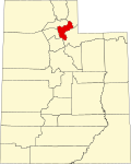
Enterprise is located in the western part of Morgan Valley, along Interstate 84. Peterson is just to the west, across I-84 and the Weber River. Mountain Green is about 4 miles (6.4 km) to the northwest, and Morgan, the county seat, is some 6 miles (9.7 km) southeast. Most of the homes in Enterprise are clustered along the main street, Old Highway Road (part of the former Highway 30), which roughly parallels I-84 to the north on the benchland between Morgan and Mountain Green. The community's northern boundary is the crescent of foothills from Dry Hollow on the north to Roswell Canyon on the south. [4] According to the United States Census Bureau, the CDP has a total area of 3.8 square miles (9.8 km2), all land. [1]

History

The first settlers in Enterprise were Henry and Stephen Hales, who arrived in 1861. They found fertile land on the bench, but little water for irrigation. They dug a 2-mile (3.2 km) ditch from the Weber River to water their farmland. A canal company was organized in 1863 to irrigate the whole area, but Enterprise was short on water for many years as thieves diverted water upstream. The first schoolhouse was built in 1863. A townsite with official blocks was surveyed and laid out in 1865. A sawmill operated in Roswell Canyon in the 1870s. [4] Although it was not an official census precinct, the 1880 census enumerated 81 residents in Enterprise. [5]

Demographics

As of the census [3] of 2010, there were 605 people, 147 households, and 133 families residing in the CDP. There were 155 housing units, of which 147 were occupied. The racial makeup of the population was 96.2% White, 0.5% Black or African American, 1.3% American Indian and Alaska Native, 0.3% Asian, 0.2% Native Hawaiian and Other Pacific Islander, 0.2% from some other race, and 1.3% from two or more races. Hispanic or Latino of any race were 4.0% of the population.

There were 147 households, out of which 62.6% had children under the age of 18 living with them. 84.4% had married couples living together. 8.2% of all households were made up of individuals, and 6.8% had someone living alone who was 65 years of age or older. The average household size was 4.12, and the average family size was 4.38.

The population was 50.6% female, and the median age was 22.9 years.

See also

Related Research Articles

<span class="mw-page-title-main">Morgan County, Utah</span> County in Utah, United States

Morgan County is a county in northern Utah, United States. As of the 2020 census, the population was 12,295. Its county seat and largest city is Morgan. Morgan County is part of the Ogden-Clearfield, UT Metropolitan Statistical Area as well as the Salt Lake City-Provo-Orem, UT Combined Statistical Area.

<span class="mw-page-title-main">Beaver, Alaska</span> CDP in Alaska, United States

Beaver is a census-designated place (CDP) in Yukon-Koyukuk Census Area, Alaska, United States. At the 2010 census the population was 84, unchanged from 2000.

<span class="mw-page-title-main">Canyon Day, Arizona</span> CDP in Gila County, Arizona

Canyon Day is a census-designated place (CDP) in Gila County, Arizona, United States, on the Fort Apache Indian Reservation. The population was 1,209 at the 2010 census.

<span class="mw-page-title-main">Lake Montezuma, Arizona</span> CDP in Yavapai County, Arizona

Lake Montezuma is a census-designated place (CDP) in Yavapai County in the U.S. state of Arizona. The population was 5,111 at the 2020 census. The CDP includes the communities of Rimrock and McGuireville. Located along Interstate 17, it is 20 miles (32 km) south of Sedona and 8 miles (13 km) north of Camp Verde in central Arizona's Verde Valley.

<span class="mw-page-title-main">Sunol, California</span> Census-designated place in California, United States

Sunol is an unincorporated area and census-designated place in Alameda County, California. Located in the Sunol Valley of the East Bay, the population was 913 at the 2010 census. It is best known as the location of the Sunol Water Temple and for its historic tourist railroad system, the Niles Canyon Railway.

<span class="mw-page-title-main">Prunedale, California</span> Place in California, United States

Prunedale is a unincorporated community in Monterey County, California, United States. It is located 8 miles (13 km) north of Salinas at an elevation of 92 feet (28 m). The population was 18,885 as of the 2020 census, up from 17,560 in 2010. For statistical purposes, the United States Census Bureau has defined Prunedale as a census-designated place (CDP). Plum trees were grown in Prunedale in the early days of its founding, but the trees died soon after due to poor irrigation and fertilizer.

<span class="mw-page-title-main">Lisbon, Florida</span> Census-designated place in Florida

Lisbon is an unincorporated community and census-designated place (CDP) in Lake County, Florida, United States. The population was 260 at the 2000 census. It is part of the Orlando–Kissimmee Metropolitan Statistical Area.

<span class="mw-page-title-main">Tice, Florida</span> Census-designated place in Florida, United States

Tice is an unincorporated community and census-designated place (CDP) in Lee County, Florida, United States. As of the 2020 census, the CDP population was 4,853. It is part of the Cape Coral-Fort Myers, Florida Metropolitan Statistical Area.

<span class="mw-page-title-main">Simms, Montana</span> CDP in Montana, United States

Simms is a census-designated place (CDP) in Cascade County, Montana, United States. The population was 354 at the 2010 census. It is part of the Great Falls, Montana Metropolitan Statistical Area.

<span class="mw-page-title-main">Hungry Horse, Montana</span> Unincorporated community in Montana, United States

Hungry Horse is an unincorporated community and census-designated place (CDP) in Flathead County, Montana, United States. The population was 828 at the 2020 census. The ZIP code for Hungry Horse is 59919.

<span class="mw-page-title-main">Smith Valley, Nevada</span> Census-designated place in Nevada, United States

Smith Valley is a census-designated place (CDP) in Lyon County, Nevada, United States. The population was 1,603 at the 2010 census.

<span class="mw-page-title-main">Whittingham, New Jersey</span> Populated place in Middlesex County, New Jersey, US

Whittingham, also known as Greenbriar at Whittingham, is an unincorporated community and census-designated place (CDP) located within Monroe Township, in Middlesex County, in the U.S. state of New Jersey. As of the 2010 United States Census, the CDP's population was 2,476. The area is focused around the age-restricted gated community of Whittingham.

<span class="mw-page-title-main">Oakwood, Pennsylvania</span> Census-designated place in Pennsylvania, United States

Oakwood is an unincorporated area and census-designated place (CDP) in Lawrence County, Pennsylvania, United States. The population was 2,270 at the 2010 census.

<span class="mw-page-title-main">Huntington, Utah</span> City in Utah, United States

Huntington is a city in northwestern Emery County, Utah, United States. The population was 2,129 at the 2010 census. It is the largest town in Emery County.

<span class="mw-page-title-main">Cedar City, Utah</span> City in the United States

Cedar City is the largest city in Iron County, Utah, United States. Located 250 miles (400 km) south of Salt Lake City, it is 170 miles (270 km) north of Las Vegas on Interstate 15. Southern Utah University is located in Cedar City. It is the home of the Utah Shakespeare Festival, the Utah Summer Games, the Simon Fest Theatre Co., and other events. As of the 2020 census the city had a population of 35,235, up from 28,857 in the 2010 census.

<span class="mw-page-title-main">Klickitat, Washington</span> Census-designated place in Washington, United States

Klickitat is an unincorporated community and census-designated place (CDP) in Klickitat County, Washington, United States. The population was 362 at the 2010 census. Once the site of a lumber mill, it is now primarily a bedroom community.

<span class="mw-page-title-main">Grand Canyon West, Arizona</span> Census-designated place in Arizona, United States

Grand Canyon West is a census-designated place (CDP) in Mohave County, Arizona, United States, located on the Hualapai Reservation. The population was reported as 0 at the 2020 census. Grand Canyon West is home to the tribe's Grand Canyon business operations, including the Grand Canyon West Airport and the Grand Canyon Skywalk. Typically, they are open from 8:00 a.m. – 6:00 p.m., including all holidays.

<span class="mw-page-title-main">Beryl Junction, Utah</span> CDP in Utah, United States

Beryl Junction is a census-designated place (CDP) in Iron County, Utah, United States. The population was 197 at the 2010 census. Beryl Junction Airport, a small, private airport, is located here.

Pine Canyon is an unincorporated community and census-designated place (CDP) in Monterey County, California, just south of King City. Pine Canyon sits at an elevation of 515 feet (157 m). As of the 2020 census, the population was 1,871.

Clacks Canyon is a census-designated place (CDP) in Mohave County, Arizona, United States. The population was 167 at the 2020 census.

References

  1. 1 2 "2010 Census U.S. Gazetteer File for Places: Utah". Archived from the original on April 7, 2014. Retrieved April 4, 2014.
  2. 1 2 "Enterprise". Geographic Names Information System . United States Geological Survey, United States Department of the Interior . Retrieved April 4, 2014.
  3. 1 2 "American FactFinder". U.S. Census Bureau. Archived from the original on February 12, 2020. Retrieved April 7, 2014.
  4. 1 2 Smith, Linda H. (January 1999). A History of Morgan County (PDF). Utah Centennial County History Series. Salt Lake City, Utah: Utah State Historical Society. pp. 58–61. ISBN   0-913738-36-0 . Retrieved July 16, 2012.[ permanent dead link ]
  5. "Census of Population and Housing". U.S. Census Bureau. Retrieved November 18, 2011.

Commons-logo.svg Media related to Enterprise, Morgan County, Utah at Wikimedia Commons