Prestongrange

Last updated

Colliery engine Beam engine, Prestongrange Colliery.jpg
Colliery engine
Prestongrange
Prestongrange House (geograph 1817805).jpg
Prestongrange House
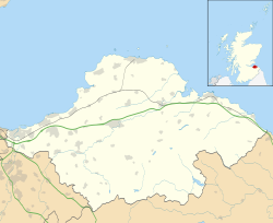
East Lothian UK location map.svg
Red pog.svg
Prestongrange
Scotland location map.svg
Red pog.svg
Prestongrange
Location within Scotland
OS grid reference NT378736
Civil parish
Council area
Lieutenancy area
Country Scotland
Sovereign state United Kingdom
Post town PRESTONPANS
Postcode district EH32
Dialling code 01875
Police Scotland
Fire Scottish
Ambulance Scottish
UK Parliament
Scottish Parliament
List of places
UK
Scotland
55°57′07″N2°59′46″W / 55.952°N 2.996°W / 55.952; -2.996 Coordinates: 55°57′07″N2°59′46″W / 55.952°N 2.996°W / 55.952; -2.996

Prestongrange is a place in East Lothian, Scotland, United Kingdom, situated between Musselburgh to the west, and Prestonpans to the east.

Contents

The place name derives from "Preston", meaning "priest's town", and a grange (or granary) which was worked by the Cistercian monks of Newbattle Abbey.

In the early 17th century, Mark Ker took possession of the lands from the abbey, and after the Grant Suttie family took over, the Prestongrange Colliery was no longer productive and fell into disuse.

In 1830, Sir George Grant Suttie leased Prestongrange Colliery to Matthias Dunn, the Inspector of Mines.
Prestongrange House

This fine mansion-house was partly rebuilt by Mark Kerr and Helen Leslie. It passed through marriage to John Morison of Saughton Hall around 1600. Laters owners included Alexander Morison, Lord Prestongrange who extended it in 1620. In the early 19th century it was greatly extended by the architect William Henry Playfair. [1]

See also

Related Research Articles

East Lothian Council area of Scotland

East Lothian is one of the 32 council areas of Scotland, as well as a historic county, registration county and lieutenancy area. The county was also known as Haddingtonshire.

Midlothian Council area of Scotland

Midlothian is a historic county, registration county, lieutenancy area and one of 32 council areas of Scotland used for local government. Midlothian lies in the east-central Lowlands, bordering the City of Edinburgh, East Lothian and the Scottish Borders.

Musselburgh Town in East Lothian, Scotland

Musselburgh is the largest settlement in East Lothian, Scotland, on the coast of the Firth of Forth, 5 miles (8 km) east of Edinburgh city centre. It has a population of 21,100.

Tranent Town in East Lothian, Scotland

Tranent is a town in East Lothian, in the south-east of Scotland. The town lies 6 miles from the boundary of Edinburgh, and 9.1 miles from the city centre. It lies beside the A1 road, the A1 runs through the parish splitting the parish from its associated villages and hamlets namely Meadowmill and the port of the parish Cockenzie. The original main post road ran straight through the town until the new A1 was built. Built on a gentle slope, about 90 metres (300 ft) above sea level it is one of the oldest towns in East Lothian. The population of the town is approximately 12,140, an increase of over 4,000 since 2001. Tranent was formerly a major mining town, but now serves as a commuter town for Edinburgh.

Mark Kerr, 1st Earl of Lothian was a Scottish nobleman and politician. He became the first Earl of Lothian in 1606.

Inveresk Conservation village in East Lothian, Scotland

Inveresk is a village in East Lothian, Scotland situated 58 mi (1 km) to the south of Musselburgh. It has been designated a conservation area since 1969. It is situated on slightly elevated ground on the north bank of a loop of the River Esk. This ridge of ground, 20 to 25 metres above sea level, was used by the Romans as the location for Inveresk Roman Fort in the 2nd century AD.

Pencaitland Village in East Lothian, Scotland

Pencaitland is a village in East Lothian, Scotland, about 12 miles south-east of Edinburgh, 5 mi (8 km) south-west of Haddington, and 1 mi (2 km) east of Ormiston.

Prestonpans Human settlement in Scotland

Prestonpans is a small mining town, situated approximately eight miles east of Edinburgh, Scotland, in the unitary council area of East Lothian. The population as of 2020 is 10,460. It is near the site of the 1745 Battle of Prestonpans. The town, established in the eleventh century, has a variety of important historical architecture, including: Preston Tower and the doocot and the local Mercat Cross, which is the only one of its kind in Scotland that remains in its original form and location. Prestonpans is "Scotland's Mural Town", with many murals depicting local history.

Keith Marischal Historic site in Humbie, East Lothian

Keith Marischal is a Scottish Baronial Country house lying in the parish of Humbie, East Lothian, Scotland. The original building was an "L-shaped" Tower house, built long before 1589 when it was extended into a "U-shaped" courtyard house. The building acquired its modern appearance in the 19th century when the courtyard was filled in. The house is protected as a category B listed building.

Newbattle Abbey

Newbattle Abbey was a Cistercian monastery near the village of Newbattle in Midlothian, Scotland, which subsequently become a stately home and then an educational institution.

Prestongrange Museum Industry museum in Prestongrange, Scotland

Prestongrange Museum is an industrial heritage museum at Prestongrange between Musselburgh and Prestonpans on the B1348 on the East Lothian coast, Scotland. Founded as the original site of the National Mining Museum, its operation reverted to East Lothian Council Museum Service in 1992.

Prestongrange House

Prestongrange House is a historic house at Prestongrange near Prestonpans, East Lothian, Scotland, UK. It is situated near to two other historic houses, Hamilton House and Northfield House.

Royal Musselburgh Golf Club

The Royal Musselburgh Golf Club is a golf club at Prestongrange House, Prestongrange near Prestonpans, East Lothian, Scotland, on the B1361.

Morrisons Haven

Morrison's Haven is a harbour at Prestongrange, East Lothian, Scotland, UK, on the B1348, close to Levenhall Links, Prestongrange Industrial Heritage Museum, Prestonpans, and Prestongrange House.

Northfield House, East Lothian

Northfield House is a seventeenth-century historic house at Preston, East Lothian, Scotland, UK. It is situated very close to Hamilton House and Preston Tower, and one mile east to Prestongrange House and the Royal Musselburgh Golf Club. It is a Category A listed building.

Prestongrange Parish Church

Prestongrange Parish Church is a Church of Scotland kirk situated in the small, former mining town of Prestonpans in East Lothian. The church was built in 1596, one of the first churches to be built in Scotland following the Scottish Reformation in 1560. In 1606, Prestonpans was created a parish in its own right following centuries of being part of the parish of Tranent.

Bankton House Historic site

Bankton House is a late 17th-century house situated south of Prestonpans in East Lothian, Scotland. The house is located between the A1 road and the East Coast Main Line railway at grid reference NT394736.

Alexander Morison, Lord Prestongrange (1579–1631) was a 17th-century Scottish judge, Senator of the College of Justice and Lord President of the Court of Session.

Lady Susan Harriet Grant-Suttie was a noblewoman, philanthropist and parish councillor.

References

  1. Colin McWilliam, The Buildings of Scotland: Lothian.