Highway 19A, known locally as the Oceanside Route or the Old Island Highway, is a provincial highway in British Columbia, Canada. It runs along two former sections of Highway 19 on Vancouver Island, within Nanaimo and between Craig's Crossing and Campbell River. The section of Highway 19A between Craig's Crossing and Campbell River is 136.89 km (85.06 mi) long, and the Nanaimo alignment covers 10.64 km (6.61 mi). The highway was established after Highway 19 was realigned to a new road between 1996 and 2001.

Queens County is a county in the province of Prince Edward Island, Canada. It is the largest county in the province by population with 89,770 (2021) and land. Charlottetown is the county seat of Queens County, and is the largest city and the capital of Prince Edward Island.
Cornwall is a Canadian town located in Queens County, Prince Edward Island. The town is located immediately west of the provincial capital Charlottetown.
Route 1 is a 120-kilometre (75 mi) long provincial highway that serves as the Prince Edward Island section of the Trans-Canada Highway. Route 1 traverses the southern shores of Prince Edward Island, from the Confederation Bridge in Borden-Carleton to the Wood Islands ferry dock, and bypasses the provincial capital, Charlottetown. It is an uncontrolled access 2-lane highway with a maximum speed limit of 90 km/h (55 mph), except within towns and urban areas.

Route 2, also known as Veterans Memorial Highway and the All Weather Highway, is a 216-kilometre (134 mi) two-lane uncontrolled access highway traversing Prince Edward Island, Canada from Tignish to Souris. Route 2 was recognized as the first numbered highway in the province in 1890, when it opened between Charlottetown and Summerside.
Route 3 is a 33 km (21 mi) long, two-lane uncontrolled access secondary highway in Prince Edward Island, Canada. Its maximum speed limit is 90 km/h (55 mph).

Route 4 is a 63 km (39 mi) long, two-lane uncontrolled access secondary highway in eastern Prince Edward Island, Canada. In runs east from the Trans-Canada Highway (Route 1) at Wood Islands along the Northumberland Straight to Route 18 the settlement of High Bank, where it turns north and passes through Murray River and Montague before ending at Route 2 at Dingwells Mills. Its maximum speed limit is 90 km/h (56 mph).
Route 1A is a 20-kilometre (12 mi) long provincial highway in central Prince Edward Island. The route is a spur route of the Route 1 which connects the Trans-Canada Highway near Borden-Carleton and the Confederation Bridge with the city of Summerside. It is an uncontrolled access 2-lane highway with a maximum speed limit of 90 km/h (55 mph) and is considered a "Core route" of Canada's National Highway System. Route 1A is unnamed except for the portion within Summerside city limits, where it is known as Read Drive.

Route 13 is a 39 km (24 mi) two-lane uncontrolled access secondary highway traversing the central portion of Prince Edward Island, Canada in a more or less north–south direction between Crapaud and Cavendish. It passes through a mainly rural area of Prince Edward Island. A portion of Route 13 is commonly called the "Hopalong Road."
Kingston is a rural municipality in Prince Edward Island, Canada. It is located within Queens County to the west of Charlottetown. The community is mainly farms with a small residential area.
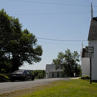
Route 715 is a 53.2-kilometre (33.1 mi) long local highway in Queens County, New Brunswick. Its western terminus is in Jemseg at Route 695 near its interchange with Route 2 and its eastern terminus is in Coles Island at Route 10 and Route 112. It is signed as an east–west highway although its westernmost portion along the Saint John River runs nearly due north and south.
Prince Edward Island Route 248 is a 13.9-kilometre (8.6 mi) long north–south collector highway and local road in Queens County, Prince Edward Island. Route 248 begins at an intersection with Route 27 in the community of Cornwall just east of Route 19. The route parallels MacEwens Creek and the North River through farms and suburbs northeast of Cornwall into the village of Miltonvale Park, where it terminates at a junction with Route 2. The route also serves as the main road through the community of Warren Grove.

Prince Edward Island Route 6 is a secondary highway in central Prince Edward Island.
Prince Edward Island Route 15 is a secondary highway in central Prince Edward Island.

Prince Edward Island Route 7 is a secondary highway in central Prince Edward Island. The short connecting route begins at an intersection with Route 2 west of Charlottetown, and runs north to Oyster Bed Bridge, where the road continues as Route 6. It is an uncontrolled, paved two-lane road for its entire length.
Route 18, also known as Cape Bear Road, is a 23.9 kilometres (14.9 mi), two-lane, uncontrolled-access, secondary highway in eastern Prince Edward Island. Its southern terminus is at Route 4 in High Bank and its northern terminus is at Route 4 in Murray River. The route is entirely in Kings County.
Route 22 is a 28.6 km (17.8 mi), two-lane, uncontrolled-access, secondary highway in eastern Prince Edward Island. Its southern terminus is at Route 210 and Route 320 in Montague and its northern terminus is at Route 2 in Mount Stewart. The route is in Kings and Queens counties.
Route 26, also known as Georgetown Road and Pownal Road, is an 11.3-kilometre (7.0 mi), two-lane, uncontrolled-access, secondary highway in central Prince Edward Island. The route is entirely in Queens County.
Route 225 is a 33.4-kilometre (20.8 mi), two-lane, uncontrolled-access, secondary highway in central Prince Edward Island. Route 225 passes through the hilly central portion of Queens County, parallel to and roughly halfway between the Trans-Canada Highway and Route 2. Its speed limit is 80 km/h (50 mph) except within several villages along the route.
Route 27, also known as Main Street and Dog River Road, is a 7.5-kilometre (4.7 mi), two-lane, uncontrolled-access, secondary highway in central Prince Edward Island. Route 27 was created upon the opening of a new alignment of Route 1 bypassing the town of Cornwall on October 21, 2019. The route is entirely in Queens County.
