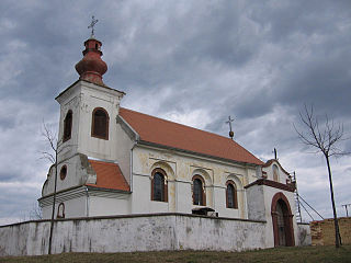
Prkovci | |
|---|---|
Village | |
 | |
 | |
| Country | |
| County | |
| Municipality | Ivankovo |
| Area | |
| • Total | 16.5 km2 (6.4 sq mi) |
| Population (2021) [2] | |
| • Total | 456 |
| • Density | 28/km2 (72/sq mi) |
| Time zone | UTC+1 (CET) |
| • Summer (DST) | UTC+2 (CEST) |
Prkovci | |
|---|---|
Village | |
| | |
| | |
| Country | |
| County | |
| Municipality | Ivankovo |
| Area | |
| • Total | 16.5 km2 (6.4 sq mi) |
| Population (2021) [2] | |
| • Total | 456 |
| • Density | 28/km2 (72/sq mi) |
| Time zone | UTC+1 (CET) |
| • Summer (DST) | UTC+2 (CEST) |
The name of the village in Croatian is plural.
Podcrkavlje is a village and a municipality in Brod-Posavina County, Croatia.
Banoštor is a village in Serbia. It is situated in the Beočin municipality, in the Vojvodina province. Although the village is geographically located in Syrmia, it is part of the South Bačka District. The village has a Serb ethnic majority and its population numbering 780 people.
Hričovské Podhradie is a village and municipality in Žilina District in the Žilina Region of northern Slovakia.

Géderlak is a village in Bács-Kiskun county, in the Southern Great Plain region of southern Hungary.
Petrijevci is a village and a municipality in Slavonia, in the Osijek-Baranja County of northeastern Croatia.

Kruščić is a village in the Kula municipality, West Bačka District, Autonomous Province of Vojvodina, Republic of Serbia. The population of the village is ethnically mixed and numbers 1,852 people.
Andrijaševci is a village and a municipality in Vukovar-Syrmia County in eastern Croatia. Despite its name, the seat of the municipality is in the village of Rokovci.
Babin Potok is a village in the municipality of Prokuplje, Serbia. According to the 2002 census, the village has a population of 674 people.
Čeglje is a village in Croatia. It is connected by the D1 highway. The village belongs to the Jastrebarsko administrative area, and according to 2001 figures, its population is of 445. Čeglje is situated right on the administrative border with Karlovac County. The village has a small church called Saint Mary Christian helper.
Tušilović is a village in Croatia. It is connected by the D1 highway. It has around 800 people living in it. It is known for its beautiful nature.

Orolik is a village in the Stari Jankovci municipality, Vukovar-Syrmia County, in eastern Croatia. The village is connected with the rest of the country by the D46 state road connecting it with the town of Vinkovci and continuing into Serbia as the State Road 120 to the nearest town of Šid, D57 road and by the M105 railway.
Kozji Vrh is a village in Croatia's Primorje-Gorski Kotar County. The village is connected by the D32 highway.
Gorači is a village in the western part of Croatia. Administratively, it is part of Primorje-Gorski Kotar County. The village is connected by the D32 highway.

Slakovci is a village in Stari Jankovci municipality of Vukovar-Syrmia County in eastern Croatia. It is connected by the D46 state road. The village is physically connected with the village of Srijemske Laze. The village is connected with the rest of the country by the D46 state road connecting it with the town of Vinkovci and continuing into Serbia as the State Road 120 to the nearest town of Šid.
Macute is a village in Croatia, in the municipality of Voćin, Virovitica-Podravina County. It is connected by the D69 highway.

Bijelo Brdo is a village in the Erdut municipality in eastern Croatia. It is connected by the D213 road and by R202 railway. It has a total of 1,961 inhabitants (2011).
Podvornica is a village in Croatia.
Dubranec is a village in Croatia.
Osekovo is a village in Croatia.
Lukovo is a village in the municipality of Raška, Serbia. According to the 2002 census, the village has a population of 38 people.
Villages of Vukovar-Syrmia County | ||
|---|---|---|
| Villages administered as part of cities |  | |
| Villages serving as municipal seat (other villages in municipality) | ||
45°13′N18°37′E / 45.217°N 18.617°E
| | This Vukovar-Syrmia County geography article is a stub. You can help Wikipedia by expanding it. |