Jarmina | |
|---|---|
| Municipality of Jarmina Općina Jarmina | |
 | |
 Flag  Seal | |
 | |
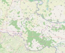 Jarmina Location in Croatia  Jarmina Jarmina (Croatia)  Jarmina Jarmina (Europe) | |
| Coordinates: 45°19′N18°44′E / 45.317°N 18.733°E | |
| Country | |
| County | |
| Government | |
| • Mayor | Mario Matić (HDZ) |
| Area | |
| 13.0 km2 (5.0 sq mi) | |
| • Urban | 13.0 km2 (5.0 sq mi) |
| Population (2021) [2] | |
| 2,016 | |
| • Density | 160/km2 (400/sq mi) |
| • Urban | 2,016 |
| • Urban density | 160/km2 (400/sq mi) |
| Time zone | UTC+1 (CET) |
| • Summer (DST) | UTC+2 (CEST) |
| Postal code | 32280 |
| Area code | 32 |
| Vehicle registration | VK |
| Website | jarmina |
Jarmina is a village and municipality in the Vukovar-Syrmia County in Croatia.

