Vukovar is a city in Croatia, in the eastern regions of Syrmia and Slavonia. It contains Croatia's largest river port, located at the confluence of the Vuka and the Danube. Vukovar is the seat of Vukovar-Syrmia County and the second largest city in the county after Vinkovci. The city's registered population was 22,616 in the 2021 census, with a total of 23,536 in the municipality.

Vukovar-Srijem County, Vukovar-Sirmium County or Vukovar-Syrmia County, named after the eponymous town of Vukovar and the region of Syrmia, is the easternmost Croatian county. It includes the eastern parts of the region of Slavonia and the western parts of the region of Syrmia, as well as the lower Sava river basin, Posavina and Danube river basin Podunavlje. Due to the overlapping definitions of geographic regions, division on Slavonia and Syrmia approximately divides the county vertically into north-west and south-east half, while division on Posavina and Podunavlje divides it horizontally on north-east and south-west half.
Stara Gradiška is a village and a municipality in Slavonia, in the Brod-Posavina County of Croatia. It is located on the left bank of the river Sava, across from Gradiška in Bosnia and Herzegovina.

Borovo, also known as Borovo Selo, is a village and a municipality in Vukovar-Syrmia County in eastern part of Croatia. Situated on the banks of the Danube river, it shares its border with Serbia and the municipality of Bač on the opposite side. The historical development of Borovo is intricately linked with the Danube, which has played a pivotal role in its development as a notable industrial hub in the region.

Negoslavci is a village and a municipality in Vukovar-Syrmia County in eastern Croatia. It is located south of the town of Vukovar, seat of the county. Landscape of the Negoslavci Municipality is marked by the Pannonian Basin plains and agricultural fields of maize, wheat, common sunflower and sugar beet.

Bogdanovci is a village and municipality in the Vukovar-Syrmia County in eastern Croatia. It is located a few kilometers south of Vukovar in eastern Slavonia. Bogdanovci is underdeveloped municipality which is statistically classified as the First Category Area of Special State Concern by the Government of Croatia.
Drenovci is a village and municipality in the Vukovar-Syrmia County in Croatia. The municipality is part of Slavonia.
Jarmina is a village and municipality in the Vukovar-Syrmia County in Croatia.

Čonoplja is a village in Serbia. It is situated in the Sombor municipality, in the West Bačka District, Vojvodina province. The village has a Serb ethnic majority and its population numbering 4,359 people.
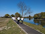
Soljani are a village in Cvelferija in the southernmost part of Vukovar-Syrmia County. From the 2011 census the village had a population of 1241 inhabitants.
The Sijekovac killings, also called the Sijekovac massacre, refers to the killing of Serb civilians, in Sijekovac near Bosanski Brod, Bosnia and Herzegovina on 26 March 1992. The assailants were members of Croat and Bosniak army units. The exact number of casualties is unknown. The initial reported number was eleven, while the Republika Srpska authorities listed 47, however, exhumations in Sijekovac carried out for two weeks in 2004 unearthed 58 bodies of victims, of whom 18 were children.
Azanja is a village in Central Serbia, in the municipality of Smederevska Palanka. It lies in the region of Great Morava valley, on rivers of Jezava and Jasenica. Azanja is 160 meters above mean sea level. With 4,014 residents, it is one of largest villages in Central Serbia.
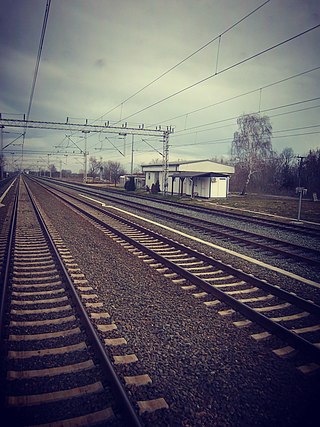
Đeletovci is a village in the municipality of Nijemci within the Vukovar-Syrmia County, Croatia. It had a population of 511 people in the 2011 census. The village is located on the Zagreb-Belgrade Railway and the D57 road.

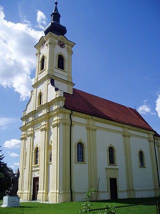
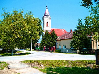
Pačetin is a village in the municipality of Trpinja, Vukovar-Syrmia County in the easternmost part of Croatia. At the time of the 2011 Census the population of the village was 541. Village lies north of the Vuka River and west of the M601 railway. Its major landmark is the Church of St. Nicholas from the 18th century. County road Ž4111 passing through the villages of Pačetin, Bobota and Vera connect all three villages with D2 road and D55 road. Pačetin is 28.6 km southeast of Osijek, the economic and cultural centre of Slavonia and 17.2 km from the Osijek Airport. County seat Vukovar is 17.3 km east of Pačetin.

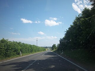
Srijemske Laze is a village in Stari Jankovci municipality of Vukovar-Syrmia County in eastern Croatia. The village is physically connected with the village of Slakovci. According to 2011 census there is 566 residents in the village. The largest ethnic group in the village are Serbs of Croatia. The village is connected with the rest of the country by the D46 state road connecting it with the town of Vinkovci and continuing into Serbia as the State Road 120 to the nearest town of Šid. Surrounding landscape of the village is marked by the Pannonian Basin plains and agricultural fields of corn, wheat, common sunflower and sugar beet.

Slakovci is a village in Stari Jankovci municipality of Vukovar-Syrmia County in eastern Croatia. It is connected by the D46 state road. The village is physically connected with the village of Srijemske Laze. The village is connected with the rest of the country by the D46 state road connecting it with the town of Vinkovci and continuing into Serbia as the State Road 120 to the nearest town of Šid.
Banovci ;, also known as Šidski Banovci, is a village located in the Vukovar-Syrmia County of Croatia, near the Serbian border. The village had a population of 256 as of the 2021 census.

Bršadin is a village in the Trpinja Municipality in Croatian easternmost Vukovar-Syrmia County. Bršadin is located north of the Vuka river and west of the town of Vukovar on the main road to Vinkovci.

Bobota is a village in the Municipality of Trpinja in Vukovar-Syrmia County in eastern Croatia. Regional Bobota Canal, the first major water management project in modern-day Croatia in the post-Roman Empire period, was named after the village.
Crkveni Bok is a village in central Croatia, in the municipality of Sunja, Sisak-Moslavina County. It is located in the Banija region, in the fertile plains on the right bank of the Sava river, to the east of the town of Sunja and some 20 km north-west of village of Jasenovac.