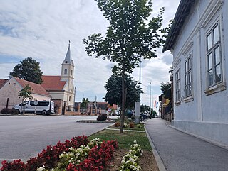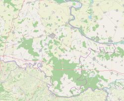
Otok is a town in eastern Croatia, located 20 km south of Vinkovci, in eastern Slavonia. The settlement gained the status of town by the decision of the Parliament of Croatia on July 13, 2006. At the time, nearby Privlaka was a part of the municipality, but was subsequently declared a municipality in its own right. The population of the town of Otok is 6,343, with 4,694 residents in Otok itself and 1,649 in the nearby village of Komletinci. In the census of 2011, 99.31% of the population declared themselves Croats.

Farkaševac is a municipality in Zagreb County, Croatia.

Andrijaševci is a village and a municipality in Vukovar-Syrmia County in eastern Croatia. Despite its name, the seat of the municipality is in the village of Rokovci.

Šarengrad is a village in eastern Croatia. It is located along the Danube river and is administratively part of Croatian easternmost town of Ilok. Šarengrad is known for its landscape which is dominated by the river and picturesque houses and church tower next to it. Island of Šarengrad is an 9 km2 river island situated close to the village.
Novo Nevesinje is a settlement in the region of Baranja, Croatia. Administratively, it is located in the Petlovac municipality within the Osijek-Baranja County. Population is 63 people.

Bapska is a village in Croatia.

Mohovo is a village in Vukovar-Syrmia County in easternmost part of Croatia. It is administratively part of the town of Ilok.
Brotnja is a village in Croatia. It is connected by the D218 highway.
Neteka is a village in Croatia. It is connected by the D218 highway.
Mazin is a village in Croatia. It is connected by the D218 highway.
Tomingaj is a village in Croatia. Nikola Tesla lived in Tomingaj in 1874.
Vučipolje is a village in Croatia. It is connected by the D1 road.
Oraovac is a village in Croatia.
Dabašnica is a village in Croatia.
Dugopolje is a village in Croatia.
Osredci is a village in Croatia.
Zaklopac is a village in Croatia.
Glogovo is a village in Croatia.
Gubavčevo Polje is a village in Croatia.
Omsica is a village in Croatia.


