The Kingdom of Aragon was a medieval and early modern kingdom on the Iberian Peninsula, corresponding to the modern-day autonomous community of Aragon, in Spain. It should not be confused with the larger Crown of Aragon, which also included other territories — the Principality of Catalonia, the Kingdom of Valencia, the Kingdom of Majorca, and other possessions that are now part of France, Italy, and Greece — that were also under the rule of the King of Aragon, but were administered separately from the Kingdom of Aragon.

Villanúa is a Pyrenean municipality in Spain in the north of Huesca province, in la Jacetania, set where the Aragon valley gets wider. Its name refers to the "new village" repopulated in the late 10th century. Villanúa's altitude is 953 m and it covers 58.2 km2. The village is at the bottom of mount Collarada and in 2018 had 447 inhabitants.

Biescas is a municipality of northeastern Spain close to the border with France, in the midst of the Pyrenees in the province of Huesca. The name seems to provide from the term bizka, which means "hill" in a Proto-Indo-European language.

The Diocese of Jaca is an episcopal see in the northeastern Spanish province of Huesca, part of the autonomous community of Aragón. The diocese is subordinate to the Archdiocese of Pamplona y Tudela.

Puente la Reina is a town and municipality located in the autonomous community of Navarre, in northern Spain.

The Diocese of Huesca is located in north-eastern Spain, in the province of Huesca, part of the autonomous community of Aragón. The diocese is suffragan to the Archdiocese of Zaragoza.

Canfranc is a municipality in the Aragón Valley of north-eastern Spain consisting of two villages, the original village and Canfranc Estación, which developed with the establishment of Canfranc International railway station to serve railway traffic across the Pyrenees.
The Aragonese Way is a route of the Way of St. James beginning at the French-Spanish border at the pass of Somport and joining the French Way at Puente la Reina in Navarre. It is the continuation of the Arles Way which begins in Arles and crosses the Pyrenees into Spain at Somport.

The monastery of San Juan de la Peña is a religious complex in the town of Santa Cruz de la Serós, at the south-west of Jaca, in the province of Huesca, Spain. It was one of the most important monasteries in Aragon in the Middle Ages. Its two-level church is partially carved in the stone of the great cliff that overhangs the foundation. San Juan de la Peña means "Saint John of the Cliff".
Castiello de Jaca is a municipality located in the province of Huesca, Aragon, Spain. According to the 2004 census (INE), the municipality has a population of 198 inhabitants. It is serviced by the Jaca-Astun bus. There are 2 restaurants/bars. Recent developments have seen the size of the town increase greatly.

Hoz de Jaca is a municipality located in the province of Huesca, Aragon, Spain. According to the 2004 census (INE), the municipality has a population of 74 inhabitants.

Puente de Montañana, in Catalan: Lo Pont de Montanyana, or in Aragonese: Puent de Montanyana, is a municipality located in the province of Huesca, Aragon, Spain. According to the 2004 census (INE), the municipality has a population of 102 inhabitants.

La Sotonera is a municipality located in the province of Huesca, Aragon, Spain. It is situated between Huesca and Ayerbe in the Hoya de Huesca. According to 2018 (INE) data, the municipality has a population of 894 inhabitants.

Aratorés is a small village located in the municipality of Castiello de Jaca in the Huesca province of Aragón, Spain. According to the 2012 census (INE), the village has a population of 40 inhabitants. Aratorés is located at an altitude of 1,021 metres (3,350 ft) and it is at the top of a hill that dominates the Aragón valley.

Sasabe, a small place near Jaca in Huesca province, Aragon region, Spain is an ermitage that became a former semi-itinerant bishopric and is now a Latin Catholic titular see.

The Abbey of San Pedro de Siresa is a monastery in the Valle de Hecho,. It was constructed between the 9th and 13th centuries, and is the northernmost monastery in Aragon.

La Jacetania is a comarca in northern Aragon, Spain. It is located in the northwestern corner of the Huesca and Zaragoza provinces. The administrative capital is Jaca, with 13,374 inhabitants the largest town of the comarca. The area is famous for its ski resorts.

Aísa is a town and municipality located in the province of Huesca, Aragon, Spain. According to the 2009 census (INE), the municipality had a population of 394 inhabitants. The municipality includes the towns of Candanchú, Esposa and Sinués.

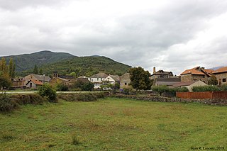
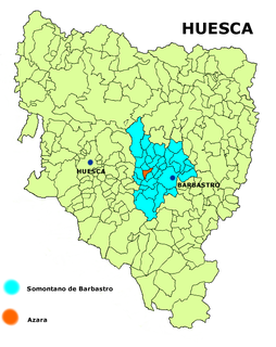
Azara is a municipality in the province of Huesca, Spain. In 2018, it had a population of 174 inhabitants. It is located in the middle of a valley named after Alferche, to the right of the La Clamor Canyon, surrounded by sandstone the highest among which is Peña de Santa Margarita, 40 km away from Huesca.

Ribagorza or Ribagorça is a comarca (county) in Aragon, Spain, situated in the north-east of the province of Huesca. It borders the French département of the Haute-Garonne to the north and Catalonia to the east. Within Aragon its neighboring counties are Sobrarbe, Somontano de Barbastro, and La Litera. It roughly corresponds to the Aragonese part of the medieval County of Ribagorza. The administrative capital of Ribagorza is Graus, although the historical capital of the county was at Benabarre.


