
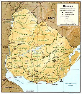
Montevideo is the capital and largest city of Uruguay. According to the 2011 census, the city proper has a population of 1,319,108 in an area of 201 square kilometres (78 sq mi). The southernmost capital city in the Americas, Montevideo is situated on the southern coast of the country, on the northeastern bank of the Río de la Plata.

Piriápolis is a city in the Maldonado Department of Uruguay. It is an important summer resort in the country, predating the larger and better known resort town of Punta del Este. Because it is mainly used as a resort, it has a relatively small permanent population for a city of its size.

Nueva Palmira is a city in Colonia Department in south-western Uruguay.

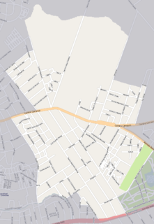
Carrasco is a barrio in Montevideo, Uruguay. Located on the city's southeast coast, the barrio was originally an elegant seaside resort. However, it eventually became the city's most exclusive suburb. Carrasco is regarded as one of the most expensive barrios in Montevideo, and features a wide range of architectural styles.

Carmelo is a city located in the department of Colonia of western Uruguay, noted for its wineries.

Pocitos is an upscale beach barrio in Uruguay's capital city, Montevideo.

The Rambla of Montevideo is an avenue that goes all along the coastline of Montevideo, Uruguay, and also the longest continuous sidewalk in the world. At a length of over 22.2 uninterrupted kilometres (13.7 mi), the promenade runs along the Río de la Plata and continues down the entire coast of Montevideo. Since all the southern departments of Uruguay are against either the Río de la Plata or the Atlantic Ocean, they all have ramblas as well. The Rambla is an integral part of Montevidean identity and has been proposed as a World Heritage site.

Tres Cruces is a barrio of Montevideo, Uruguay. Its name means "three crossings", referring to the three major transportation routes which intersect in the area: Avenida 18 de Julio, Bulevar Artigas and Avenida 8 de Octubre. It is also the starting point of Italia Avenue.
Tourism in Uruguay is one of the most important facets of the nation's economy.
Parque Batlle, formerly Parque de los Aliados, is a barrio and a major public central park in Montevideo, Uruguay. It is named in honour of José Batlle y Ordóñez, President of Uruguay from 1911–1915.

Parque Rodó is both a barrio of Montevideo, Uruguay and a park which lies mostly outside the limits of the barrio itself and belongs to Punta Carretas. The name "Rodó" has been given in memory of José Enrique Rodó, an important Uruguayan writer whose monument is in the southern side of the main park.

Punta Carretas is a barrio of Montevideo, Uruguay.

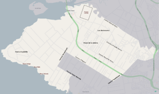
Malvín is a barrio of Montevideo, Uruguay.
Las Canteras is a barrio of Montevideo, Uruguay.

Bella Vista is a barrio of Montevideo, Uruguay and part of the Capurro / Bella Vista composite barrio, with Artigas Boulevard separating the two.

Carrasco Norte is a barrio of Montevideo, Uruguay.
Paso de la Arena, also known by the composite name Paso de la Arena–Los Bulevares–Rincón del Cerro–Santiago Vázquez is a barrio of Montevideo, Uruguay. It shares borders with Lezica–Melilla and Conciliación to the north and northeast, with Nuevo París and La Paloma–Tomkinson to the east and southeast, with Casabó–Pajas Blancas to the south and with the Río de la Plata to the southwest, west and northwest.

Route 10 is a national route of Uruguay. In 1983, it was assigned the name Juan Díaz de Solís, honouring the Spanish navigator.

Lagomar is a residential neighbourhood and resort of Ciudad de la Costa in Canelones, Uruguay.

Ruta Interbalnearia or Ruta Líber Seregni is a national route of Uruguay. It connects Montevideo with Punta del Este to the east along the coast. The road is approximately 90 kilometres (56 mi) in length. It is marked on maps and signs as IB.


