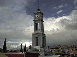
Putla District

Last updated
Putla District
District
Oaxaca regions and districts.svg
Oaxaca regions and districts: Sierra Sur to the southwest
Coordinates: 17°01′N97°55′W / 17.017°N 97.917°W / 17.017; -97.917 Coordinates: 17°01′N97°55′W / 17.017°N 97.917°W / 17.017; -97.917
CountryFlag of Mexico.svg  Mexico
State Oaxaca

Putla District is located in the west of the Sierra Sur Region of the State of Oaxaca, Mexico. [1]

Sierra Sur de Oaxaca Region in Oaxaca, Mexico

Sierra Sur is a region in the state of Oaxaca, Mexico. It includes the districts of Putla, Sola de Vega, Miahuatlán and Yautepec. Miahuatlán de Porfirio Díaz is the largest city. The region has 70 municipalities, some very poor, such as Zanizá, Amoltepec and Los Loxichas.

Oaxaca State of Mexico

Oaxaca, officially the Free and Sovereign State of Oaxaca, is one of the 31 states which, along with Mexico City, make up the 32 federative entities of Mexico. It is divided into 570 municipalities, of which 418 are governed by the system of usos y costumbres with recognized local forms of self-governance. Its capital city is Oaxaca de Juárez.

Mexico Country in the southern portion of North America

Mexico, officially the United Mexican States, is a country in the southern portion of North America. It is bordered to the north by the United States; to the south and west by the Pacific Ocean; to the southeast by Guatemala, Belize, and the Caribbean Sea; and to the east by the Gulf of Mexico. Covering almost 2,000,000 square kilometres (770,000 sq mi), the nation is the fifth largest country in the Americas by total area and the 13th largest independent state in the world. With an estimated population of over 120 million people, the country is the tenth most populous state and the most populous Spanish-speaking state in the world, while being the second most populous nation in Latin America after Brazil. Mexico is a federation comprising 31 states and Mexico City, a special federal entity that is also the capital city and its most populous city. Other metropolises in the state include Guadalajara, Monterrey, Puebla, Toluca, Tijuana and León.

Municipalities

Putla Municipalities Putla Municipalities.svg
Putla Municipalities

The district includes the following municipalities: [1]

Constancia del Rosario Municipality and town in Oaxaca, Mexico

Constancia del Rosario is a town and municipality in Oaxaca in south-western Mexico. The municipality covers an area of 298.54 km². It is part of Putla District in the west of the Sierra Sur Region.

La Reforma, Oaxaca Municipality and town in Oaxaca, Mexico

La Reforma is a town and municipality in Oaxaca in south-western Mexico. The municipality covers an area of 496.3 km². It is part of Putla District in the west of the Sierra Sur Region.

Mesones Hidalgo Municipality and town in Oaxaca, Mexico

Mesones Hidalgo is a town and municipality in Oaxaca in south-western Mexico. The municipality covers an area of 353.4 km². It is part of Putla District in the west of the Sierra Sur Region.

Related Research Articles

Tlaxiaco Place in Oaxaca, Mexico

Tlaxiaco is a city, and its surrounding municipality of the same name, in the Mexican state of Oaxaca. It is located in the Tlaxiaco District in the south of the Mixteca Region, with a population of about 17,450.

Putla Villa de Guerrero Place in Oaxaca, Mexico

Putla Villa de Guerrero or simply Putla, is a town and municipality in the State of Oaxaca, Mexico. It is part of Putla District in the west of the Sierra Sur Region.

San Jacinto Tlacotepec Municipality and town in Oaxaca, Mexico

San Jacinto Tlacotepec is a town and municipality in Oaxaca in south-western Mexico. The municipality covers an area of 233.5 km². It is part of the Sola de Vega District in the Sierra Sur Region.

Santa Cruz Itundujia Municipality and town in Oaxaca, Mexico

Santa Cruz Itundujia is a town and municipality in Oaxaca in south-western Mexico. The municipality covers an area of km². It is part of Putla District in the west of the Sierra Sur Region.

Santa María Ipalapa Municipality and town in Oaxaca, Mexico

Santa María Ipalapa is a town and municipality in Oaxaca in south-western Mexico. The municipality covers an area of km². It is part of Putla District in the west of the Sierra Sur Region.

Santa María Zacatepec is a town and municipality in Oaxaca in south-western Mexico. The municipality covers an area of km². It is part of Putla District in the west of the Sierra Sur Region.

Centro District District in Oaxaca, Mexico

Centro District is located in the Valles Centrales Region of the State of Oaxaca, Mexico. The district includes the state capital Oaxaca and satellite towns. The district has an average elevation of 1,550 meters. The climate is mild, with average temperatures ranging from 16°C in Winter to 25°C in spring.

Zimatlán District District in Oaxaca, Mexico

Zimatlán District is located in the west of the Valles Centrales Region of the State of Oaxaca, Mexico.

Tlacolula District District in Oaxaca, Mexico

Tlacolula District is located in the east of the Valles Centrales Region of the State of Oaxaca, Mexico.

Sola de Vega District District in Oaxaca, Mexico

Sola de Vega District is located in the Sierra Sur Region of the State of Oaxaca, Mexico. The district center is Villa Sola de Vega.

Miahuatlán District District in Oaxaca, Mexico

Miahuatlán District is located in the south of the Sierra Sur Region of the State of Oaxaca, Mexico.

Teotitlán District District in Oaxaca, Mexico

Teotitlán District is located in the north of the Cañada Region of the State of Oaxaca, Mexico.

Cuicatlán District District in Oaxaca, Mexico

Cuicatlán District is located in the northeast of the Cañada Region of the State of Oaxaca, Mexico.

Jamiltepec District District in Oaxaca, Mexico

Jamiltepec District is located in the west of the Costa Region of the State of Oaxaca, Mexico.

Pochutla District District in Oaxaca, Mexico

Pochutla District is located in the east of the Costa Region of the State of Oaxaca, Mexico. The primary city is San Pedro Pochutla.

Tlaxiaco District District in Oaxaca, Mexico

Tlaxiaco District is located in the south of the Mixteca Region of the State of Oaxaca, Mexico. The main city is the Heroic City of Tlaxiaco

Huajuapan District District in Oaxaca, Mexico

Huajuapan District is located in the north of the Mixteca Region of the State of Oaxaca, Mexico. The principal city is Huajuapan de León.

Indigenous people of Oaxaca

The Indigenous people of Oaxaca are descendants of the inhabitants of what is now the state of Oaxaca, Mexico who were present before the Spanish invasion. Several cultures flourished in the ancient region of Oaxaca from as far back as 2000 BC, of whom the Zapotecs and Mixtecs were perhaps the most advanced, with complex social organization and sophisticated arts.

The Tacuate are an indigenous people of Mexico who live in the state of Oaxaca. The Tacuate language is one of the Mixtec languages; in 2010, there were 1,500 speakers.

Zacatepec Mixtec, or Tacuate, is a Mixtec language of Oaxaca. It is spoken in the town of Santa María Zacatepec and other towns in Oaxaca, Mexico.

References