Tehuantepec District | |
---|---|
District | |
Oaxaca regions and districts: Istmo to Southeast | |
Coordinates: 16°19′N95°13′W / 16.317°N 95.217°W Coordinates: 16°19′N95°13′W / 16.317°N 95.217°W | |
Country | |
State | Oaxaca |
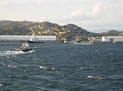
Tehuantepec District is located in the west of the Istmo Region of the State of Oaxaca, Mexico. It includes the cities of Salina Cruz and Tehuantepec. [1]
Oaxaca, officially the Free and Sovereign State of Oaxaca, is one of the 31 states which, along with Mexico City, make up the 32 federative entities of Mexico. It is divided into 570 municipalities, of which 418 are governed by the system of usos y costumbres with recognized local forms of self-governance. Its capital city is Oaxaca de Juárez.
Mexico, officially the United Mexican States, is a country in the southern portion of North America. It is bordered to the north by the United States; to the south and west by the Pacific Ocean; to the southeast by Guatemala, Belize, and the Caribbean Sea; and to the east by the Gulf of Mexico. Covering almost 2,000,000 square kilometres (770,000 sq mi), the nation is the fifth largest country in the Americas by total area and the 13th largest independent state in the world. With an estimated population of over 120 million people, the country is the eleventh most populous state and the most populous Spanish-speaking state in the world, while being the second most populous nation in Latin America after Brazil. Mexico is a federation comprising 31 states and Mexico City, a special federal entity that is also the capital city and its most populous city. Other metropolises in the state include Guadalajara, Monterrey, Puebla, Toluca, Tijuana and León.
Salina Cruz is a major seaport on the Pacific coast of the Mexican state of Oaxaca. It is the state's third-largest city and is the municipal seat of the municipality of the same name. It is part of the Tehuantepec District in the west of the Istmo Region. The city had a 2005 census population of 71,314, while its municipality, with an area of 113.55 km2 (43.84 sq mi) had a population of 76,219, the state's fourth-largest municipality in population.
The district includes the following municipalities: [1]
Municipality | Area (km2) | Total population | Indigenous population |
---|---|---|---|
Guevea de Humboldt | 515 | 5,283 | 2,475 |
Magdalena Tequisistlán | |||
Magdalena Tlacotepec | 235 | 1165 | |
Salina Cruz | 114 | 76,219 | |
San Blas Atempa | 148 | 16,899 | |
San Mateo del Mar | 75 | 12,667 | |
San Miguel Tenango | 327 | 684 | |
San Pedro Comitancillo | 166 | 3,858 | 1,941 |
San Pedro Huamelula | 505 | 8,834 | 546 |
San Pedro Huilotepec | 103 | ||
Santa María Guienagati | 212 | 2,911 | 684 |
Santa María Jalapa del Marqués | |||
Santa María Mixtequilla | |||
Santa María Totolapilla | |||
Santiago Astata | |||
Santiago Lachiguiri | 674 | 4,361 | 2,339 |
Santiago Laollaga | |||
Santo Domingo Chihuitán | |||
Tehuantepec | 966 | 57,163 |
Coatzacoalcos is a major port city in the southern part of the Mexican state of Veracruz, on the Coatzacoalcos River. Coatzacoalcos comes from a Nahuatl word meaning "Site of the Snake" or "Where the snake hides". The city serves as the municipal seat of the municipality of the same name.
The Isthmus of Tehuantepec is an isthmus in Mexico. It represents the shortest distance between the Gulf of Mexico and the Pacific Ocean. Prior to the opening of the Panama Canal, it was a major shipping route known simply as the Tehuantepec Route. The name is taken from the town of Santo Domingo Tehuantepec in the state of Oaxaca; this was derived from the Nahuatl term tecuani-tepec.
Tehuantepec is a city and municipality in the southeast of the Mexican state of Oaxaca. It is part of the Tehuantepec District in the west of the Istmo Region. The area was important in pre Hispanic period as part of a trade route that connected Central America with what is now the center of Mexico. Later it became a secondary capital of the Zapotec dominion, before it was conquered by the Spanish in the early 16th century.
Juchitán de Zaragoza is an indigenous town in the southeast of the Mexican state of Oaxaca. It is part of the Juchitán District in the west of the Istmo de Tehuantepec region. With a 2005 census population of 74,714 inhabitants, it is the fourth-largest city in the state. The majority of the indigenous inhabitants are Zapotecs and Huaves. The town also serves as the municipal seat for the surrounding municipality, with which it shares a name. The municipality has an area of 414.64 km² and a population of 85,869, the state's third-largest in population.
The Tehuantepec jackrabbit is easily distinguished from other species of jackrabbits by two black stripes that run from the base of the ears to the nape, and by its white flanks. Underparts are white, upperparts are bright-brown washed with black, rump is gray, and the tail is black. This leporid is one of the largest jackrabbits and has large ears and legs. Adults weigh about 3500 to 4000 grams.
The Ferrocarril Transístmico, also known as Ferrocarril del Istmo de Tehuantepec, S.A. de C.V. or simply Ferroistmo, is today a railroad with no rolling stock, owned by the Mexican government, that crosses the Isthmus of Tehuantepec between Puerto Mexico, Veracruz, and Salina Cruz, Oaxaca. It is leased to Ferrocarril del Sureste FERROSUR. It was formerly leased to Ferrocarriles Chiapas-Mayab until Genesee & Wyoming gave up its concession in 2007. Originally it was known as the Tehuantepec Railway.
San Pedro Pochutla is a city and municipality located in the south of Oaxaca state, Mexico next to the Pacific Ocean. It is an important commercial, transportation and administrative hub for the Pochutla District in the east of the Costa Region. Pochutla is located at the junction of coastal Highway 200 and Highway 175 to Oaxaca, with 175 functioning as the town’s main thoroughfare. Its name means "place of kapok trees ", and most of the city is built on a lakebed which was drained during the colonial period. The municipality is best known as being the home of the oceanside communities of Puerto Ángel and Zipolite.
The Sierra Madre de Oaxaca is a mountain range in southern Mexico. It is primarily in the state of Oaxaca, and extends north into the states of Puebla and Veracruz.
La Sierra Norte de Oaxaca is a heavily wooded region in the state of Oaxaca, Mexico. It is 62 km from the city of Oaxaca on Federal highway 175, heading east towards Tuxtepec. The region is divided into three districts: Ixtlán, which has 26 municipalities, Villa Alta, which has 25 municipalities and Mixe, which has 17 municipalities.
Federal Highway 185 is a Federal Highway of Mexico. The highway travels from Coatzacoalcos, Veracruz in the north to Salina Cruz, Oaxaca in the south. It is also known as the Carretera Transístmica because it crosses the Isthmus of Tehuantepec. It crosses the Sierra Madre de Oaxaca at Chivela Pass.
San Pedro Huilotepec is a town and municipality in Oaxaca in south-western Mexico. It is part of the Tehuantepec District in the west of the Istmo Region. "Huilotepec" means stone wasp.
Santiago Astata is a town and municipality in Oaxaca in south-western Mexico. It is part of the Tehuantepec District in the west of the Istmo Region. The name "Astata" means "place of herons".
El Corte River is the primary tributary of the Coatzacoalcos River, flowing through the Mexican states of Oaxaca and Veracruz to the Gulf of Mexico.
Istmo de Tehuantepec is the largest region of the state of Oaxaca, located in southwestern Mexico.
Juchitán District is located in the east of the Istmo de Tehuantepec region of the State of Oaxaca, Mexico, covering the southern part of a low-lying corridor through the mountains that separates the Gulf of Mexico from the Pacific ocean. The district has an area of 13,300 km2 and a population as of 2005 of 339,445.
The Indigenous people of Oaxaca are descendants of the inhabitants of what is now the state of Oaxaca, Mexico who were present before the Spanish invasion. Several cultures flourished in the ancient region of Oaxaca from as far back as 2000 BC, of whom the Zapotecs and Mixtecs were perhaps the most advanced, with complex social organization and sophisticated arts.
The 2011 edition of the Carrera Panamericana Mexican sports car racing event started in Huatulco, Oaxaca and finished in Zacatecas, Zacatecas. This edition was composed by 7 stages. The race started in October 21 and finished in October 27.
XHHLL-FM 97.1/XEHLL-AM 550 is a combo radio station in Salina Cruz, Oaxaca carrying the Los 40 format.
This article about a location in the Mexican state of Oaxaca is a stub. You can help Wikipedia by expanding it. |