Pyramid Hill, Victoria

Last updated

Pyramid Hill
Victoria
Pyramid Hill Store 001.JPG
Supermarket, built in 1933
Australia Victoria Loddon Shire location map.svg
Red pog.svg
Pyramid Hill
Coordinates 36°04′0″S144°08′0″E / 36.06667°S 144.13333°E / -36.06667; 144.13333
Population475 (UCL 2021) [1]
Postcode(s) 3575
Location
LGA(s) Shire of Loddon
State electorate(s) Murray Plains
Federal division(s) Mallee

Pyramid Hill is a small town in the Shire of Loddon, Victoria, Australia, between Bendigo and Kyneton. As of the 2021 census, it had a population of 598. The town, which is named for a nearby hill, has walking trails and historic Art Deco architecture.

Contents

In 1836, Major Mitchell camped at a 180-metre-high granite rise he named Pyramid Hill, since its shape reminded him of Egypt's pyramids. It became part of a pastoral area. In the 1870s, a township appeared at the hill's base. After the railway station opened in 1884, the town grew quickly and moved 3 km west of the hill. Farming accounts for over 30% of employment. In 2008, a local piggery owner visited Manila to find workers, leading Pyramid Hill to develop a small Filipino community that has revitalised not just the farms but the town itself. Pyramid Hill has a team that plays in the Loddon Valley Football Netball League, and the Filipinos host an annual cultural fiesta.

History

Pyramid Hill is on the traditional lands of the Barapa Barapa.

On 28 June 1836, Thomas Mitchell, Surveyor-General of New South Wales, [lower-alpha 1] spied a granite hill from Mount Hope while he was out exploring what he termed "Australia Felix", the rich plains of what is now western Victoria. It rises 187 metres (614 ft) above sea level. His party camped at that hill's foot the next day. Mitchell, the first non-Indigenous person to see the area, named the triangular rise Pyramid Hill. He wrote that, "being quite isolated, it closely resembled the monuments of Egypt."


The town is named after a nearby hill that rises 180 metres above sea level. Originally the town was situated at the base of Pyramid Hill, but was relocated when the railway station was built.

The Post Office opened on 17 November 1875. [2] The railway arrived in 1884.

Education

Pyramid Hill College, a state school, opened in 1876 and serves Foundation to Year 10 students. A Catholic school, St Patrick's Primary School, opened in 1956 and closed in 2024 due to declining enrollment.

Sport

The town has an Australian Rules football team, Pyramid Hill Football Netball Club competes in the Loddon Valley Football League.

Golfers play at the course of the Pyramid Hill Golf Club on Victoria Street. [3]

In the media

The town has one radio station which broadcasts a syndicated programme from the Power Country FM group on the 88 MHz frequency.

Sue Brooks, a former Pyramid Hill resident, directed the film Road to Nhill (1997). Set and filmed in Pyramid Hill, it is based on both an actual incident and the heavily embellished yarns her father would spin about the town. Road to Nhill toured regional Victorian cities to gross $1 million. Pyramid Hill and Nhill were featured on a Back Roads episode that depicted its Filipino community.

Road to Nhill (1997) was set and filmed in Pyramid Hill. The unsolved disappearance and suspected murder of one resident, Krystal Fraser, has

Demographics

In the 2021 census, Pyramid Hill had a population of 598. [4]

Notes

  1. The land which is now Victoria was then part of the Colony of New South Wales, which virtually covered the mainland's eastern half. Victoria

Related Research Articles

<span class="mw-page-title-main">Box Hill, Victoria</span> Suburb of Melbourne, Victoria, Australia

Box Hill is a suburb of Melbourne, Victoria, Australia, 14 kilometres (8.7 mi) east of the city's Central Business District (CBD), located within the City of Whitehorse local government area. Box Hill recorded a population of 14,353 at the 2021 census.

<span class="mw-page-title-main">Wedderburn, Victoria</span> Town in Victoria, Australia

Wedderburn is a rural town in Victoria, Australia on the Calder Highway, 217 kilometres (135 mi) north of Victoria's capital city, Melbourne. At the 2021 census, Wedderburn had a population of 951. It is mainly a farming community but its early residents were gold miners and prospectors.

<span class="mw-page-title-main">Nhill</span> Town in Victoria, Australia

Nhill is a town in the Wimmera, in western Victoria, Australia. Nhill is located on the Western Highway, halfway between Adelaide and Melbourne. At the 2016 census, Nhill had a population of 1,749. "Nhill" is believed to be a Wergaia word meaning "early morning mist rising over water" or "white mist rising from the water".

<span class="mw-page-title-main">Jeparit</span> Town in Victoria, Australia

Jeparit is a town on the Wimmera River in Western Victoria, Australia, 370 kilometres (230 mi) north west of Melbourne. At the 2016 census Jeparit had a population of 342, down from 394 five years earlier.
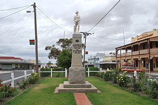
<span class="mw-page-title-main">Ararat, Victoria</span> City in Australia

Ararat is a town in the Central Highlands region in Victoria, Australia, about 198 kilometres (120 mi) west of Melbourne, on the Western Highway on the eastern slopes of the Ararat Hills and Cemetery Creek valley between Victoria's Western District and the Wimmera. Its urban population according to 2021 census is 8,500 and services the region of 11,880 residents across the Rural City's boundaries. It is also the home of the 2018/19 GMGA Golf Championship Final.

<span class="mw-page-title-main">Rainbow, Victoria</span> Town in Victoria, Australia

Rainbow is a town in the Shire of Hindmarsh in northwest Victoria, Australia, 400 kilometres (250 mi) from Melbourne. The nearest large towns are Warracknabeal, Dimboola and Nhill, all to the south. At the 2021 census, Rainbow had a population of 672.

<span class="mw-page-title-main">North Geelong, Victoria</span> Suburb of Geelong, Victoria, Australia

North Geelong is a suburb of Geelong in the Australian state of Victoria. The suburb was bypassed by traffic from Melbourne coming from the Princes Freeway by the creation of the Geelong Ring Road, which was complete in 2009. At the 2016 census, North Geelong had a population of 2,966.

<span class="mw-page-title-main">Trafalgar, Victoria</span> Town in Victoria, Australia

Trafalgar is a town in the West Gippsland region of Victoria, Australia. The town lies on the Princes Highway and main Gippsland railway line about 10 kilometres (6 mi) west of Moe. The town backs onto the foothills of the Strzelecki Ranges to the south. The township sits at approximately 70 metres above sea level. At the 2016 census, Trafalgar had a population of 3,912. The town is named in honour of the Battle of Trafalgar, 1805, which established the Royal Navy's supremacy at sea; allowing consolidation of Britain's Australian colonies at the time.

<span class="mw-page-title-main">Loddon River</span> River in Victoria, Australia

The Loddon River, an inland river of the north–central catchment, part of the Murray-Darling basin, is located in the lower Riverina bioregion and Central Highlands and Loddon Mallee regions of the Australian state of Victoria. The headwaters of the Loddon River rise on the northern slopes of the Great Dividing Range east of Daylesford and descend to flow north into the Little Murray River, near Swan Hill. The river is impounded by the Cairn Curran and Laanecoorie reservoirs.
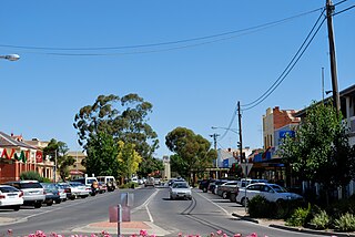
<span class="mw-page-title-main">Kerang</span> Town in Victoria, Australia

Kerang is a town on the Loddon River in northern Victoria in Australia. It is the commercial centre to an irrigation district based on livestock, horticulture, lucerne and grain. It is located 279 kilometres (173 mi) north-west of Melbourne on the Murray Valley Highway a few kilometres north of its intersection with the Loddon Valley Highway, elevation 78 metres (256 ft). At the 2016 census, Kerang had a population of 3,893. Kerang is believed to be an Aboriginal word for Cockatoo. It is home to the largest solar and battery farm in the country which was opened in June 2019. The 50-megawatt battery system is located outside of Kerang and stores 100 per cent renewable energy. The 2,000 solar panels have become a tourist attraction and are drawing many businesses to the town.

<span class="mw-page-title-main">Boort</span> Town in Victoria, Australia

Boort is a town in Victoria, Australia, located next to Lake Boort, in the Shire of Loddon. The town is known for its native birdlife. Boort is a local Aboriginal word meaning "Smoke from the hill".

<span class="mw-page-title-main">Swan Hill</span> City in Victoria, Australia

Swan Hill is a city in the northwest of Victoria, Australia on the Murray Valley Highway and on the south bank of the Murray River, downstream from the junction of the Loddon River. At the 2021 census, Swan Hill had a population of 11,508.

<span class="mw-page-title-main">Ultima, Victoria</span> Town in Victoria, Australia

Ultima is a town and district in northern Victoria, Australia. The town is in the Rural City of Swan Hill local government area, 353 kilometres (219 mi) north-west of the state capital, Melbourne, and 35 kilometres (22 mi) south-west of Swan Hill. At the 2021 census, Ultima had a population of 173, down from 333 in 2011.

<span class="mw-page-title-main">Pyramid railway station</span> Railway station in Pyramid, Victoria, Australia

Pyramid railway station is located on the Piangil line in Victoria, Australia. It serves the town of Pyramid Hill, and it opened on 12 February 1884 as Pyramid Hill. It was renamed Pyramid on 9 May 1904.

<span class="mw-page-title-main">Bridgewater On Loddon, Victoria</span> Town in Victoria, Australia

Bridgewater On Loddon is a town in north central Victoria, Australia. The town is located on the Calder Highway, north-west of Bendigo, astride the Loddon River. At the 2021 census, Bridgewater On Loddon had a population of 341. The rural area which surrounds Bridgewater on Loddon is named simply "Bridgewater".

<span class="mw-page-title-main">Goroke, Victoria</span> Town in Victoria, Australia

Goroke is a town in the Wimmera region of Victoria. The town is located in the Shire of West Wimmera local government area, 370 kilometres (230 mi) north west of the state capital, Melbourne. At the 2016 census, Goroke recorded a population of 299.
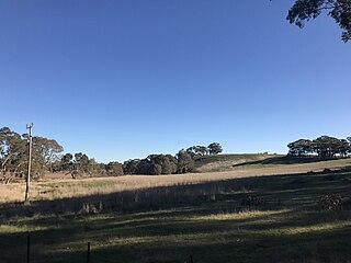
<span class="mw-page-title-main">Muckleford, Victoria</span> Town in Victoria, Australia

Muckleford is a locality in central Victoria, Australia. The area, also known as Wattle Flat, lies along the Muckleford Creek, a minor tributary of the Loddon River, approximately 127 kilometres north-west of the Melbourne city centre, and within the jurisdiction of the Mount Alexander Shire council. The nearest sizeable town is Castlemaine, approximately 7 km to the east. The original township is named after the English hamlet of the same name in Dorset, UK.

<span class="mw-page-title-main">Mitiamo, Victoria</span> Town in northern Victoria, Australia

Mitiamo is a town in northern Victoria, Australia. It is in the Shire of Loddon, 222 kilometres (138 mi) north of the state capital, Melbourne. At the 2021 census, Mitiamo had a population of 116.
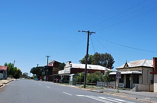
<span class="mw-page-title-main">Korong Vale, Victoria</span> Town in Victoria, Australia

Korong Vale is a town in north western Victoria. The town is in the Shire of Loddon, 232 kilometres (144 mi) north west of the state capital of Melbourne. At the 2016 census, Korong Vale had a population of 168.

<span class="mw-page-title-main">Willaura</span> Town in Victoria, Australia

Willaura is a town in western Victoria, Australia in the Rural City of Ararat local government area, 231 kilometres (144 mi) west of the state capital, Melbourne. At the 2021 census, Willaura and surrounding area had a population of 439.

References

  1. Australian Bureau of Statistics (28 June 2022). "Pyramid Hill (urban centre and locality)". Australian Census 2021.  OOjs UI icon edit-ltr-progressive.svg
  2. Phoenix Auctions History, Post Office List , retrieved 19 February 2021
  3. Golf Select, Pyramid Hill , retrieved 11 May 2009
  4. Australian Bureau of Statistics (31 October 2012). "Pyramid Hill (L) (Urban Centre/Locality)". 2011 Census QuickStats. Retrieved 6 December 2014. OOjs UI icon edit-ltr-progressive.svg